Tag: weather

  • ELVES: When a Lightning Produces Powerful Electromagnetic Pulses

    ELVES: When a Lightning Produces Powerful Electromagnetic Pulses

    Lightning is only one of several electromagnetic phenomena caused by thunderstorms that we can see here on Earth. Pilots have reported seeing red “sprites” and “blue jets” above thunderclouds for decades. Translucent, ring-shaped “ELVES” and gamma-ray bursts that seemed to originate from the clouds have also been reported. The interconnected nature of these radiation events is still poorly understood. But there is a possible connection between the ELVES and the gamma-ray bursts.

    What Is An ELVES?
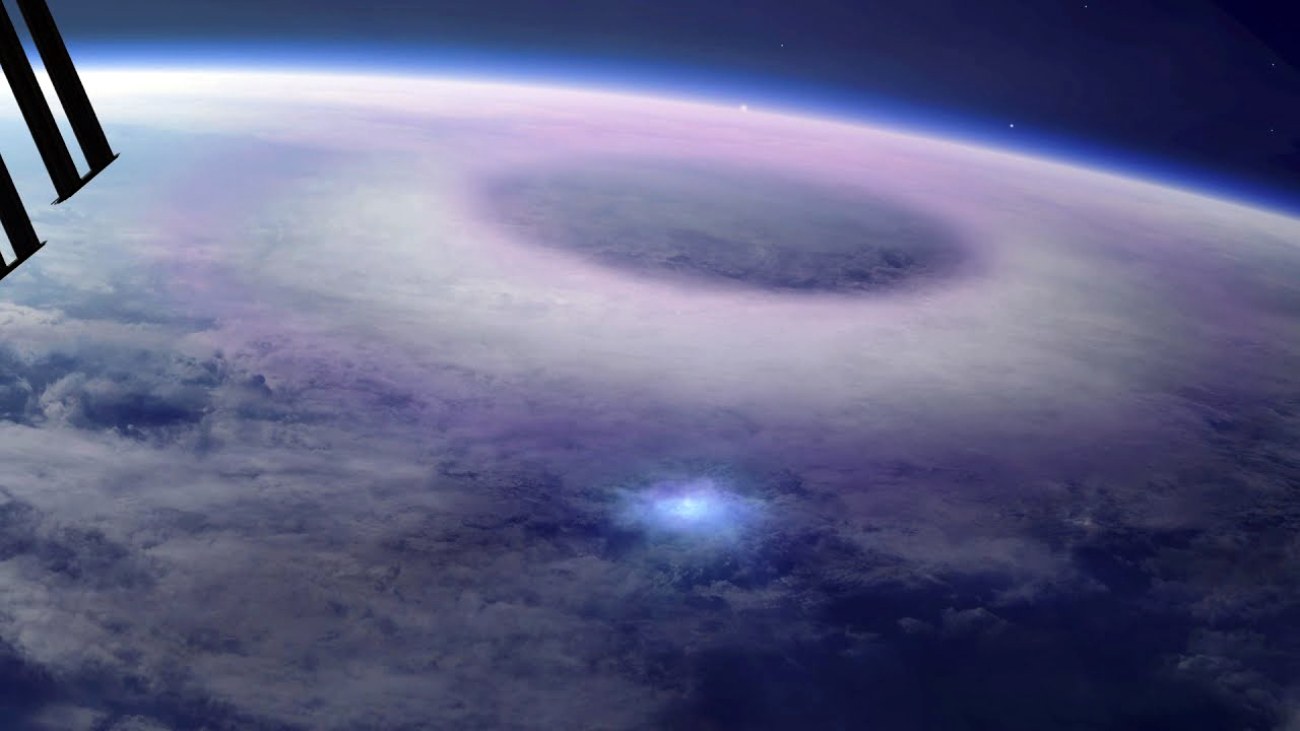
    The large formation of an ELVES recorded by the International Space Station from 250 miles (400 km) above.
    The large formation of an ELVES recorded by the International Space Station from 250 miles (400 km) above. (Credit: ESA)

    Emissions of Light and Very Low Frequency Perturbations due to Electromagnetic Pulse Sources” is an abbreviation for this singular occurrence called ELVES. The ELVES is a kind of TLE, or “Transient Luminouse Events.” Transient luminous events (TLEs) are atmospheric phenomena that arise as a byproduct of primary thunderstorm lightning.

    The light of an ELVES comes from the excitation of nitrogen molecules brought on by collisions between electrons. The electromagnetic pulse might have energized the electrons due to a discharge from an underlying thunderstorm.

    The Atmosphere-Space Interactions Monitor (ASIM) captured this animation of a terrestrial gamma-ray flash (TGF) and subsequent ELVES. (Credit: Birkeland Centre for Space Science and Mount Visual)

    The ELVES usually glows for 1 millisecond, and they appear as a ring-shaped light expanding 250 mi (400 km) in diameter. ELVES was originally recorded on an STS-41 Space Shuttle flight in 1990. For a while, nobody knew for sure what color ELVES was, but we now believe it is red.

    Short gamma-ray bursts generated in thunderstorms appear to be responsible for the formation of ELVES.

    How Does ELVES Form?

    Above the thunderclouds, the infographic depicts a variety of electromagnetic events including the ELVES.
    Above the thunderclouds, the infographic depicts a variety of electromagnetic events including the ELVES.

    Some millionths of a second is all that this gamma-ray burst in the atmosphere above a thunderstorm takes. The intense electromagnetic field produced by a lightning strike accelerates electrons in the immediate vicinity. These electrons collide with the nitrogen molecules, exciting them.

    During intense discharges, the electrons gain enough speed to combine with other air particles, producing gamma rays. The gamma flash that is sent into the atmosphere as a consequence usually only lasts for 30–40 millionths of a second (microseconds).

    When Thunderstorms Produce Powerful Electromagnetic Pulses
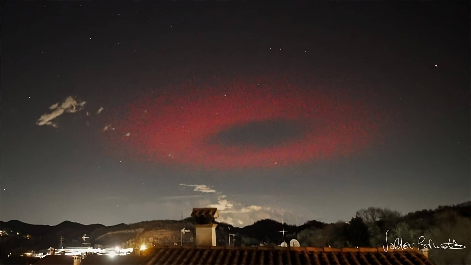
    Late in March, around 62 miles (100 km) above Ancona, Italy, a red ELVES ring with a radius of approximately 220 miles (350 km) was photographed.
    Late in March, around 62 miles (100 km) above Ancona, Italy, a red ELVES ring with a radius of approximately 220 miles (350 km) was photographed. (Credit: Valter Binotto)

    In addition to the gamma-ray, the lightning from a thunderstorm produces powerful electromagnetic waves that go upwards through the atmosphere as an electromagnetic pulse (EMP). This occurs because lightning supercharges the ions present in the atmosphere. This is where the formation of ELVES comes into play.

    Once the pulse reaches the bottom of the ionosphere, some 50–55 miles (80–90 km) above the earth, it converts its energy to electrons, which in turn hit gas molecules—usually nitrogen—in the atmosphere, stimulating them enough to create the primarily reddish light. This light is known as ELVES, or ELVESs in the plural.

    An ELVES is normally perceptible for a fraction of a second (usually 1 millisecond). Many reported ELVES glows started about the same time as the gamma-ray burst, providing evidence that the two events could be related.

    The Electromagnetic Event of ELVES

    Artist’s impression of TARANIS in orbit with thunderstorms generating ELVES.
    Artist’s impression of TARANIS in orbit with thunderstorms generating ELVES. (Credit: NASA)

    The European Space Agency’s Atmosphere-Space Interactions Monitor (ASIM) captured numerous signals from a thunderstorm reported by ISS astronauts east of the Indonesian island of Sulawesi. Lightning in the cloud was the first visible sign of this electromagnetic phenomenon.

    A gamma-ray burst was likely set off at its onset. Scientists believe gamma rays are created when supersonic electrons collide with airborne atomic nuclei, slow down, and release high-energy photons during a thunderstorm.
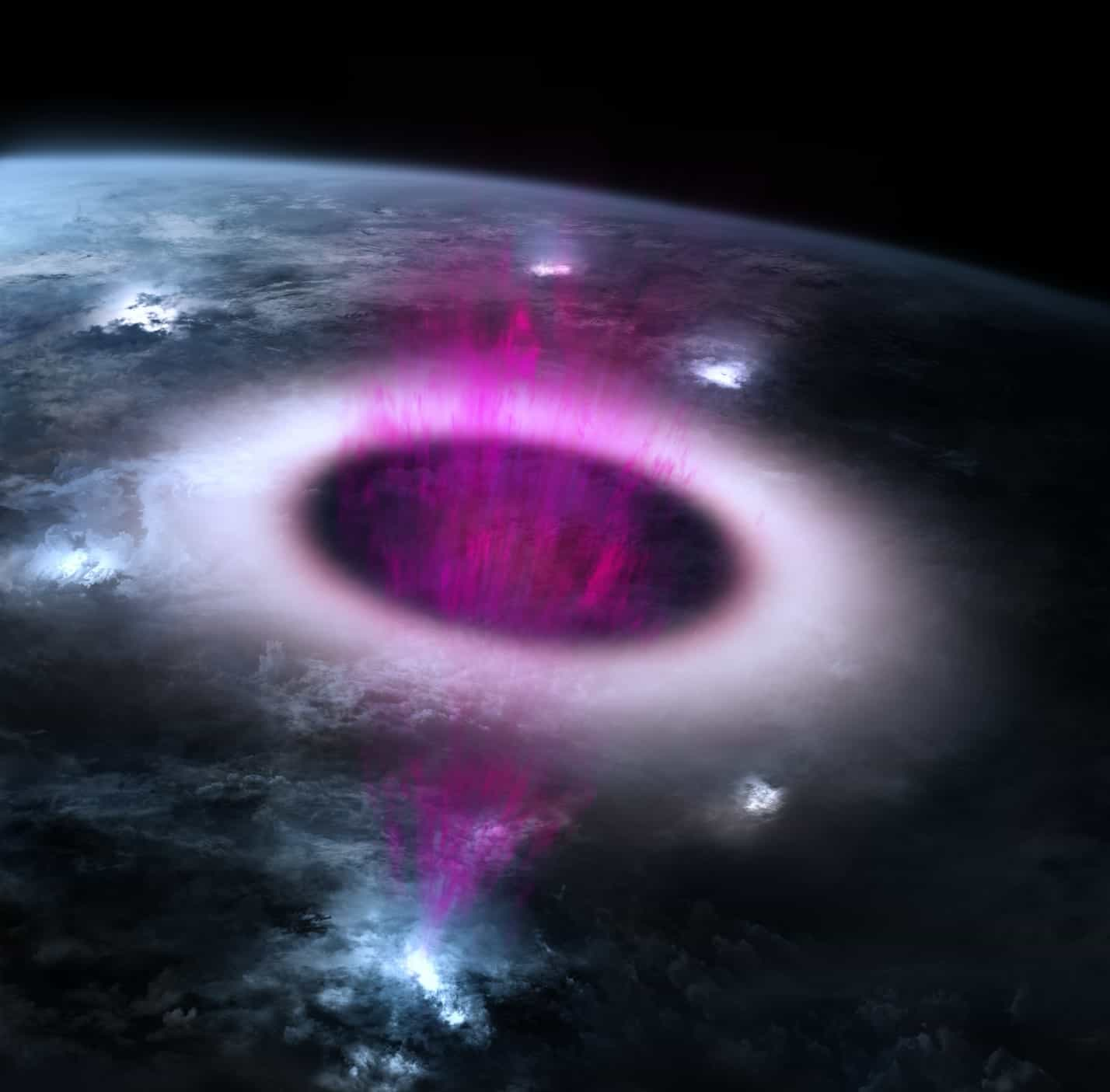
    The strong electric field associated with lightning (light blue) results in a terrestrial gamma-ray burst (magenta). The subsequent electromagnetic pulse is what causes ELVES, the widening ring of UV emission (red and white).
    The strong electric field associated with lightning (light blue) results in a terrestrial gamma-ray burst (magenta). The subsequent electromagnetic pulse is what causes ELVES, the widening ring of UV emission (red and white). (Credit: NASA)

    The gamma-ray burst lasted for 30–40 microseconds and was seen to occur at a height of around 7.5 miles (12 km), or 0.60 miles (1 km) below the cloud top. The flare not only emitted gamma rays, but also set off an electromagnetic pulse in the thunderstorm that spread horizontally and vertically for miles. At that height of 50–55 miles (80–90 km), it created an ELVES, which appeared as a ring-shaped light.

    The ISS’s sophisticated detectors picked it up in the electromagnetic spectrum’s reddish and ultraviolet regions. This time the observed ELVES started to glow a little more than 10 microseconds after the gamma-ray burst began.

  • Most Useful Clouds to Predict the Weather

    Most Useful Clouds to Predict the Weather

    Humans have been able to accurately forecast the weather by studying natural patterns for thousands of years. Clouds, in particular, may provide useful information about the near-term weather. Where do you think the day’s weather will stand? Take a look at the sky and make your own forecast.


    Listed below are five different classes of clouds, each with its own significance.

    The Formation of the Clouds

    The accuracy of weather predictions has risen dramatically in recent decades. However, mankind has been able to foretell the weather down to the hour by studying cloud patterns for thousands of years. Clouds, depending on their make-up, might be white, gray, thick, or thin.

    The transformation of water vapor into a liquid state results in the formation of clouds.


    Clouds are formed when warm air that is already saturated with water cools, causing some of the water to condense into droplets. When air travels upward, it cools down because of the decrease in temperature.

    Clouds are made up of tiny droplets of water or ice crystals suspended in the air. It’s clear that these particles are always in transit. According to scientists, a 1 km3 cumulus cloud may weigh up to 1,000,000 tons.

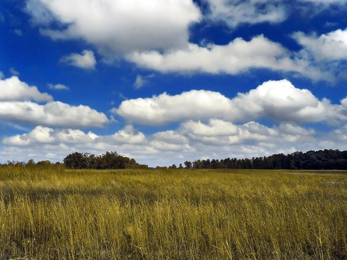
    Cumulus

    Hazy clouds are called cumulus clouds

    Cumulus cloud
    Hazy clouds are called cumulus clouds. Image: GoldenMedows,, CC BY-SA 3.0

    These clouds have the distinct appearance of cotton due to their smooth surfaces. Both of their flat bases are on the same horizontal plane. With the sun shining on them, they take on a dazzlingly white color. Not only do they not foretell an impending rain, but they are also not even somewhat interesting.

    Scientists classify cumulus clouds into three categories:

    • Cumulus humilis, which is broad and short in height;
    • Cumulus mediocris, which has a moderate height but few protuberances;
    • Cumulus congestus, which is tall and bushy. This is the last phase of cumulus development preceding the formation of cumulonimbus.

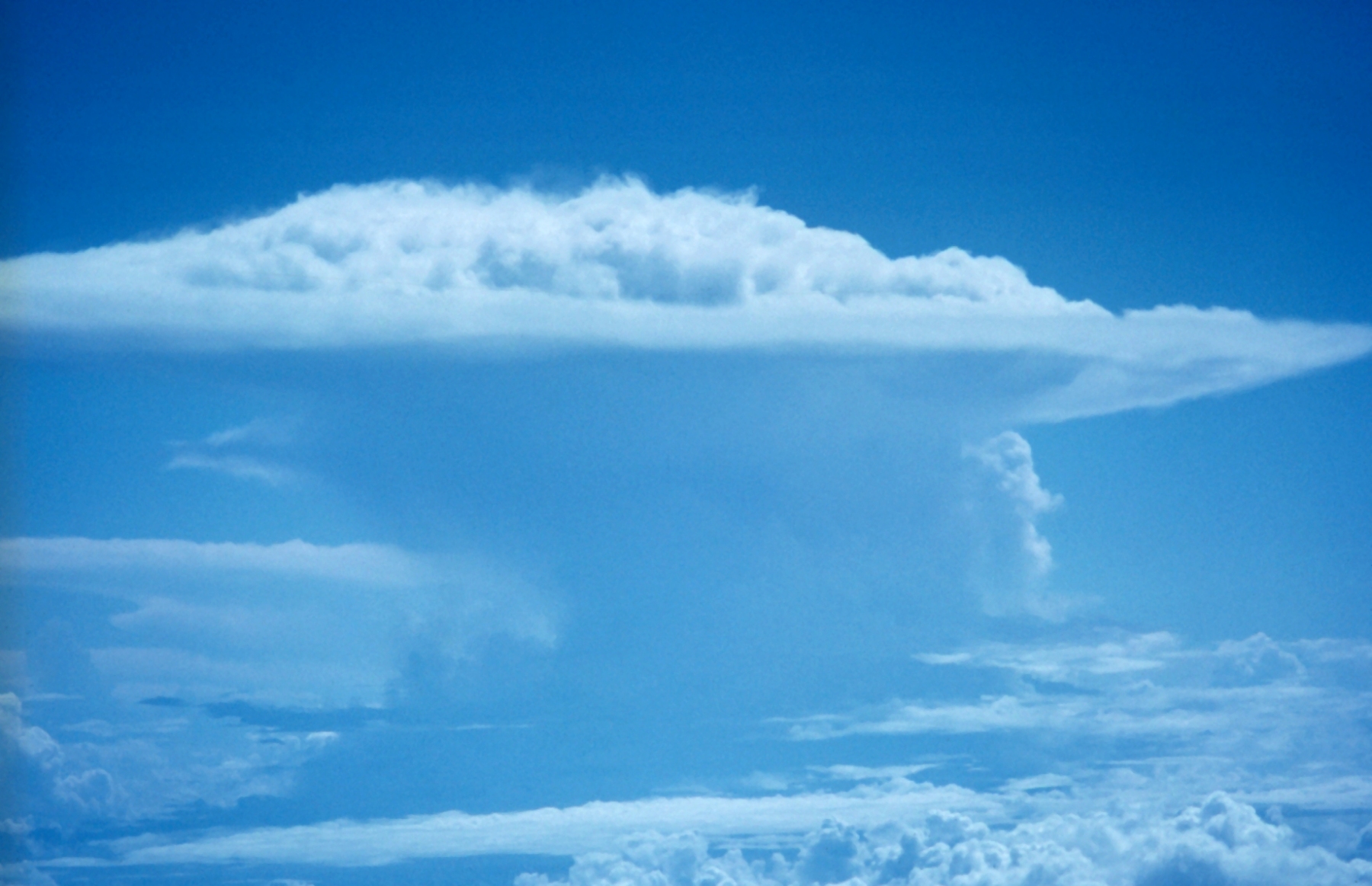
    Cumulonimbus

    Thunderstorms can be brought on by the Cumulonimbus cloud

    Cumulonimbus cloud
    Cumulonimbus incus.

    It shouldn’t rain as long as the cumulus clouds stay tiny, but if they keep getting bigger and higher in the sky, that’s a terrible omen.


    Storm clouds that are capable of producing hail are called cumulonimbus.

    Cirrus

    High in the sky, cirrus clouds float about

    Cirrus cloud
    High in the sky, cirrus clouds float about. Image: Cirrus clouds2, CC BY-SA 3.0

    Very high in the atmosphere, between 3.5 and 7 miles (6 and 12 kilometers), cirrus forms as thin, white threads. The arrival of a warm front that might bring rain within 12 hours is signaled by cirrus clouds that get lower and thicker as time passes.

    Stratus

    These stratus clouds, like the Stratus nebulosus, are low and gray

    Stratus cloud
    These stratus clouds, like the Stratus nebulosus, are low and gray.

    Grey stratus clouds often hover fewer than 1650 feet (500 meters) above the earth. Hilltops and high-rises are readily hidden from view. Stratus clouds are a continuous blanket that might provide a little rain. If they make it to the ground, they’ll be like a dense fog.

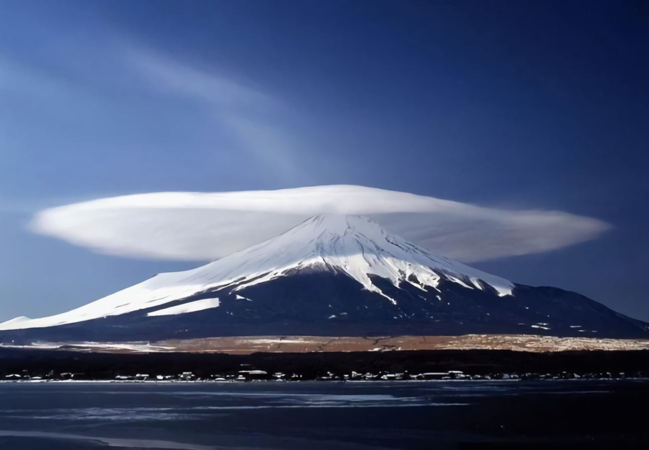
    Lenticular clouds

    Lenticular clouds are often observed near peaks

    best clouds to predict the weather Lenticular clouds
    Lenticular clouds are often observed near peaks, such as here in Japan near the Mount Fuji.

    A lenticular cloud’s shape has nothing to do with the weather’s trajectory. Their distinctive form recalls a lens or possibly a UFO. You may often see these clouds in the vicinity of mountain peaks. They owe their form to the presence of wind at high altitudes.

  • Are Thrips Really the Indicator of Thunderstorms?

    Are Thrips Really the Indicator of Thunderstorms?

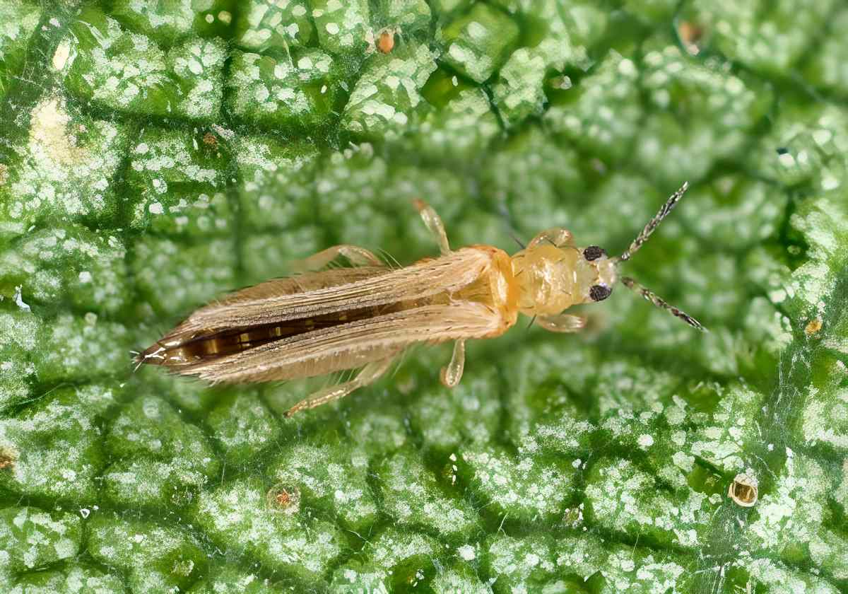
    Thunderstorm creatures, also known as thrips or fringed-wing insects, are often little, black, and very unpleasant. They are often called thunderflies, thunderbugs, storm flies, thunderblights, or storm bugs. These tiny insects, which rarely exceed 0.12 inches (3 millimeters) in length, seem to arrive en masse if the weather is hot and humid and a rainstorm is on the horizon. Although there are over 6,000 different species of thrips, their tiny size means they are often overlooked.

    When Thrips Cluster in Thousands

    Thunderstorm
    (Image: Fort Valley State University)

    They cluster together in the thousands, resembling dark clouds, which are unpleasant for anybody who is caught in them because the thrips fall on any exposed skin and also in the nasal passages, oral cavity, and eyes, producing a crawling, itchy sensation. But may the reason for their mass hording be the approaching thunderstorm? Are they really suitable as thunderstorm indicators? If that’s the case, then how can thrips anticipate the arrival of a thunderstorm?

    On hot, humid summer days, several species of thrips are known to engage in swarming flights. Temperatures over 70 degrees Fahrenheit (20 degrees Celsius) and stable, unchanging climatic conditions trigger the huge swarming of thrips. Thrips may rapidly become a nuisance when they emerge in masses, landing on humans and being drawn to all bright colors. When it’s hot and steamy outside, humans sweat, and thrips lick this perspiration off their skin and sometimes even bite through it. This causes irritation and, in really sensitive individuals, skin inflammation.

    Humans as Landing Pands

    But the thunderstorm is not the cause of the thrips’ mass presence. Instead, the little insects, which are normally dispersed across the skies, settle on the ground in a coordinated effort when a storm is approaching. So they cluster around the places where people like us go and even utilize us as landing pads.

    Thus, an increase in the number of thrips in the lower levels of the atmosphere may actually be an indicator of an approaching thunderstorm.

    Electric Field as a Thunderstorm Indicator

    However, how can thrips know when a storm is about to hit the area? This is more related to a physical phenomenon than the weather itself. This is because electrically charged thunderclouds also alter the atmospheric electric field. Thunderstorms may produce electric fields as strong as 15 kilovolts per foot (kV/ft) (50 kilovolts per meter), compared to the typical 0.03 kV/ft (0.1 kV/m).

    Research on fruit flies and other insects demonstrates that strong electric fields may cause thrips to lose control of their flight and become disoriented. For instance, British thrips researcher William Kirk believes that tiny insects like thrips, in particular, are impacted by variations in electric field strength and are no longer able to fly at roughly 2.4 kV/ft (8 kV/m) and beyond. So, this electric charge might also be responsible for the sudden swarms of thrips that arrive near the ground just before a rainstorm. In most cases, though, it appears that thrips swarms are indicators of an impending storm.

  • Why Don’t All Trees Lose Their Leaves in the Fall?

    Why Don’t All Trees Lose Their Leaves in the Fall?

    With the arrival of autumn, the leaves on most trees change color, becoming red, yellow, or brown. Oaks, beeches, and chestnuts turn entirely bare of leaves in a few weeks. However, conifers like firs, spruces, and other related species don’t appear to care much that fall, and winter are on the way. Even in the dead of winter, their needles maintain their vibrant green color. Although most shrubs lose their leaves in the autumn, evergreens are an exception. But why? As to why certain trees and shrubs lose their leaves while others do not, science comes to our aid for an explanation.

    Frosty Waters

    Most plants have trouble with both the cold and a lack of water throughout the winter. The freezing temperatures of winter prevent water from seeping through the ground.

    This water supply is further depleted during frost because deciduous plants, in particular, lose so much water via their leaves during photosynthesis.

    Because of this, plants with full foliage can essentially freeze to death. As a result, many deciduous trees totally shed their leaves to prevent this fate. During the barren winter months, this shedding of leaves prevents animals from eating the leaves.

    buy amoxicillin online https://cphia2023.com/wp-content/uploads/2025/03/jpg/amoxicillin.html no prescription pharmacy

    Nitrogen Reserves

    However, the tree swiftly recycles all of the leaves it can use before they fall. It is no surprise that nitrogen is crucial for plant growth, and this includes nitrogenous protein-building components in particular.

    These components are broken down into water-soluble chemicals and sent to the plant’s main stem and roots as a kind of nutrition reserve.

    buy accutane online https://cphia2023.com/wp-content/uploads/2025/03/jpg/accutane.html no prescription pharmacy

    As a result of this breakdown, the leaves retain traces of their yellow and red colors. Nitrogen is the reason for the vibrant foliage of fall.

    Budget-Friendly Conifers

    However, most conifers retain their foliage throughout the year. They have a wax covering on their needles, so they lose less water via their already dramatically decreased leaf area, making them better able to withstand drought and cold.

    In addition, stomata (tiny openings for gas exchange with the environment) in fir, spruce, and other trees are buried deep in needle cavities. As a result, they can manage to maintain their needle leaves while receiving just a little amount of water.

    Many conifers grow in regions where winters are long. Thus, they preserve their leaves because frost may still occur in early summer and is already occurring in early autumn, giving them a reason to wait it out.

    The time with enough brightness and warmth is insufficient to allow for the formation of leaves and, subsequently, to also collect enough energy for fruits and seeds. Thus, the trees decided not to shed their leaves in the first place.

    Both Coniferous and Deciduous Trees Have Exceptions

    Despite being a member of the conifer family, the larch also sheds its leaves. The larch is a conifer that thrives in extreme cold, such as in the high mountains and the far north.

    There, not even conifers’ natural resistance to cold is enough to ensure their survival. To prevent any more water loss throughout the winter, it decides to shed its leaves as the best strategy.

    However, evergreen foliage is not limited to conifers: Cherry laurel and rhododendron are two deciduous plants that keep their leaves throughout the winter.

    These crops are often sourced from warmer climates with shorter winters. Since this is the case, it is frequently not worth the effort for them to lose their old leaves and grow new ones each spring.

    Those plants hold on to their leaves rather than invest in replacing them. Climate has a major role in this decision. Even though some evergreen deciduous trees and shrubs are able to survive the harsher and longer winters, native species ultimately outcompete them.

    buy clenbuterol online https://cphia2023.com/wp-content/uploads/2025/03/jpg/clenbuterol.html no prescription pharmacy

    They mostly exist as ornamental plants in a garden.

  • Are No Two Snowflakes Really Alike?

    Are No Two Snowflakes Really Alike?

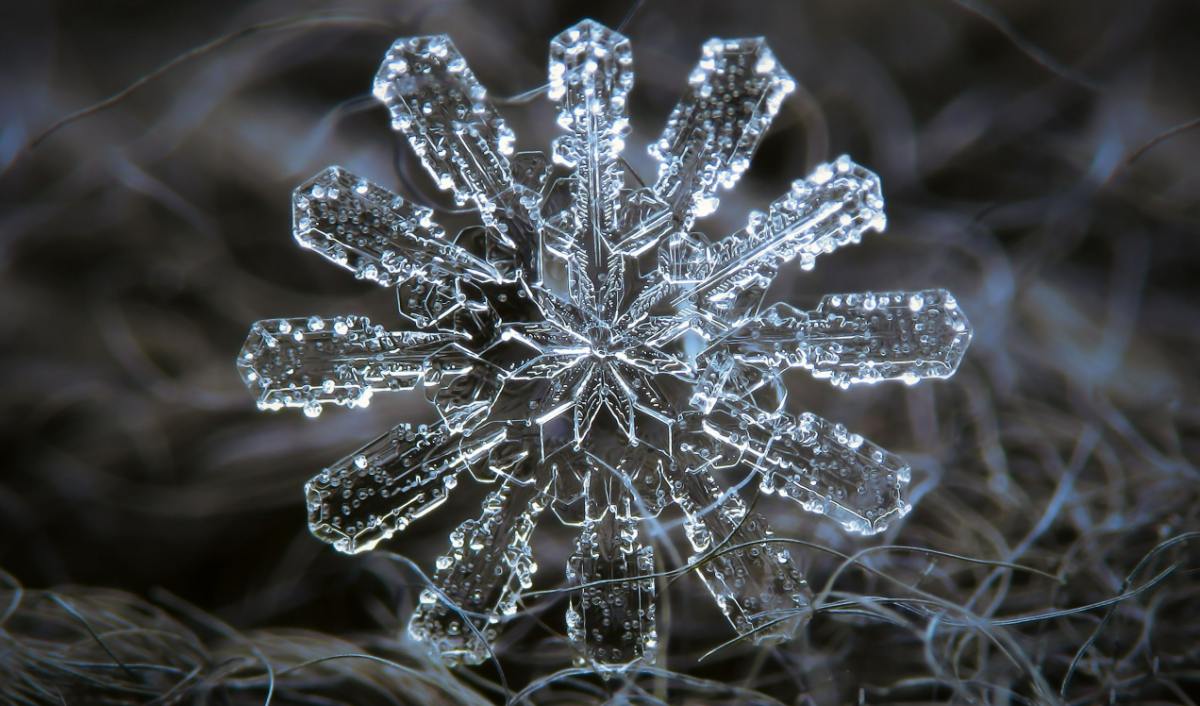
    A single snowflake drifts gently to the ground, where it may join the others of its kind. One snowflake follows another, and then a few million more, until the whole rooftop is blanketed in white. Snowflakes may fall from the sky by the billions, yet no two snow crystals are ever the same, as the old saying goes. In the same way that every person is different, each of these objects is also unique. But how accurate is that?

    It’s indeed exceedingly rare that any two complicated snow crystals would look precisely the same. It’s so improbable that you probably wouldn’t even find carbon duplicates if you looked at every crystal ever produced. That is the essence of this query. It depends on what you mean by the “same” and what you mean by the term “snow crystal.” Because the matter is really a lot more complicated than that.

    When does a snowflake form?

    snowflake
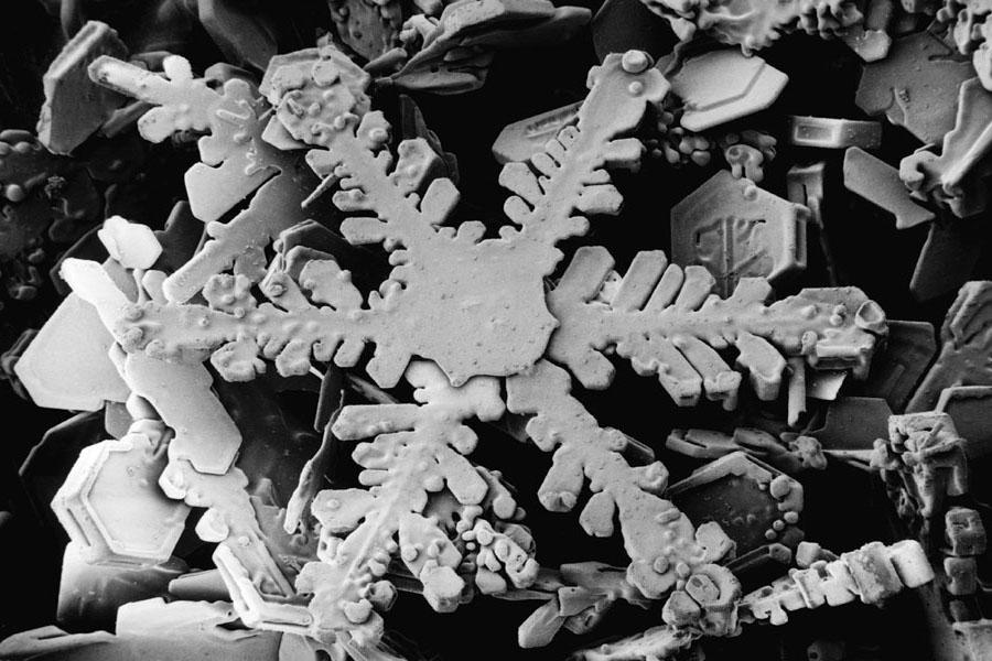
    An ordinary hexagonal dendrite.

    It is actually possible for two snow crystals made of just a few water molecules to be identical. There, the crystals are still too small to be seen with the naked eye or with a microscope.

    If more water molecules bind to one of the two mini-crystals, causing them to grow bigger as they fall from the cloud to Earth, the likelihood is that one of the crystals will grow at a different rate than the other ones. Changing the environment just a little bit—for instance, by altering the temperature or the humidity—can produce a snowflake with whole new characteristics.

    Also, different crystals form even if kept under the exact same circumstances. This is because the atoms never align with perfect regularity, which means they are prone to producing differences.

    The development of a snowflake is to stock 10 items on a rack so that there are 10 possible positions for the first item, 9 for the second item, and 8 for the third item.

    There are more than a billion possible arrangements for only 10 items. And as the items on the rack expand, the total combinations climb infinitely. This is also true with snow crystals. When they are bigger, that is, when they gather more atoms, it is less probable that two identical forms will be generated.

    Do identical snow crystals exist?

    Snow crystals with many shapes
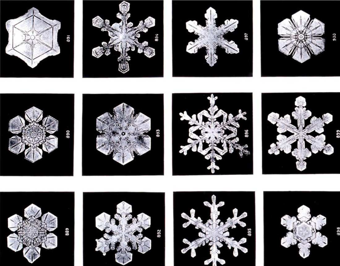
    All snowflakes have the familiar hexagonal symmetry shown in these 1902 photos. (Image: Wilson Bentley, “Monthly Weather Review” for 1902)

    Almost a century and a half ago, farmer Wilson Bentley (1865–1931) planted the idea that no two snow crystals are alike. In his lifetime, he examined innumerable snowflakes and took hundreds of photographs of these crystals under a microscope. When he examined snowflakes in 1922, he said, “Every crystal was a masterpiece of design, and no one design was ever repeated. When a snowflake melted, that design was forever lost.” It would seem that throughout his lifetime, Bentley never came across any two snowflakes that were the same.

    Nobody ventured to cast doubt on this plausible idea for quite some time. In the 1980s, Nancy Knight of the U.S. National Center for Atmospheric Research released photos of two snow crystals that, under the microscope, appeared exactly the same. It seemed like a dogma had been debunked.

    The question is whether or not the likeness in appearance implies a likeness in character. Because an optical microscope can’t resolve the atomic detail. And if you go through a reasonable number of snow crystals, it’s not hard to envisage finding two that are indistinguishable under the microscope. Furthermore, identical snow crystals could be manufactured artificially, and although they may seem similar, they won’t be identical at the subatomic level.


  • Can Frogs Really Predict the Weather?

    Can Frogs Really Predict the Weather?

    Frogs are weather experts. Some frogs and toads, based on their croaking, egg-laying, and even skin color, are said to allow us to predict whether it will rain soon or not. But what is the truth behind the frogs’ purportedly preternatural weather forecasting abilities?

    Long ago in Switzerland, if you would put a tree frog in a jar half full of water and give it a little ladder to climb, it could forecast good weather by climbing the ladder and bad weather by descending back into the water. Even today, in Germany, a weatherman is referred to as a Wetterfrosch, which translates as “weather frog.”

    Tree frogs are known to climb trees in favorable weather and make an awful noise, croaking sweetly for hours on end, thus the frog weather prediction theory actually has some validity.

    Monitoring the Humidity

    Numerous accounts point out the daily behavioral changes in amphibians and some reptiles related to predicted weather. Some species, for instance, become more active just before it starts to rain, while others are more likely to make their distinctive croaking sounds. The weather probably has a lot to do with this shift in behavior.

    Frogs and toads are highly reliant on accurately monitoring the humidity or temperature of their surroundings. That’s because amphibians are ectothermic, meaning they don’t produce their own heat. So, their blood, muscles, and skin, along with the rest of their organs, are always at the same temperature as their surroundings.

    Exceptionally Sensitive to Moisture Levels

    Frogs’ skin is very porous because of the abundance of glands on its surface. Because of this, they suffer significant water loss due to evaporation. But frogs and toads have a more refined sense of moisture via their skin than people do. In the tropics, for example, certain frog species usually come out of the underbrush when the humidity rises in anticipation of rain.

    Finally, amphibians like frogs and toads produce their offspring in aquatic environments. Thus, in order to effectively reproduce, they have to predict when there will be adequate puddles and pools from rain in which their tadpoles may grow. This means that when the weather or temperature changes, frogs have to adjust their behavior accordingly.

    Climbing Tree Frog

    So why then do frogs choose to remain low when bad weather is approaching, yet climb up when conditions are favorable? There are no precise investigations of the topic available. However, there are two theories among frog scientists as to why this occurs: The tree frog, in contrast to most other frog species, enjoys vertical environments and bright sunlight. Male frogs, especially those still in their juvenile stages, spend most of the late summer sitting on bushy branches and leaves to soak up some rays.

    However, the accessibility of food is equally important. The same goes for tree frogs, who also utilize their perches to swoop down on prey. Insects like mosquitoes are sensitive to weather changes, something our ancestors accounted for in their agricultural guidelines. With less wind and more sunshine, insects may ride the warm updrafts to greater heights in their flights. They tend to linger on the ground if a severe wind and a drop in temperature are expected.

    It is unknown, however, whether tree frogs actively pursue prey higher or lower, or if they instead respond immediately to changes in the weather. One thing scientists can agree on is that frogs and toads frequently respond to a shift in the weather before humans do. And this, of course, has nothing to do with clairvoyance.

  • How does drought change the soil?

    How does drought change the soil?

    How does drought affect the soil? Drought is a lack of water that occurs as a result of lower precipitation or higher evaporation. More evaporation occurs due to high temperatures, but also due to wind. A meteorological drought means that it is one to two months drier than usual. Even long after a drought is over and the soil has long since become waterlogged again, scientists can still tell that it has been exposed to drought.

    This was recently shown by an experiment. Researchers created extreme drought in a greenhouse for a meadow. The bacteria active in the soil did not like it at all: their number decreased and they were less active overall. This is a disadvantage for the soil because the bacteria are important for nitrogen fixation and ensuring the soil breathes. The fungi in the soil, on the other hand, benefited from the drought.

    Even two months after the end of the artificially induced drought, the original biological state had not been regained: soil bacteria had not recovered in terms of numbers or activity. Plants in the greenhouse also changed. Fast-growing grass species tolerated the lack of water better and spread more than slow-growing grasses. The experiment showed that droughts have a lasting impact on the soil habitat.

    How do plants react to dry soil?

    If the soil is too dry, this can have serious consequences for plants. When the roots of a plant realize that there is a lack of water, they send out a kind of alarm signal: a stress hormone is released that causes the stomata, the small pores in the leaves, to close.

    Stomata are important for photosynthesis, in which the plant converts carbon dioxide and water into oxygen and glucose. Carbon dioxide enters the leaf through them, and oxygen and water exit.

    A plant can prevent about 90% of water loss in soil

    However, when a plant suffers from drought stress, it tries to keep the water with it and therefore closes its stomata. This prevents about 90% of the water loss. Exactly how much varies from plant to plant.

    However, if the stomata are closed due to drought, photosynthesis no longer takes place, and so the plant does not grow. There may be fewer flowers or no flowers at all. Or there may be less or nothing left to harvest because grains, fruits, or vegetables cannot ripen properly. The taste of fruits and vegetables may also deteriorate.

    The drought stress on plants can be more clearly visible on fruit and vegetable shelves in summer: tomatoes, apples, and carrots can remain significantly smaller than in times when there is sufficient water.

    In extreme cases, a plant can die

    Drought is bad for farmers and consumers, but the situation is not yet existential for the plant itself. It only becomes so when the stomata do not close sufficiently. If water is still missing, the plant’s tissue collapses because the internal pressure is no longer there. It’s like a trampoline in that its fabric doesn’t have enough stretch. The plant wilts and there is a risk that it will die.

    But too little water not only makes plants thirsty but also starves them. An international research team evaluated studies in which 26 different tree species were exposed to drought stress experiments. Although carbohydrates and other nutrients were available, the trees starved. Without water, the nutrients could no longer be transported into the trees.

    How do animals in the soil react to drought?

    Not all animals are equally sensitive to heat and drought. Earthworms, for example, have no problem with drought. Their comfort temperature is between 50 and 60 degrees Fahrenheit (10 and 15 degrees Celsius). If the soil gets too warm and too dry, they simply burrow deeper into the earth. In extreme cases, they even curl up into a ball and hold a kind of summer sleep. Earthworms can survive dry periods well with this strategy – but then they become out of sight for other animals. For example, for the mole.

    Moles have a hard time with the drought

    The mole specializes in earthworms but they live one or two stories higher than earthworms during droughts. This is because moles dig a widely branching system of tunnels underground, but this only reaches down to a depth of about 3.3 feet (1 meter). Another problem for moles is their highly developed metabolism: they need around 1.8 ounces (50 g) of food a day and they need something to eat almost all the time, otherwise, they quickly starve to death.

    Digging new, deeper burrows only works to a limited extent in dry conditions. Instead, they search for food on the surface. But this is risky for the moles since they are then more easily become prays.

    Can a lot of rain at once save the soil from drought?

    Not necessarily. It may sound strange, but puddles or flooded areas are not an indication that the soil is sufficiently waterlogged. That’s because even if water is collecting on the surface, the soil may be very dry and in desperate need of water.

    Heavy rain is no use

    This happens especially when it rains a lot within a short time, for example, during heavy rain. Soil cannot absorb such a quantity of water so quickly, especially if it is very dry.

    This is because the so-called hydraulic conductivity of soil changes which means if the soil is dry, it takes longer for the water to seep through than if the soil is moist.

    Like baking in the kitchen

    The phenomenon also occurs in the kitchen when baking: An already liquid cake batter can be mixed with water relatively easily and turned into a mass. However, this is hardly possible if there is only flour in a bowl.

    If you dump water or milk onto this dust dry powder, a pool forms on the flour. The liquid does not seep into the flour properly and the flour remains mostly dry. It is the same with dry soil: it takes time for the water to seep through – the drier the soil, the longer.

    The water gets into the environment

    This means that heavy rain, i.e. a lot of rain in a short time, does not benefit the soil at all. The water does not seep into the ground, but gets into the environment: into streams, rivers, the sewage system, or cellars – a large part also evaporates.

    Since the soil does not benefit from heavy rain, hardly any water reaches the plants or trees rooted in it and the drought persists. That’s why rain doesn’t automatically reduce the risk of forest fires.

    What kind of rain regenerates the soil?

    Dry soil can best store the missing water if it is available evenly for a long time. Meaning: when it rains moderately. Not for hours, but rather for days, or even for weeks in the case of very dry soil.

    This is the rain British people are most familiar with which causes many people to be in a bad mood. However, nature is helped immensely by this long-lasting rain because the water can seep into the soil very slowly over a long period and neither runs off nor evaporates. Light, continuous rain ensures that the water seeps exactly where it is needed.

    How long does it take for soil to store enough water?

    Soils are generally rather poor at absorbing water. Water is slow to infiltrate. Generally, heavy soil takes more time to recover than light soil when it comes to droughts.

    Heavy and therefore good soil contains a lot of clay and thus, stores water optimally. However, it takes a relatively long time to absorb water. Soil can only manage about 0.2 inches (5 mm) of water per hour of rain.

    Lighter, sandy soils dry out faster, but also absorb water more easily. 0.8 to 1.2 inches (2 to 3 cm) of rainwater can seep into the soil in an hour.

    It can take months for the soil to recover from drought

    If summer is very dry, it takes months for the soil to recover from a drought. Even if the top layer, the topsoil, stores water again, it still takes a long time for the water to seep through to the deeper soil layers. This is because the main precipitation does not fall until winter, and the soil only slowly becomes full again.


    Bibliography

  • How Does A Double Rainbow Form?

    How Does A Double Rainbow Form?

    How does a double rainbow form? The concepts of coexistence, completeness, and also the protection of the natural world are represented by the rainbow’s spectrum of colors. Even though it has been known for a long time how this characteristic sequence of colors comes about, the arch of light has not lost any of its symbolic force for us, nor has it lost its ability to fascinate us. When a double rainbow forms in the sky, it is a remarkably beautiful sight to see. But how does this multiplication even take place?

    Formation of a Single Rainbow

    single rainbow
    A primary rainbow. (Image: Earth Science Stack Exchange)

    Everybody seems to have a soft spot for rainbows, one of the many enchanting natural phenomena. They mostly appear after a rain, thanks to the sunlight that is reflected off the raindrops. The raindrop absorbs most of the visible spectrum of light, reflecting just a fraction of it. The spherical nature of the raindrop concentrates these reflections at a direction away from the Sun that is 138 degrees. This powerful beam of light will then show a rainbow thereafter.

    We have to be looking at raindrops at an angle of 138 degrees from the direction of the sun, or 42 degrees from the antisolar point, in order to see the arc of a natural rainbow.

    Light undergoes refraction, or bending, as it travels through air and then into water. All the colors of the sunlight seem a little different after passing through water drops.

    Dispersion is the process that causes the colors of a rainbow to shift apart from one another. When passing through the droplets, the different colors of sunlight are bent in slightly different ways. Due to the light’s spectral breakdown, we are able to make out the standard color spectrum. Since blue light has a shorter wavelength and is refracted more strongly in the water droplets, the blue band is the first color in the order of the rainbow, while the red band is the most outside one, followed by the yellow, green and blue stripes.

    The Reason for the 42 Degrees

    Raindrops’ ability to bend and reflect light from the sun results in the formation of a simple rainbow. There is no “gold treasure” concealed at the end of the rainbow but the direction in which a rainbow can be seen can still be calculated with a high degree of accuracy. All rainbows will always appear at an angular distance of 42 degrees around the point that is directly opposite the sun.

    Why does the angle of formation of the rainbow consistently measure out to 42 degrees all the time? When light rays enter a drop of water, the boundary layer that separates the water from the air causes them to be reflected at an angle relative to the direction from which they entered the drop.

    triple rainbow
    Light paths inside droplets. The sequence and angle of a rainbow are determined by surface refraction and the quantity of internal reflections: a regular rainbow on the left, a double rainbow in the center, and a triple rainbow on the right. (Credit: ISTA)

    However, because of the laws of physics for the shape of the objects, a reflection that is more than 42 degrees is not conceivable. All of the light rays that ought to be reflected farther than 42 degrees are instead concentrated at this boundary value.

    It is not feasible to see a rainbow at noon because the point opposing the sun that is required to create a rainbow is located below the horizon when the sun is high in the sky. When the sun is high in the sky, the rainbow is more horizontal, but when the sun is low in the sky, it is arced in a way that is proportional to its position.

    Formation of a Double Rainbow

    Double rainbow, Sea, Weather image.
    Double rainbow. Image: Pixabay.

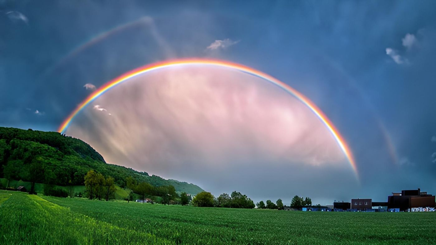
    In many cases, in addition to the primary arc, we can also see a paler secondary arc farther out in the distance. This secondary rainbow arc is virtually a mirror image of the primary arc due to the fact that its color sequence is the exact opposite of the primary arc. The light from the secondary rainbow arc, much as the light from the “regular” rainbow, is refracted into raindrops.

    But, when the light beam enters the droplet at a certain angle of incidence, a portion of it is reflected not oncebut twice at the boundary layer within the droplet. In this scenario, the maximum permissible value for the angle of the second arc is 51 degrees, instead of 42. In other words, the second rainbow arc always forms at 51 degrees.

    The number of light rays that have been twice reflected is smaller than the number of light rays that have been single-reflected, which is why the secondary rainbow arc always looks far weaker.

    References

    1. Rainbows, St-Andrews.ac.uk
    2. Featured Image: Luke Wyss
    3. “Rainbows, Halos and Glories”, Robert Greenler, Cambridge University Press, 1980.
    4. American Mathematical Society. The Mathematics of Rainbows.
    5. Gary Waldman, 1983. Introduction to Light: The Physics of Light, Vision, and Color
  • Are There Triple Rainbows? And How Are They Formed?

    Are There Triple Rainbows? And How Are They Formed?

    • A rainbow is formed when sunlight reflects off raindrops and undergoes refraction and dispersion.
    • Double rainbows occur when light is reflected twice within raindrops.
    • Triple rainbows are possible and result from three reflections of sunlight inside raindrops, but they are much fainter and rarer.

    The rainbow is an amazing natural phenomenon. The conventional pattern of colorful bands results from the fundamental laws of reflection, refraction, and dispersion. And under exceptional circumstances, a double rainbow may be marveled at. How about triple rainbows, though? Can they possibly exist? Moreover, how do they form?

    Formation of the Single Rainbow

    A primary rainbow.
    A primary rainbow. (Image: Earth Science Stack Exchange)

    Rainbows are one of the numerous natural beauties that everyone is in love with. When rain is falling, they emerge when sunlight reflects off raindrops. The majority of the color spectrum of light is absorbed by the raindrop, but a small percentage is reflected. Because of the sphere’s shape, the raindrop focuses these reflections at an angle of 138 degrees relative to the Sun. After that, there will be a rainbow seen in this intense beam of light.

    When light travels through air and then enters water, a phenomenon known as refraction occurs, which is the bending of light. Every one of the sunlight’s colors is slightly distorted when it passes through water droplets. This phenomenon, known as dispersion, is responsible for the separation of colors in a rainbow.

    In the droplets, the various sunlight wavelengths are each refracted a little bit differently. We perceive the normal color bands as a result of the light splitting into its colorful spectral components. The blue band is positioned on the inside and the red band is on the outside because the blue light has a shorter wavelength and is refracted more strongly in the water droplets.

    Moving From a Single to Double Rainbow

    double rainbow

    A second, fainter rainbow arc can be seen beyond the first one; its colors are reversed so that red is on the inside. This is because the light is reflected twice within the droplet before it leaves.

    A rainbow always appears facing a certain direction: It is situated at 42 degrees on the side of the sky that is directly opposite the sun. It is difficult to see a rainbow at noon because this antisolar point is hidden below the horizon when the sun is high in the sky.

    But sometimes, in addition to the main rainbow, a second, paler secondary arc that resembles a mirror reflection of the first arc can be observed on the outer. This is due to the fact that its color scheme completely contrasts with the main arc’s. Because the secondary arcs cause two reflections of the photons within the droplet. The intensity of this second rainbow is lowered, and the order of the colors is changed as a result of the double reflection.

    The Formation of the Triple Rainbow

    triple rainbow formation: Light paths inside droplets. The sequence and angle of a rainbow are determined by surface refraction and the quantity of internal reflections: a regular rainbow on the left, a double rainbow in the center, and a triple rainbow on the right.
    Light paths inside droplets. The sequence and angle of a rainbow are determined by surface refraction and the quantity of internal reflections: a regular rainbow on the left, a double rainbow in the center, and a triple rainbow on the right. (Credit: ISTA)

    What about the triple rainbows? A rainbow may also split into two secondary arcs. This has always been recognized as theoretically possible. As a result of the sunlight being reflected three times within the droplet, a third rainbow is created. However, this time, the light beams emerge from the drop facing the sun. Therefore, we need to gaze more intently into the sunlight in order to perceive a triple rainbow.

    Typically, a triple rainbow will emerge for a brief period of time when it is 40 degrees from the sun and the clouds are darker. The order of colors in the third rainbow will be just like the primary one.

    The tertiary rainbow cannot usually be seen since it is only about fifth as bright as the rainbow’s main arc. It is also too difficult to see the third rainbow because it faces the sunlight. Since just five triple rainbows had been reported to science in the previous 250 years, many scientists had written them off as myths. And it should come as no surprise that the first photographic proof of a triple rainbow did not appear in a scholarly publication until 2011.

    We have to be looking at raindrops at an angle of 138 degrees from the direction of the sun, or 42 degrees from the antisolar point, in order to see the arc of a natural rainbow.

    Interference Arcs and Mirror Arcs

    However, according to climate researchers and specialists, the far more typical occurrences of interference arcs and mirror arcs sometimes could be mistaken with a real third rainbow or triple rainbow.

    When sunlight reflects off a water surface, such as a lake, the angle of entrance into the droplets changes, creating a mirror arc. Typically, the main arc and the mirror arc cross.

    Contrary to actual secondary arcs, interference arcs are located on the inside of the initial rainbow and run parallel to the main arc. They create a string of successively farther-apart replicas of the initial rainbow, each of which becomes weaker and narrower. They are created by the interference—or the superposition effect—of light rays leaving the drop.

    Sources:

    1. Gary Waldman, 1983. Introduction to Light: The Physics of Light, Vision, and Color.
    2.  Triple Rainbows Exist, Photo Evidence Shows,” 2011. ScienceDaily.
    3. American Mathematical Society. The Mathematics of Rainbows.
    4. Großmann, Michael; Schmidt, Elmar; Haußmann, Alexander, 2011. “Photographic evidence for the third-order rainbow”Applied Optics.