Long before Christopher Columbus made landfall in the Caribbean in October 1492, the Western Hemisphere was home to tens of millions of people living across a vast network of empires, city states, and agricultural confederacies. Spanning two continents from the alluvial valleys of the Mississippi River to the high plateaus of the Andes, Pre-Columbian civilizations independently invented writing systems, calculated the movements of Venus with pinpoint mathematical accuracy, domesticated crops that now feed the modern world, and raised stone monuments rivaling the pyramids of the Old World.
The Olmec and the Dawn of Mesoamerican Civilization
Along the tropical Gulf Coast of modern Mexico in the states of Veracruz and Tabasco, the Olmec civilization flourished between 1500 BC and 400 BC as the foundational culture of Mesoamerica. Centered around ceremonial capitals such as San Lorenzo and La Venta, the Olmecs engineered earthen pyramids, complex basalt drainage aqueducts, and paved plazas. They are best remembered for carving seventeen colossal stone heads from single boulders of volcanic basalt transported over fifty miles from the Tuxtla Mountains, each weighing up to forty tons and depicting individual rulers wearing protective headgear.
The Olmec legacy established the cultural blueprint followed by nearly every subsequent Mesoamerican society. They developed the ritual Mesoamerican ballgame played on stone courts with solid vulcanized rubber balls, initiated bloodletting ceremonies, carved exquisite jade figurines, and laid the early foundations of the Long Count calendar and Mesoamerican hieroglyphic writing.
Teotihuacan and the Zapotecs of Monte Alban
While the Olmec world faded, highland Mexico witnessed the rise of urban metropolises on a monumental scale. In the Valley of Oaxaca, the Zapotec civilization leveled an entire mountain ridge around 500 BC to construct Monte Alban, an astronomical and administrative capital featuring carved stone slabs known as the Danzantes and early phonetic scripts. Further north in the Basin of Mexico, the city of Teotihuacan rose around 100 BC to become the sixth largest city in the world by 450 AD, housing an estimated one hundred and twenty five thousand residents from multiple ethnic groups.
Laid out along a strict grid anchored by the Avenue of the Dead, Teotihuacan was dominated by the Pyramid of the Sun, the Pyramid of the Moon, and the Temple of the Feathered Serpent.Controlling obsidian mines that supplied razor sharp volcanic glass tools across Central America, Teotihuacan exerted political and artistic influence all the way to the Maya lowlands of Guatemala before its ceremonial core was mysteriously burned and abandoned around the sixth or seventh century AD.
The Classic Maya: Mathematicians and Astronomers of the Rainforest
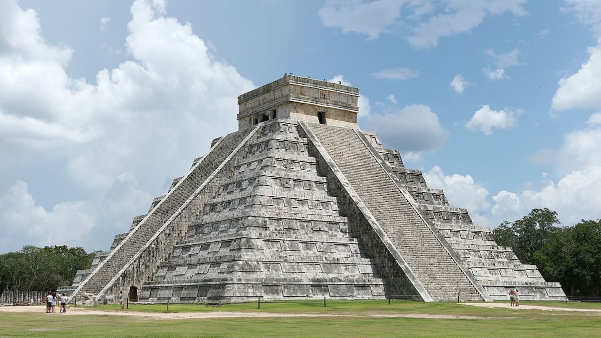
Stretching across the Yucatan Peninsula, Belize, Guatemala, and western Honduras, the Maya civilization reached its intellectual peak during the Classic Period between 250 AD and 900 AD. Unlike a single unified empire, the Maya world consisted of competing kingdoms—such as Tikal, Calakmul, Palenque, and Copan—ruled by divine kings known as k’uhul ajaw. Inside dense tropical forests where seasonal droughts posed constant challenges, Maya engineers constructed limestone reservoirs, raised agricultural causeways called sacbeob, and corbel vaulted palaces.
The Maya were the premier intellectuals of the Pre-Columbian Americas. They developed the only fully phonetic logosyllabic writing system in the Western Hemisphere, recording dynastic histories on stone stelae and bark paper codices. Crucially, Maya mathematicians independently invented the concept of positional zero centuries before its adoption in Europe, using a base twenty vigesimal system to predict solar eclipses and track the synodic cycles of Venus and Mars across millions of years.
The Aztec Empire and the Island Metropolis of Tenochtitlan
In the fourteenth century, a nomadic Nahuatl speaking people known as the Mexica migrated into the Valley of Mexico and founded their capital, Tenochtitlan, in 1325 on a marshy island in the middle of Lake Texcoco. Through a Triple Alliance with the neighboring cities of Texcoco and Tlacopan in 1428, the Aztecs forged a tribute empire spanning from the Gulf of Mexico to the Pacific Ocean, ruled by emperors such as Moctezuma II.
By 1519, Tenochtitlan had grown into a Venetian style metropolis of over two hundred thousand inhabitants, larger than Paris or Madrid at the time. Connected to the mainland by three wide stone causeways fitted with removable bridges and supplied with fresh spring water by a twin pipe aqueduct from Chapultepec, the city fed its population through chinampas—artificial floating agricultural islands anchored in the shallow lakebed by willow roots that yielded up to seven harvests of maize, beans, squash, and amaranth per year.
Andean Predecessors and the Inca Empire of Tawantinsuyu
South America possessed an equally ancient cradle of civilization that began with the coastal city of Caral in Peru around 3000 BC—contemporaneous with the Egyptian pyramids—followed by the Chavin, Nazca, Moche, Tiwanaku, and Wari cultures. In the fifteenth century, under the transformative leadership of Emperor Pachacuti, the Inca expanded outward from the highland valley of Cusco to unite these diverse Andean regions into Tawantinsuyu, the Realm of the Four Parts, the largest empire in the Pre-Columbian world.
Stretching over two thousand five hundred miles along the spine of the Andes from southern Colombia to central Chile, the Inca Empire functioned without wheeled vehicles, draft horses, currency, or a conventional written alphabet. Instead, Inca engineers unified vertical mountain climates through the Qhapaq Nan, a twenty five thousand mile network of stone paved mountain highways and braided grass suspension bridges navigated by relay runners called chasquis. They transformed steep mountain slopes into microclimatic agricultural terraces watered by stone channels, built earthquake resistant dry stone architecture at sites like Machu Picchu and Sacsayhuaman where multi-ton polygonal blocks fit together without mortar, and managed imperial taxation and census data using khipu—intricate bundles of knotted and dyed camelid cords that served as three dimensional binary and decimal calculators.
Cahokia and the Ancestral Puebloans of North America
North of the Rio Grande, complex Pre-Columbian societies adapted to vastly different ecological zones. In the arid Four Corners region of the American Southwest, the Ancestral Puebloans constructed monumental multi-story masonry Great Houses in Chaco Canyon between 850 AD and 1150 AD, aligning structures like Pueblo Bonito with the solar and lunar cycles before later carving the dramatic cliff dwellings of Mesa Verde into sandstone alcoves.
Meanwhile, along the fertile floodplains of the Mississippi River just across from modern Saint Louis, Missouri, the Mississippian culture built the metropolis of Cahokia. Reaching its zenith between 1050 AD and 1200 AD with a population rivaling twelfth-century London, Cahokia featured over one hundred earthen platform mounds arranged around vast public plazas and a solar calendar circle of wooden posts known as Woodhenge. At the heart of the city stood Monks Mound, a ten-story terraced earthen pyramid covering fourteen acres at its base—larger in footprint than the Great Pyramid of Giza—standing as enduring proof of the organizational scale of North America’s indigenous civilizations long before European contact.