Tag: map

  • Here Be Dragons: Dangerous or Unexplored Territories

    Here Be Dragons: Dangerous or Unexplored Territories

    The Latin phrase “hic sunt leones” (literally “here be lions”) or “hic sunt dracones” (literally “here be dragons”) is an expression associated with ancient maps to denote the still unexplored zones of Africa. This phrase recurs in historiography and literature but lacks evidence in medieval cartographic documentation and is rarely found in ancient artifacts.


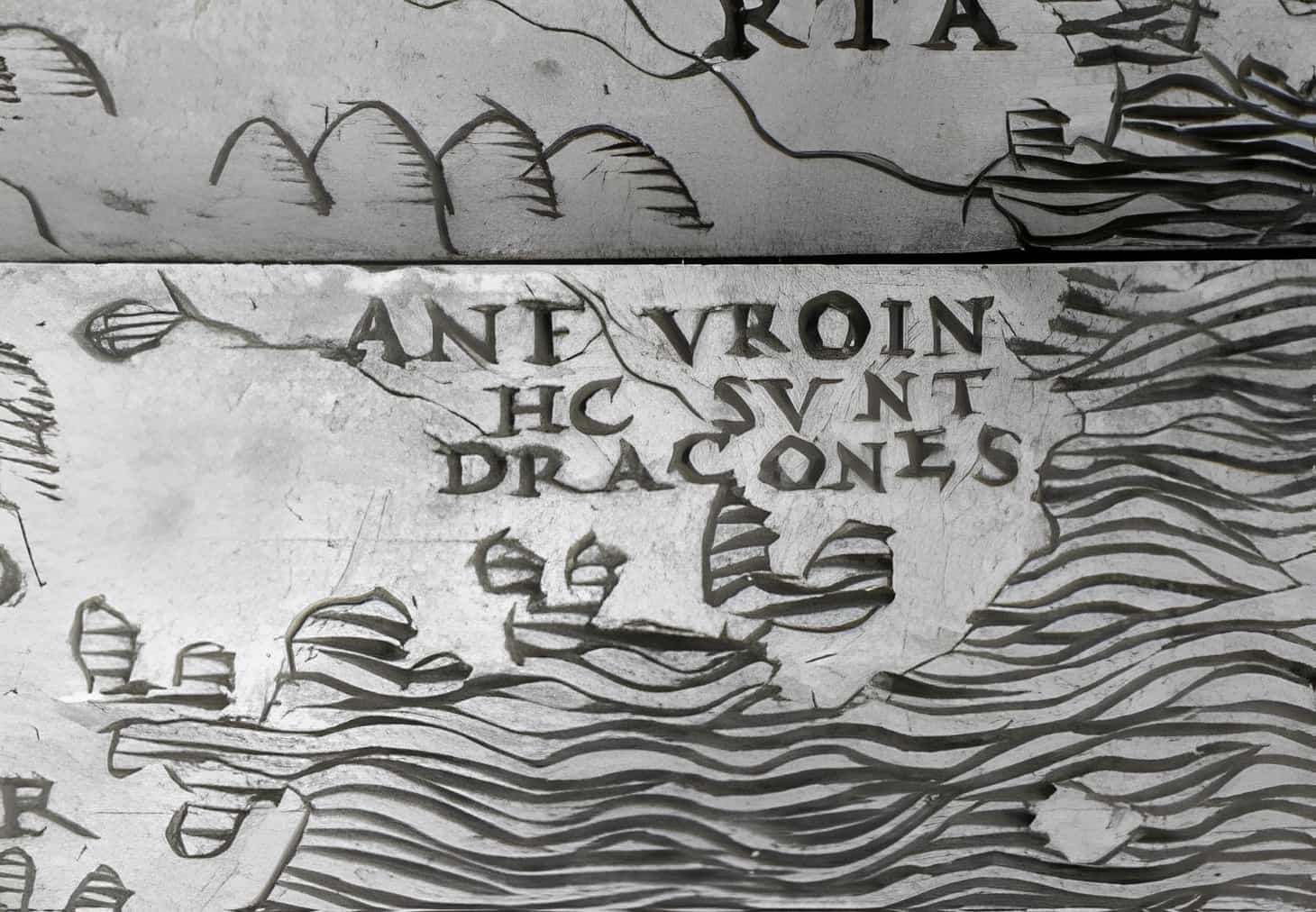
    HC SVNT DRACONES

    Early world maps often illustrated the space beyond the known world with mythical creatures like sea serpents and sea monsters. On the Hunt-Lenox Globe, one of the oldest surviving globes dating back to the years 1503–1510, the inscription HC SVNT DRACONES is located in the area of eastern Asia below the equator. While this is the only known use of the phrase on a historical map, the expression in Latin, as well as its English translation, “here be dragons,” has gained proverbial significance in the English-speaking world since the 20th century. It serves as a warning about unexplored and perilous territories.
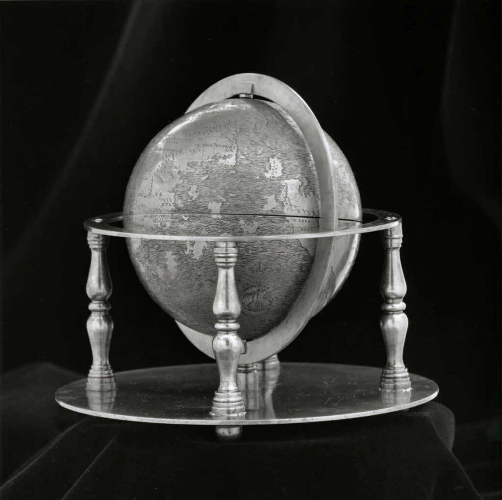
    Hunt-Lenox Globe.
    Hunt-Lenox Globe.

    Here Be Dragons and Here Be Lions

    Only the Cotton Map (10th century AD) includes the mysterious statement “hic sunt leones” between Gog and Magog and the eastern coast of Asia, accompanied by a drawing of the well-known maned feline. Indeed, in that area, there were tigers, leopards, and also lions (a small population still exists in India today). Some maps instead feature the expression “hic sunt dracones.” Additionally, it is not uncommon to come across the indication “hic nascuntur elephantes,” but the latter seems more like information about ivory resources.

    There is no historical evidence that the phrase was ever used by a cartographer for Mediterranean Africa. However, a widely spread explanation suggests that originally, the Latin phrase “hic sunt leones” appeared on geographical maps of ancient Rome and later periods, marking the unexplored regions of Africa and Asia. The phrase signified the uncertainty about what lay in those unknown lands, except for the presence of wild beasts, or it referred to territories that could not be conquered.
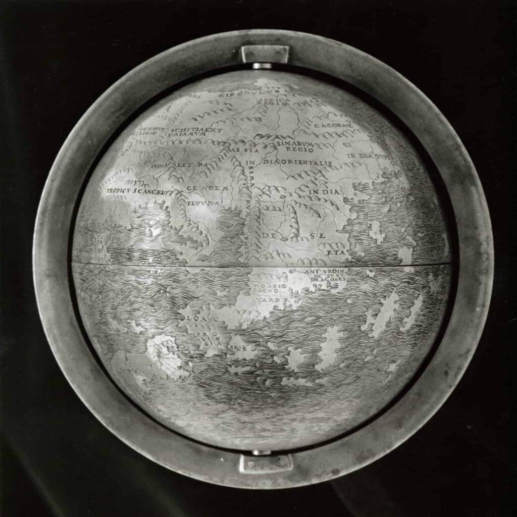
    The Hunt-Lenox globe, close-up on Asia.
    The Hunt-Lenox globe, close-up on Asia.

    Many times, pre-industrial-age cartographers adorned their maps with ornamental drawings, sometimes as per the request of patrons, featuring coats of arms, flags, large portraits of rulers, goods, and more. This was especially true for cartographic schemes intended for scholastic meditation rather than actual travel. Particularly during the late Middle Ages, the coastlines were much more known than the inland territories.

    For this reason, even well into the modern era, cartographers placed various illustrations in vast continental areas that could be somewhat curious or interesting, allowing ample space for both imaginary and unreachable places (such as the terrestrial paradise, Gog and Magog, and the realm of Prester John) and various legendary or allegorical beings, including blemmies, cynocephali, elephants, unicorns, rhinoceroses, manticores, and even lions. In reality, uninhabitable areas were defined based on temperature (excessive cold or heat) or the presence of venomous snakes and scorpions (as seen in Leardo), serving as a metaphor for satanic allegories in the Bible.


    Today, the phrase is used to indicate a situation or condition requiring particular attention or respect for a certain group of people.

    The Phrase in Literature

    • Inspired by the reading of medieval maps, Marco Polo asserts that lions were abundant in China, likely alluding to tigers since lions never lived in China (zoological classification would only emerge later).
    • The term is also the title of Stephen King’s horror short story, Here There Be Tygers, which is an allusion to the phrase.
    • In Umberto Eco’s novel “The Name of the Rose,” the symbolic meaning of this phrase is anachronistically used by one of the protagonists, Jorge da Burgos, in the sentence “There are boundaries beyond which it is not allowed to go. God wanted it written on certain maps: hic sunt leones,” when he and the protagonist, William of Baskerville, were in the secret room of the library called “finis Africae.”

    Usage of Here Be Dragons Today

    Technology, Science, and Economy

    In the source code of applications, the phrase is often inserted as a comment to warn other developers about poorly written code or confusing sections. In the financial world, risk managers use the jargon “T.B.D.” (there be dragons) to indicate risks that are not foreseeable. The Chaos Computer Club had chosen “here be dragons” as the motto for the 26th Chaos Communication Congress. Olle Häggström named a monograph published in 2016 on existential risks and transhumanism after the English translation of the phrase. OpenStreetMap names its servers after fictional dragons.

    Pop Culture

    Numerous references can also be found in pop culture: In the English original of the series Star Trek: The Next Generation, in Episode 28 “Where Silence Has Lease,” Captain Picard comments on the unknown future with: “Beyond this place there be dragons.” Additionally, in the video game Divinity 2: Ego Draconis, a parchment can be found bearing the inscription “Hic sunt Dracones,” and in the video game Eternal Darkness: Sanity’s Requiem, a document with the words “Hic sunt dracones” is discoverable.

    The formulation is also used in the BBC series Sherlock: Mycroft Holmes justifies his statement that Sherlock would be more useful in England than on a potentially deadly intelligence mission in Eastern Europe by saying, “Here be dragons,” to his brother, whom he calls a dragon slayer. In the Syfy series “The Expanse,” taken over by Amazon Prime, the eleventh episode of the second season is titled “Here There be Dragons.” In the video game The Witcher 3: Wild Hunt, the phrase is also used to indicate the outskirts of the open world that the titular character cannot venture into.


    In this context, the expression has an ironic meaning within the game, as the Witcher hunts monsters but not dragons. Other monsters are often initially introduced as “dragons,” only to be revealed as false.

    Related Expressions

    Comparable is the meaning of “Hic sunt leones.” This variant is quoted in Umberto Eco’s The Name of the Rose by William of Baskerville due to its double meaning when he finds the “finis africae” (“End of Africa”).
  • Terra Incognita: “Unknown Lands” in Cartography

    Terra Incognita: “Unknown Lands” in Cartography

    “Terra incognita” (Latin for “unknown land”) is a historical term in cartography referring to land masses or areas that were not yet mapped or described at the time. The term appears on old sea or land maps of regions that were still unexplored or only partially known. Many maps adorned such areas with dragons or other mythical creatures.

    Etymology of Terra Incognita

    • Terra: Derived from the Latin term for ‘earth’ or ‘land.’ Corresponding English terms encompass terrestrial, territory, and terrain.
    • Incognita: Originating from the Latin cognoscere, meaning ‘to know’ or ‘be acquainted with,’ with the negation ‘in-‘ as a prefix. This is connected to English words like know and the Greek term γνῶσις (gnosis) for ‘knowledge.’ Relevant English terms linked to this include agnostic, cognition, and gnosticism.
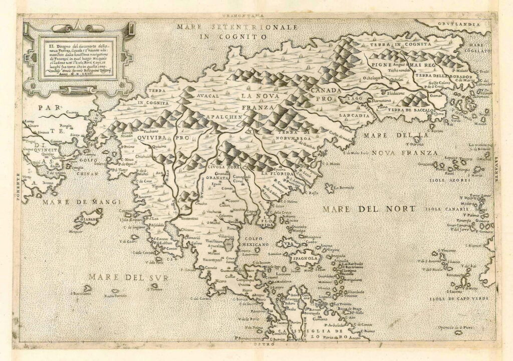
    Map of North America from 1566 with Terra Incognita and Mare Incognito (Unknown Sea).
    Map of North America from 1566 with Terra Incognita and Mare Incognito (Unknown Sea).

    Terra Incognita in History

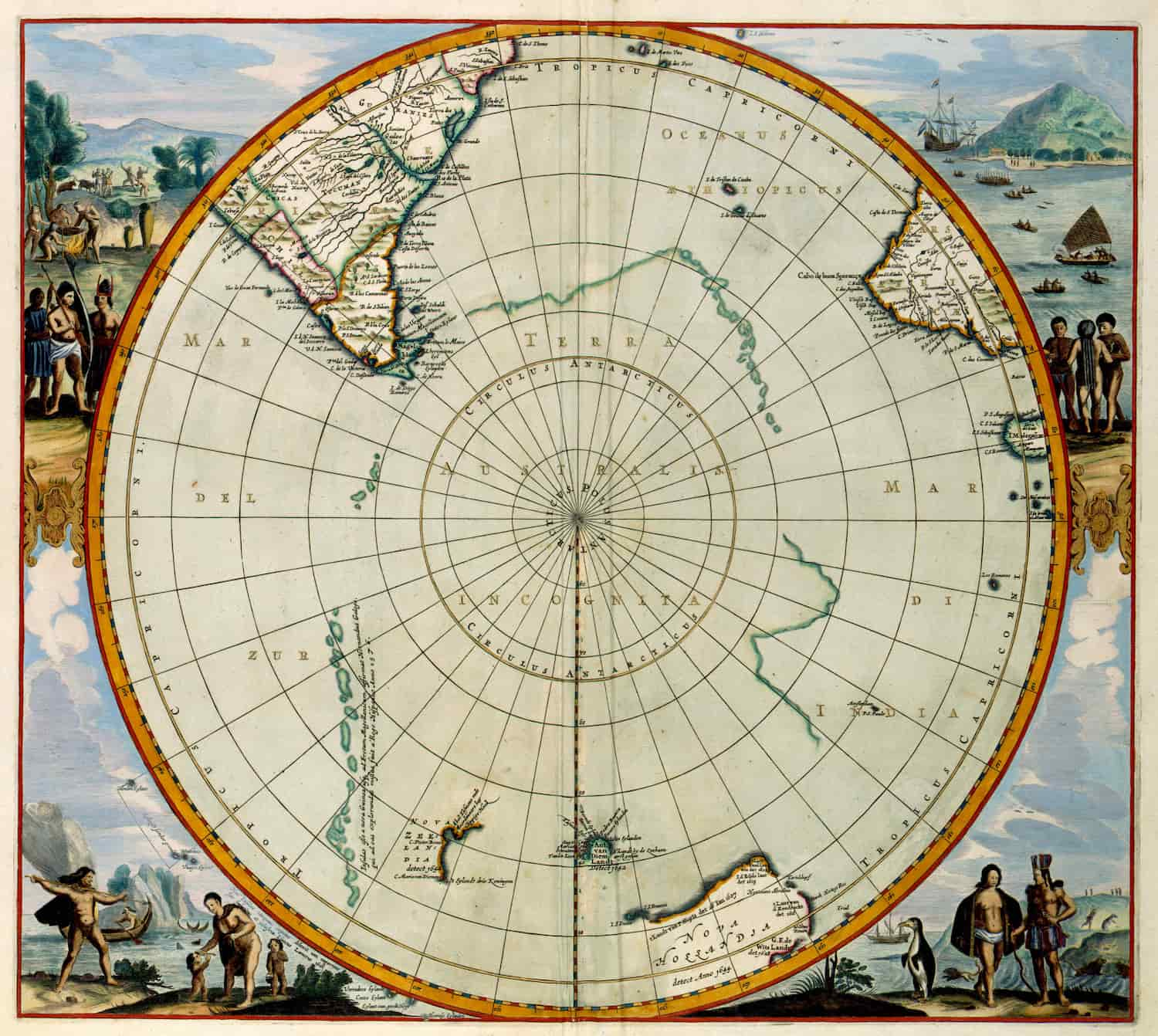
    The most significant region of Terra incognita was Terra Australis (incognita), a large landmass in the Southern Hemisphere postulated in ancient and medieval times as a counterbalance to the northern continents. The continent of Australia, discovered around 1600 by sailors, received its name from this concept.


    Other parts turned out to be nonexistent or were actually pack ice or coastal sections of Antarctica.

    In 1883, Clements Markham referred to the unknown territory as the “blank of the maps,” a term later translated into other languages such as German as “white spots”. With the increasing exploration and mapping of the Earth, the term has lost its relevance and is now predominantly used in a historical or metaphorical sense. It is overlooked that even today, significant portions of the Earth remain virtually unexplored.

    Terra Incognita
    Terra australis incognita.

    Retreat of Unknown Lands

    Since 1830, explorations have multiplied, and colonial expansion has facilitated the discovery of the last unexplored territories. Explorers, including David Livingstone, explored Central and East Africa and the Congo Basin. With the development of geographical societies in the 19th century, the mention of terra incognita gradually disappeared from maps.

    In modern times, it seems that there are no longer truly unexplored territories by humans, except for numerous underground and underwater areas. Consequently, the term is now used more metaphorically. For instance, a subject can be terra incognita for an individual if it exceeds the scope of their knowledge.

    Origins of the Expression Terra Incognita

    This inscription appeared on geographical maps, especially on world maps, to designate lands located beyond the areas known to Europeans. For a long time, the interior of Africa (particularly the Congo Basin) was considered terra incognita, as were the spaces south of New Zealand (terra australis incognita, “unknown southern land”).

    Cartographers harbored numerous myths about these territories, which they transcribed onto their maps.


    For instance, they would write on these areas: HIC SVNT DRACONES (“here, there be dragons” in Latin) or simply depict fantastical creatures, such as giant sea serpents.

    Terra Incognita Today

    Metaphorically, it still represents uncharted or unexplored areas of reality, about which one may have knowledge or suspicions but cannot yet define concretely.

    Unexplored areas at the beginning of the 21st century include:

    • The ocean floor, particularly the Tamu Massif east of Japan, identified in 2009 as the largest volcano on Earth.
    • Land structures beneath the ice of Antarctica and Greenland.
    • Some Tepui mountains in Venezuela.
    • Certain 6000-meter peaks in the eastern Tibetan Himalayas.
    • The Wakhjir Pass corridor in the Pamir Mountains of Afghanistan.
    • Some regions of the Sahara.
    • Remote rainforests in the Amazon Basin.
    • Parts of the Andes.
    • Mountains in Papua New Guinea.

    Examples of discoveries/explorations since the year 2000 include:

    • Hodgson Lake (Antarctica, 2000).
    • Muchimuk Cave System (Venezuela, 2002).
    • Gocta Waterfall (Peru, 2002).
    • Somoto Canyon (Nicaragua, 2004).
    • Erdi-Ma Plateau (Chad, 2005).
    • Sơn Đoòng Cave (Vietnam, 2009).
    • World’s Largest Peat Bog, Cuvette Centrale (Democratic Republic of Congo, 2012).
    • Taurida Cave (Russian-annexed Crimea, 2018).
    • Nazca Cat Drawing (Peru, 2020).
  • Tartaria Maps: Navigating Through the Lands of Tartaria

    Tartaria Maps: Navigating Through the Lands of Tartaria

    The Tartaria maps refer to ‘historical’ maps depicting the region of Tartaria in northern Asia. These maps offer insights into the alleged geography, landscape, and culture of the Tartaria region that supposedly existed in ‘hidden history’. This huge territory between the Caspian Sea and the Pacific Ocean, including the present-day boundaries of China and India, is referred to as Tartaria in Western European literature and cartography. From the 13th through the 19th centuries, the toponym was in regular usage.

    In many derogatory titles that had little to do with the actual inhabitants of the area, Tartaria became the most popular term for Central Asia and Siberia in European sources. European knowledge of the area was exceedingly limited, discontinuous, and partly mythological until the 19th century. The region historically known as Tartaria is now often referred to as Inner or Central Eurasia. The majority of the people in these areas have spent centuries raising cattle, despite the dry climate.

    1575 Tartaria Map

    A 1575 Tartaria Map First published in 1570.
    First published in 1570.

    View this map in higher resolution. [1.6 MB]

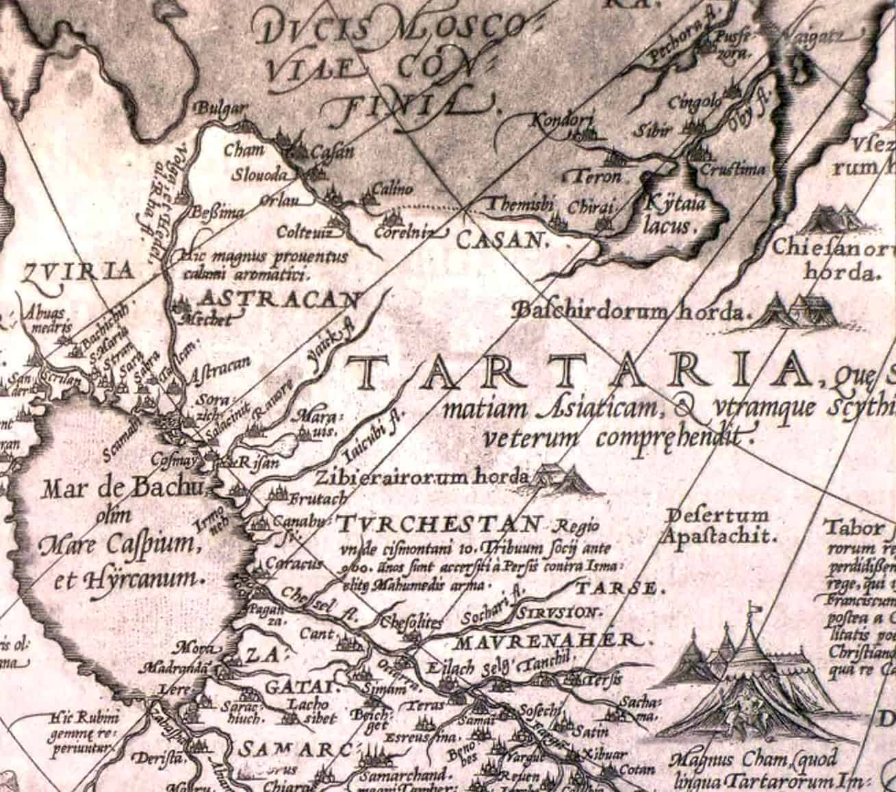
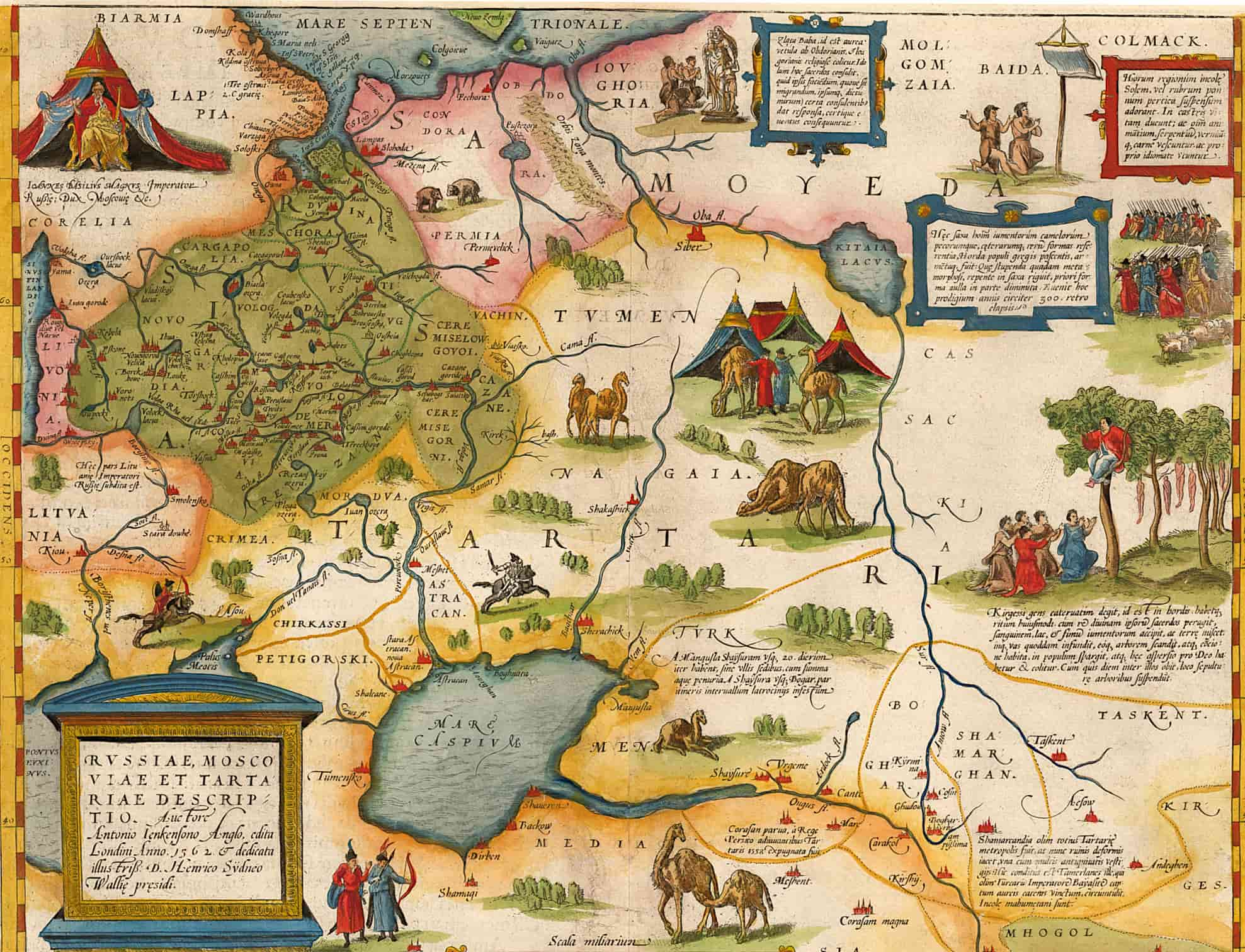
    A descriptive map of Russia and Tartaria by the explorer Anthony Jenkinson (1562). This is a scan of the map from the 1575 edition of Ortelius’ Theatrum Orbis Terrarum, first published in 1570 and republished many times between 1571 and 1641.

    Tartaria by Jodocus Hondius, 1606

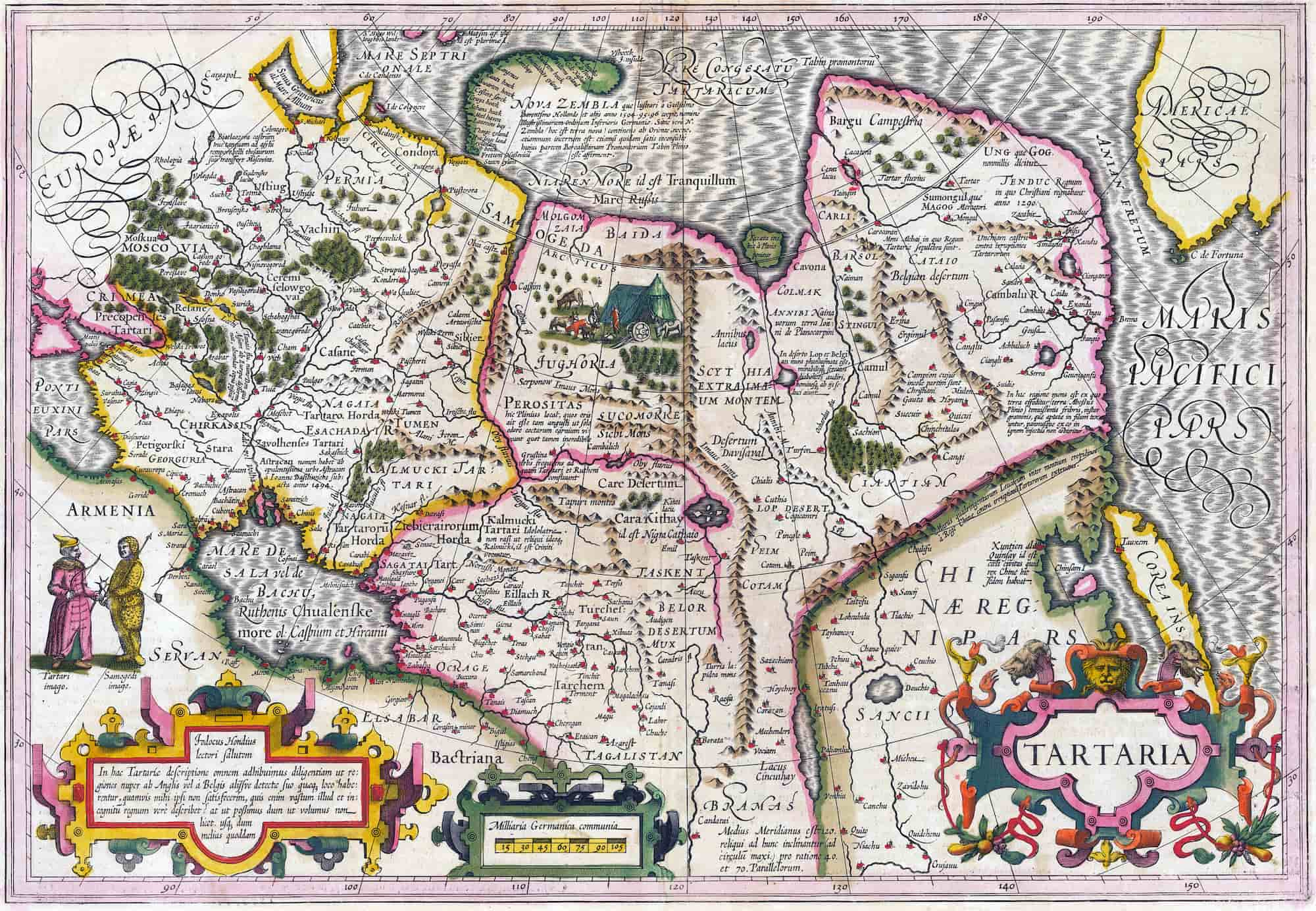
    A Tartaria map created by Jodocus Hondius (1563–1612).
    A Tartaria map created by Jodocus Hondius (1563–1612).

    View this map in higher resolution. [1.6 MB]

    A Tartaria map created by the Flemish and Dutch engraver and cartographer Jodocus Hondius (1563–1612). The map is from circa 1606. It depicts places like Tartaria, Central Asia, Asiatic Russia, the Great Wall of China, and the early Northwest Coast of America.

    The island of Corea, Cape de Fortuna, and the Straits of Anian are noteworthy landmarks. The map covers the Black Sea and Russia in addition to showcasing specifics about Nova Zembla. Livestock, tents, and scenes depicting nomadic tribes are examples of decorative components.

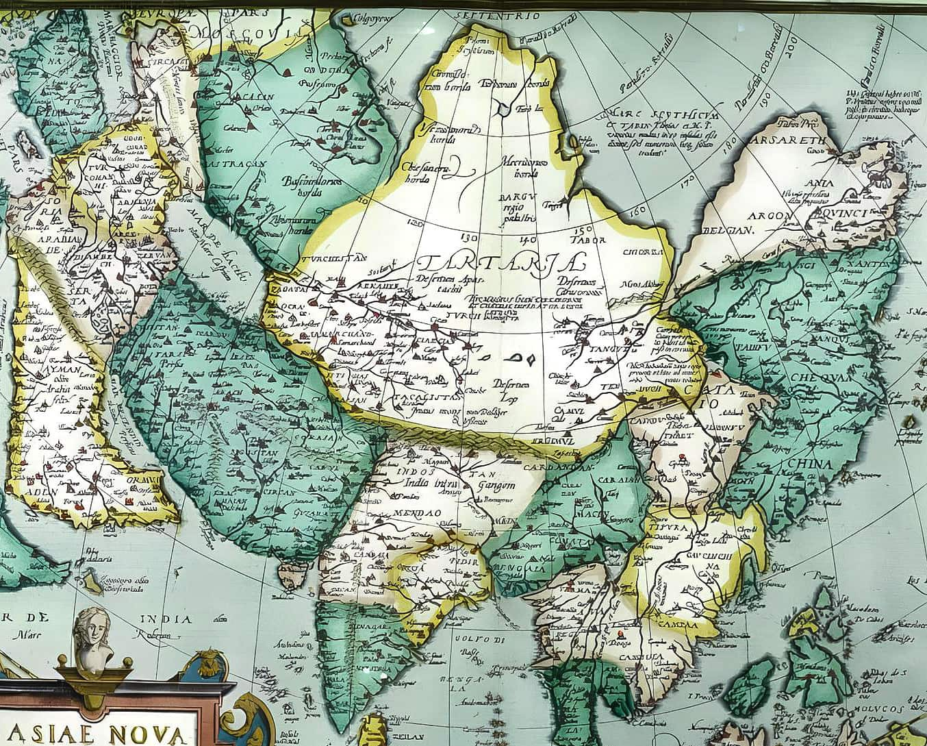
    Asiae Nova Descriptio, 1567–1570

    A Tartaria map from 1567-1570: Asiae Nova Descriptio (A New Description of Asia).
    A Tartaria map from 1567-1570: Asiae Nova Descriptio (A New Description of Asia).

    View this map in higher resolution. [1 MB]

    A Tartaria map from 1567–1570. Abraham Ortelius, Theatrum Orbis Terrarum, English publication as The Theatre of the Whole World, London 1606; this map is a reduction of Ortelius’ 8-sheet map of Asia from 1567, which was primarily taken from Giacomo Gastaldi’s wall-map of Asia from 1559–161.

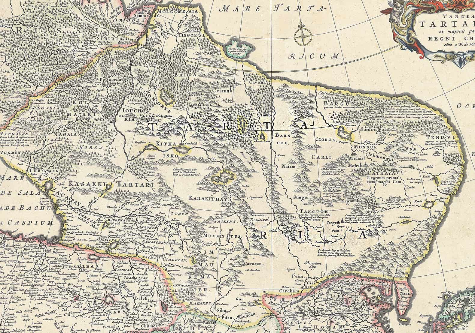
    Tartaria and the Greater Part of the Kingdom of China, 1680

    Tartaria and the Greater Part of the Kingdom of China 1680 2

    View this map in higher resolution. [11 MB]

    This map of Tartaria is from the special collection of the University of Amsterdam. This map was published by Frederik de Wit (1629–1706). He was a Dutch cartographer and artist. The map shows Oceanus Occidentalis (Atlantic Ocean) and Mare Tartaricum (Arctic Ocean).

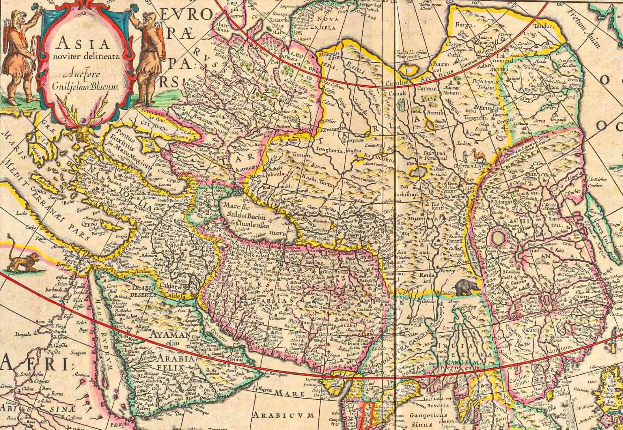
    1667 Atlas Maior

    A Tartaria map published in Joan Blaeu's 1667 Atlas Maior.
    A Tartaria map published in Joan Blaeu’s 1667 Atlas Maior.

    View this map in higher resolution. [3 MB]

    The large middle area, surrounded by yellow borders, reads “TARTARIA.” This is a Tartaria map from the 1667 printing of the Tenth of Blaeu’s series of twelve atlases. The book is titled “Le Grand Atlas, ou Cosmographie Blaviane,” in which the Earth, the Sea, and the Heavens are described.

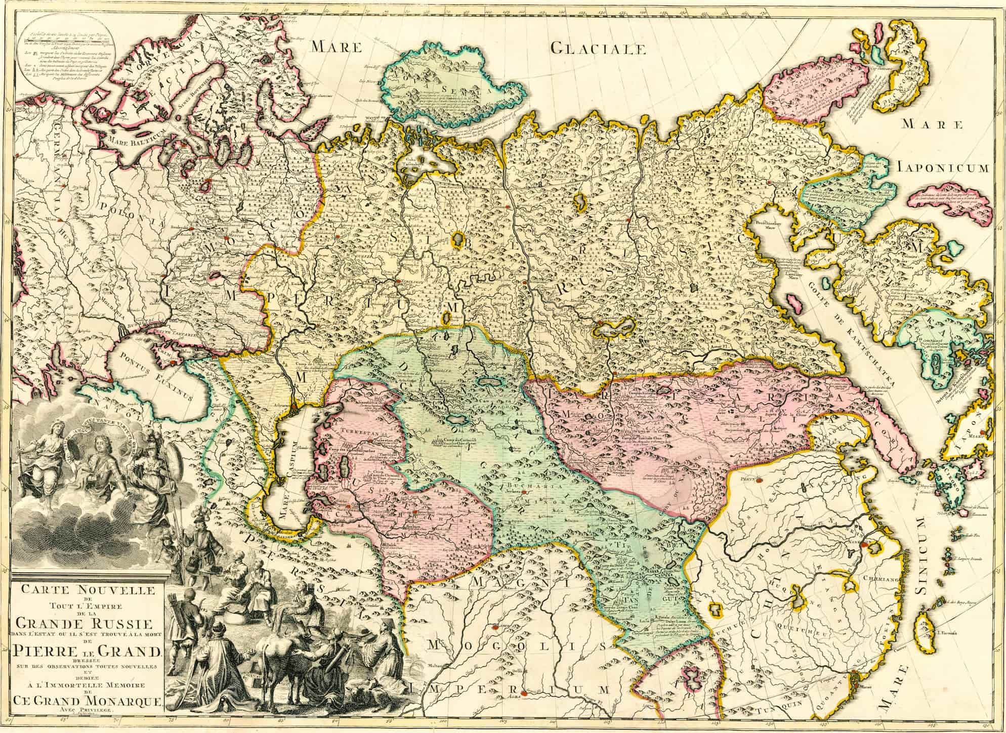
    18th-Century Tartaria Map

    18th-Century Tartaria Map, "Grand Russie."
    18th-Century Tartaria Map, “Grand Russie.”

    View this map in higher resolution. [5 MB]

    The large pink area at the right reads “TARTARIA.” It was a brand-new map depicting the whole of the Russian Empire as it was at the time of Peter the Great’s passing. The maps read, “In the immortal memory of this great monarch.”

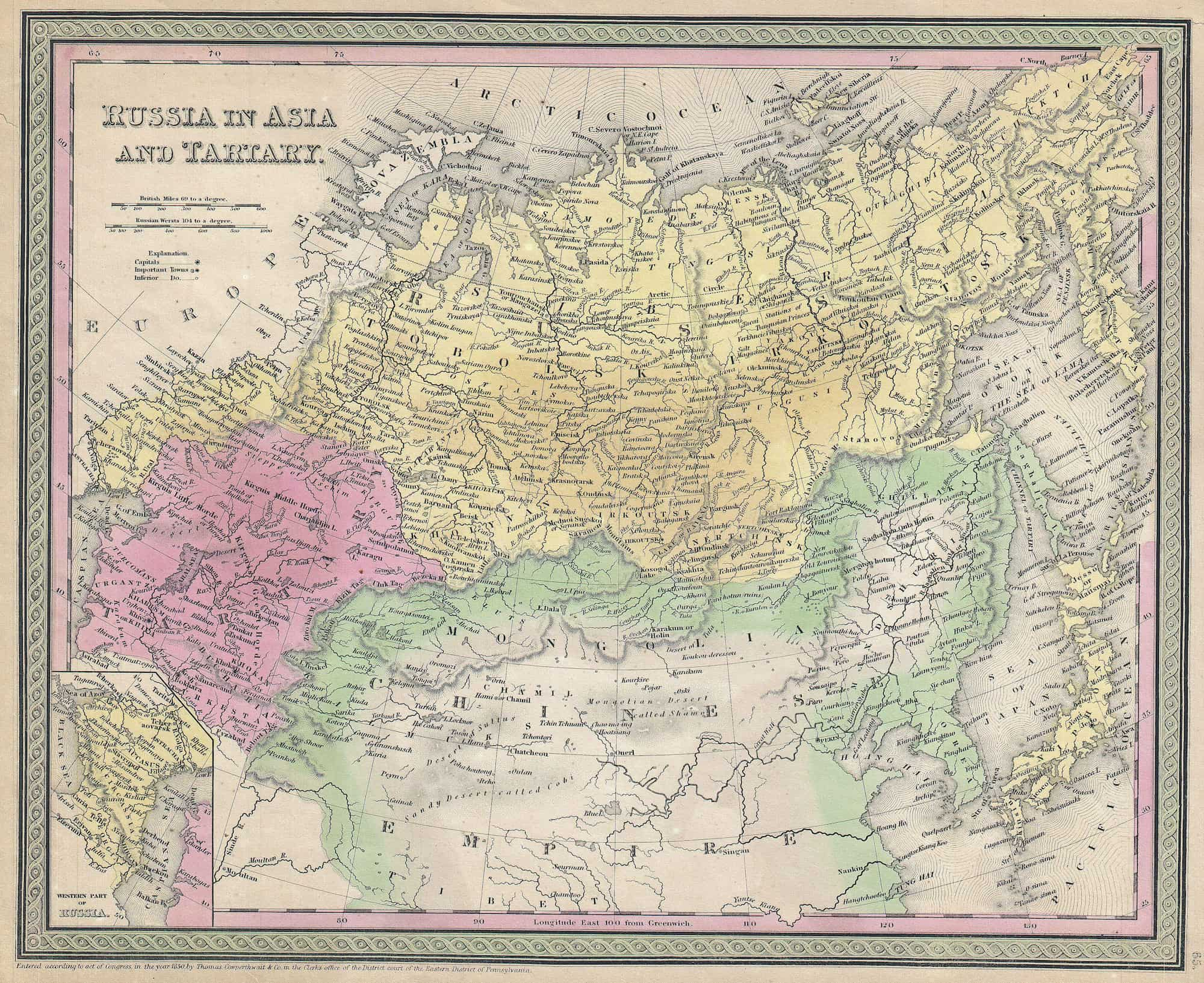
    Russia in Asia and Tartaria, 1853

    Russia in Asia and Tartary, 1853.
    Russia in Asia and Tartary, 1853.

    View this map in higher resolution. [4 MB]

    An example of S. A. Mitchell Sr.’s map of Russia in Asia and Tartaria from 1853. Beginning in the Ural Mountains and ending at the Caspian Sea, it stretches all the way to Siberia, Kamtschatka, and Japan in the east. Includes most of northern China as well as parts of Mongolia and Korea farther to the south.

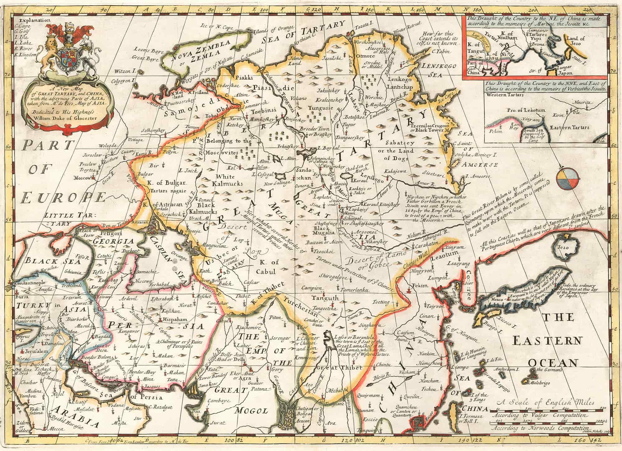
    Map of Great Tartaria and China, 17th Century

    Map of Great Tartaria, 17th century.
    Map of Great Tartaria, 17th century.

    View this map in higher resolution. [4 MB]

    A map of the Great Tartary and China, together with the neighboring parts of Asia, adapted from Mr. De Fer’s map of Asia. This work is dedicated to Prince William, Duke of Gloucester.

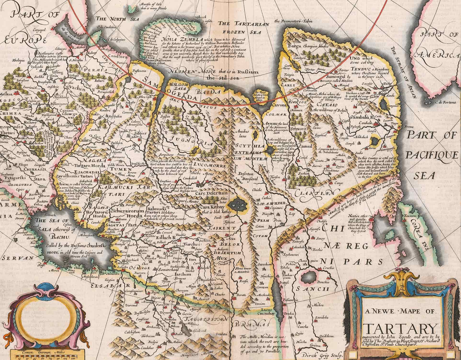
    A Tartaria Map of 1626

    A 1626 Tartaria Map by John Speed.
    A 1626 Tartaria Map by John Speed.

    View this map in higher resolution. [4 MB]

    An old map of Tartaria shows northern China, Kazakhstan, and Mongolia, as well as southern Russia and eastern China. The first English-made global atlas has this map, Speed’s map of Tartaria. There is a distinct depiction of the Great Wall of China, and the map’s interior is extensively marked.

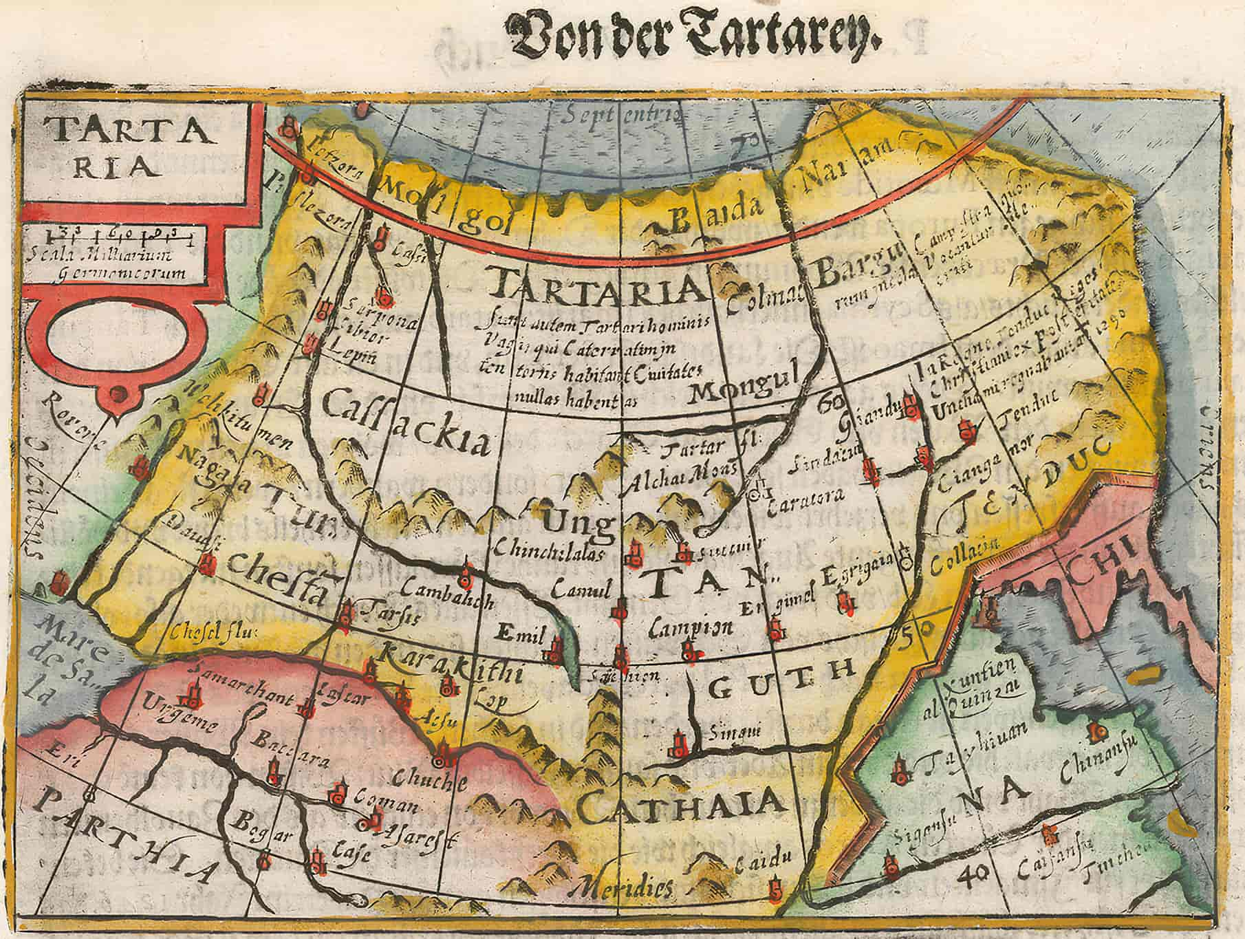
    Map of Tartaria by Bertius, 16th–17th centuries

    the 16th or 17th century Tartaria map by bertius
    A 16th or 17th century Tartaria map.

    View this map in higher resolution. [2.5 MB]

    The map of Tartaria by the geographer and cartographer Petrus Bertius (1565–1629). Bertius is best known as a mapper for his version of the Geographia of Ptolemy. In this 16th or 17th century Tartaria map, China is represented with “Chi” at the right and Parthia is shown at the bottom left next to the Caspian Sea, which reads Mar de Sala.

    1706 Tartaria Map

    The Map of Tartaria, 1706.
    The Map of Tartaria, 1706.

    View this map in higher resolution. [5.2 MB]

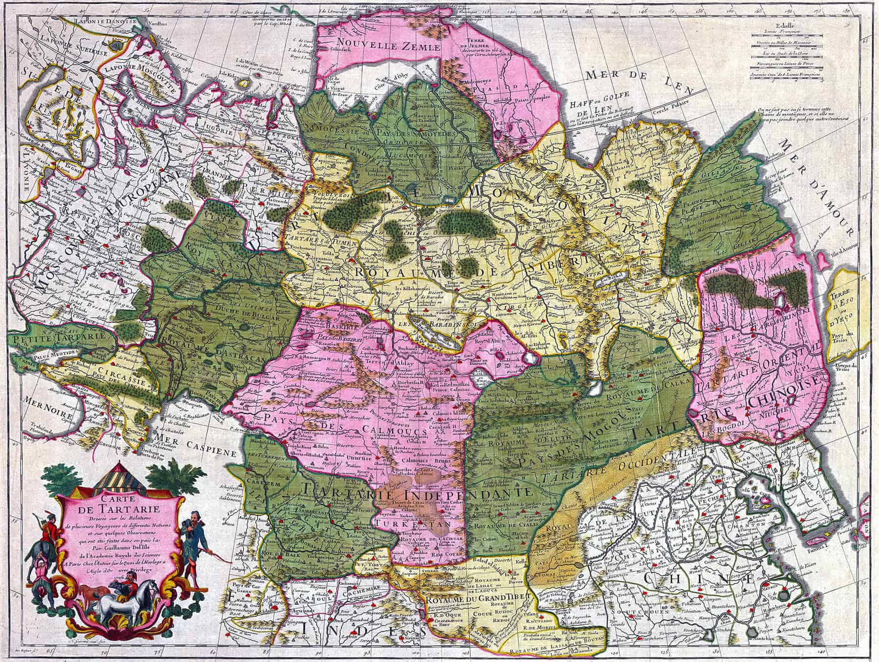
    Originally called “Carte de Tartarie” (Tartaria Map), it was created by the cartographer Guillaume Delisle (1675–1726) in 1706. The description on the bottom left side explains that this Tartaria map was drawn on the relationships of several travelers from different nations and on some observations made in French by Guillaume Delisle of the Royal Academy of Sciences, Paris.

    Tartaria Map of the Kingdom of the Great Khan, 16th Century

    A Tartaria map for Genghis Khan.
    A Tartaria map for Genghis Khan.

    View this map in higher resolution. [2.3 MB]

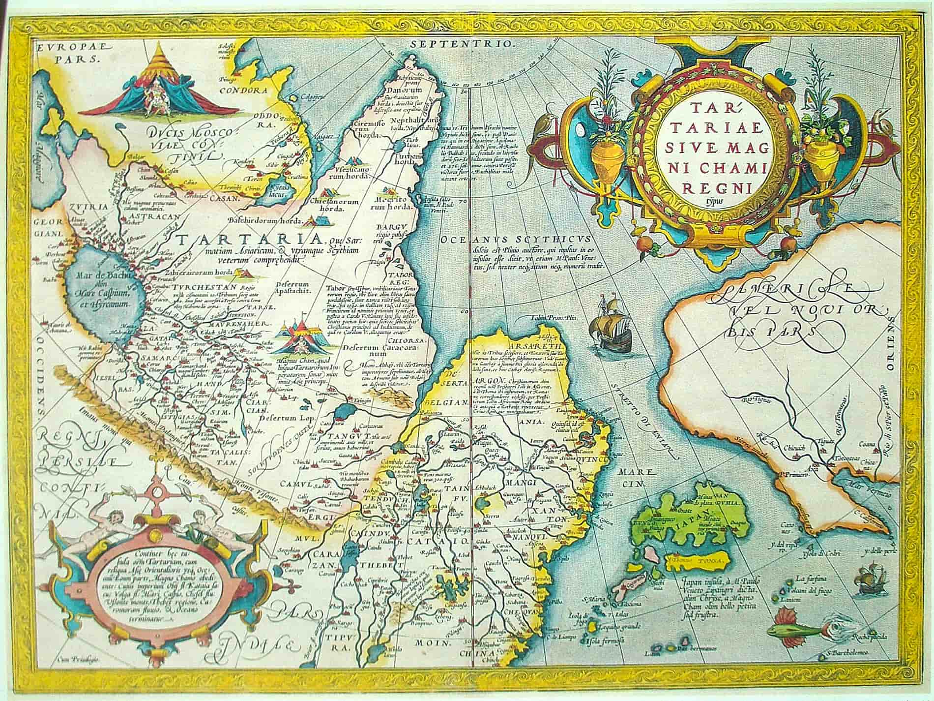
    An ancient Tartaria map drawn out by the great Brabantian mapper, geographer, and cosmographer Abraham Ortelius (1527–1598). The map shows the “Kingdom of the Great Khan,” which is likely Genghis Khan.

    See also: Genghis Khan’s Children: His Number of Sons and Daughters

    Grand Tartaria Map, 1674–1719

    Grand Tartaria Map, 1674--1719
    Grand Tartaria by Guillaume Sanson.

    View this map in higher resolution. [9.5 MB]

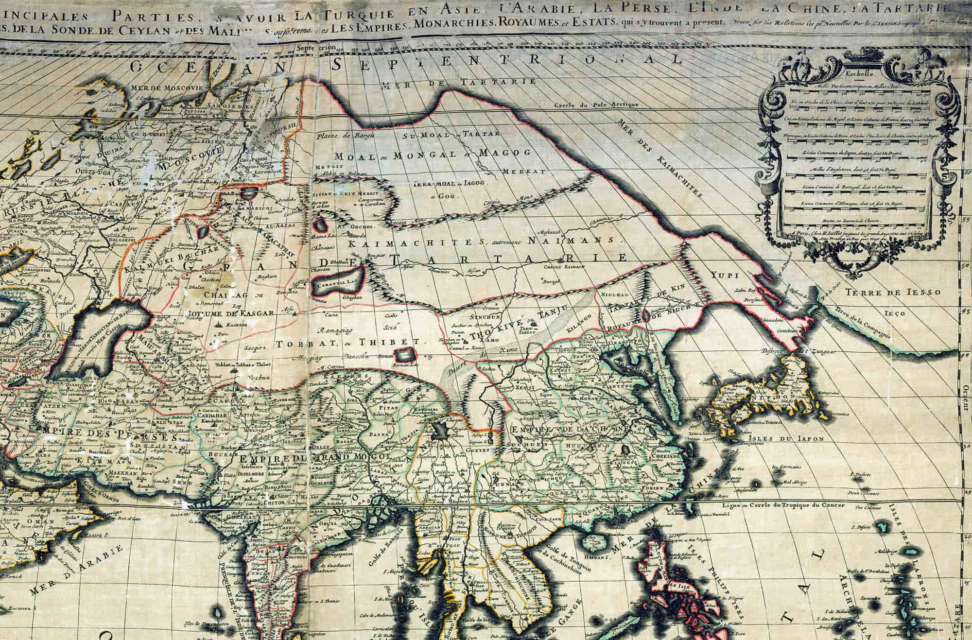
    The map of Grand Tartaria by the French cartographer Guillaume Sanson (1633–1703) at the French National Library. This map above is probably a copy from 1674–1719.

    1719 Tartaria Map

    1719 Tartaria Map
    This map of Asia and Tartaria (top) includes all of the East Indies, Japan, and India.

    View this map in higher resolution. [9 MB]

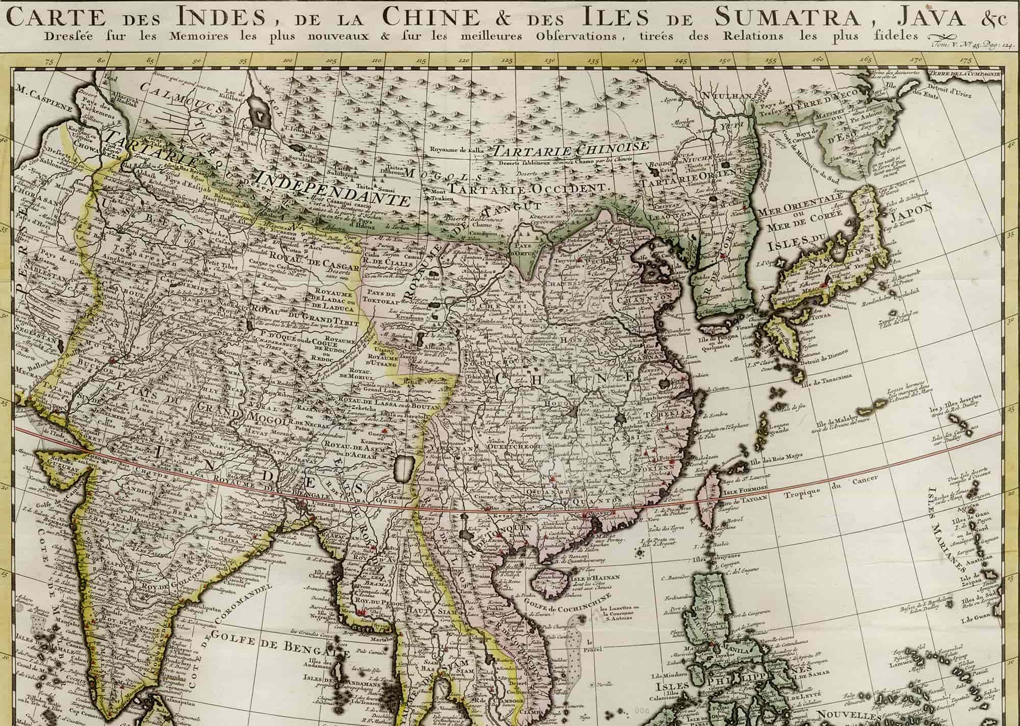
    This map of Asia and Tartaria (top) includes all of the East Indies, Japan, and India. It is drawn from H.A. Chatelain’s Atlas historique or nouvelle introduction à la chronologie (Historical Atlas or New Introduction to Ancient & Modern History, Chronology & Geography), 1719. He was a Huguenot pastor of Parisian origins.

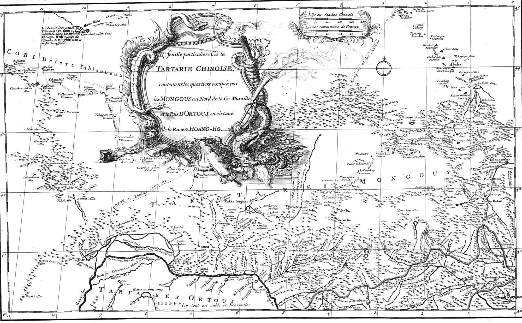
    3rd Map of Chinese Tartaria, 1737

    3rd Map of Chinese Tartaria, 1737
    From the New Atlas of China, Chinese Tartary, and Tibet, 1737.

    View this map in higher resolution. [2.4 MB]

    Third Map of Chinese Tartary or Tartaria, from the New Atlas of China, Chinese Tartary, and Tibet, 1737. It includes the regions occupied by the Mongols north of the Great Wall and the lands of Ordos, encircled by the Yellow River.

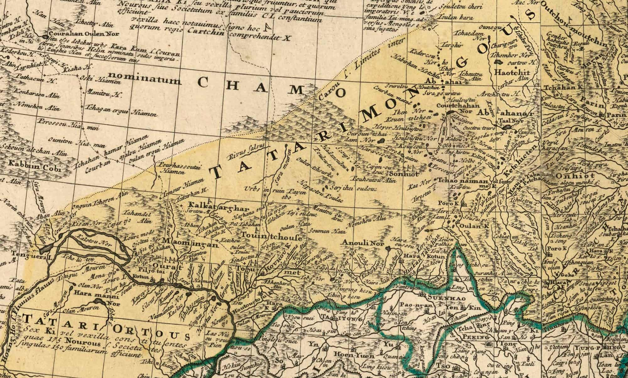
    Tatariae Sinensis, 1749

    Cropped section of the Tatariae Sinensis map.
    Cropped section of the Tatariae Sinensis map.

    View this map in higher resolution. [12.7 MB]

    Japan, Korea, Inner Mongolia, the Kingdom of Manchuria, and the Province of Great Tartary, North China, are depicted on a single Tartaria map named Tatariae Sinensis from 1749. Jean-Baptiste Bourguignon d’Anville (1697–1782), was a notable cartographer. Johann Tobias Mayer (1723-1762; elder), was also a renowned cartographer. Their works are housed in the National Library of France.

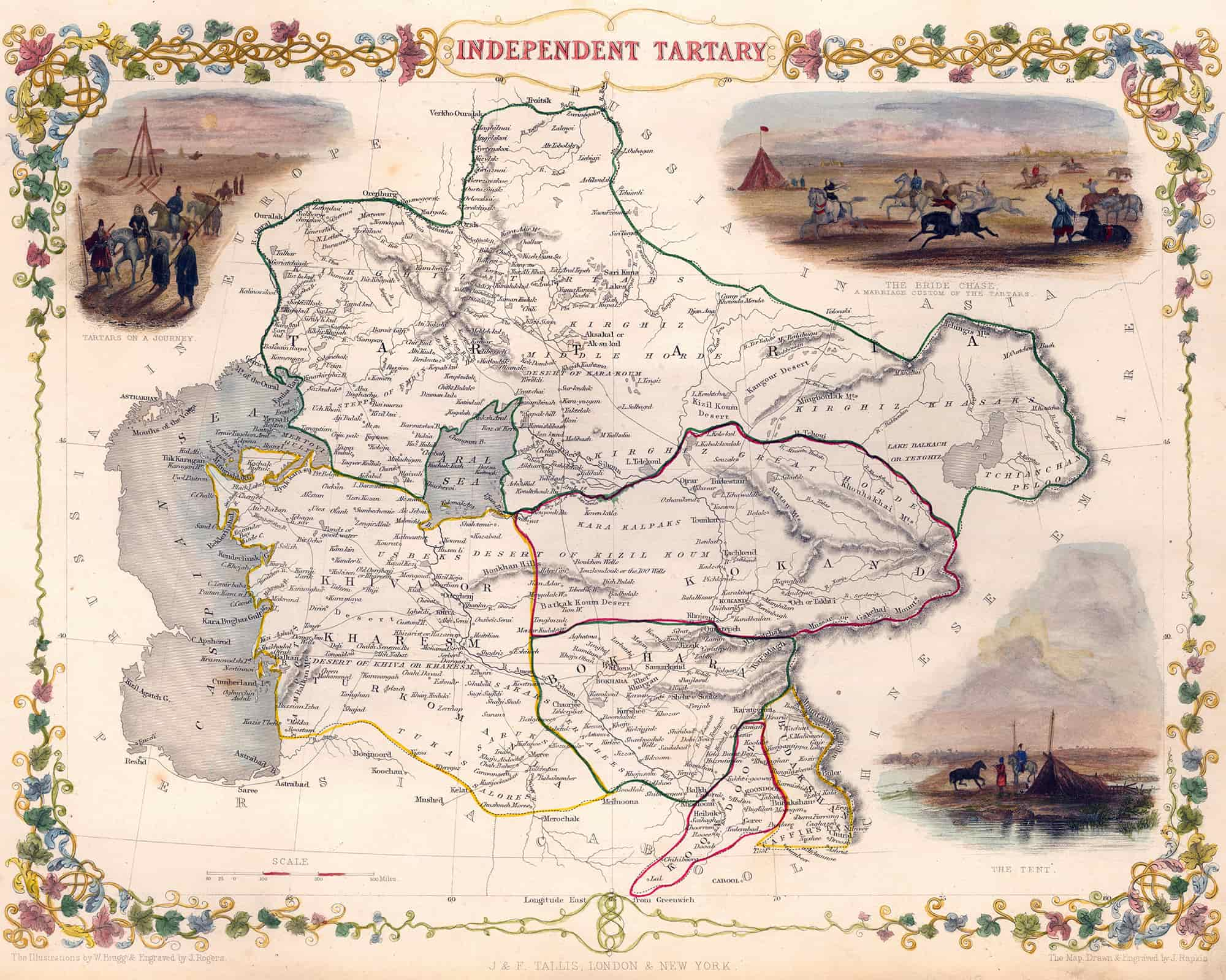
    Independent Tartaria Map, 1851

    Independent Tartaria Map, 1851
    Independent Tartary by John Tallis.

    View this map in higher resolution. [6.8 MB]

    Independent Tartaria map from 1851 with short stories about the Bride Chase, the Tartars traveling, and the Tent during those times. Engraved for the Illustrated Atlas of R. Montgomery Martin. Among the last great creators of colorful maps was the British John Tallis (1817–1876).