The Tartaria maps refer to ‘historical’ maps depicting the region of Tartaria in northern Asia. These maps offer insights into the alleged geography, landscape, and culture of the Tartaria region that supposedly existed in ‘hidden history’. This huge territory between the Caspian Sea and the Pacific Ocean, including the present-day boundaries of China and India, is referred to as Tartaria in Western European literature and cartography. From the 13th through the 19th centuries, the toponym was in regular usage.
In many derogatory titles that had little to do with the actual inhabitants of the area, Tartaria became the most popular term for Central Asia and Siberia in European sources. European knowledge of the area was exceedingly limited, discontinuous, and partly mythological until the 19th century. The region historically known as Tartaria is now often referred to as Inner or Central Eurasia. The majority of the people in these areas have spent centuries raising cattle, despite the dry climate.
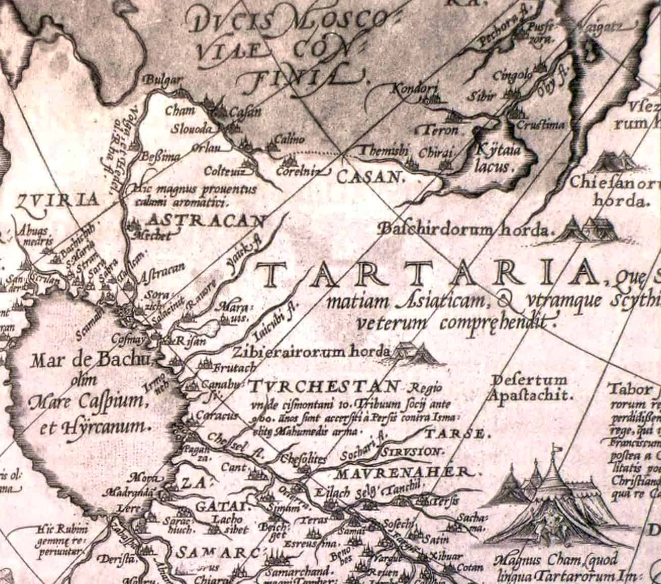
1575 Tartaria Map
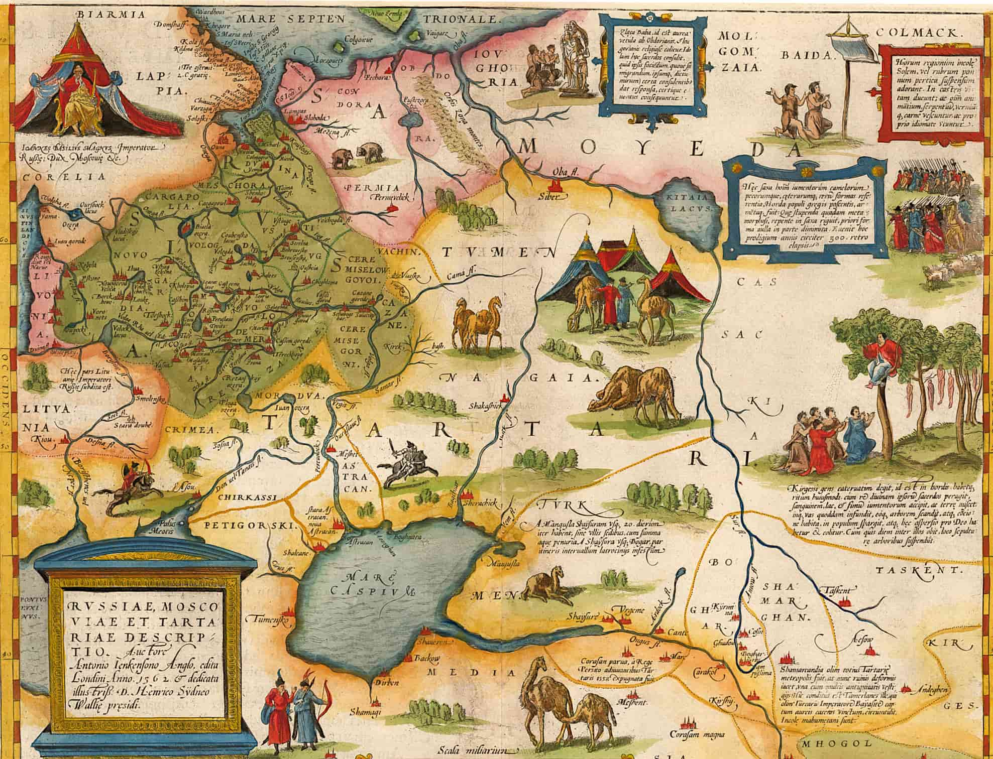
View this map in higher resolution. [1.6 MB]
A descriptive map of Russia and Tartaria by the explorer Anthony Jenkinson (1562). This is a scan of the map from the 1575 edition of Ortelius’ Theatrum Orbis Terrarum, first published in 1570 and republished many times between 1571 and 1641.
Tartaria by Jodocus Hondius, 1606
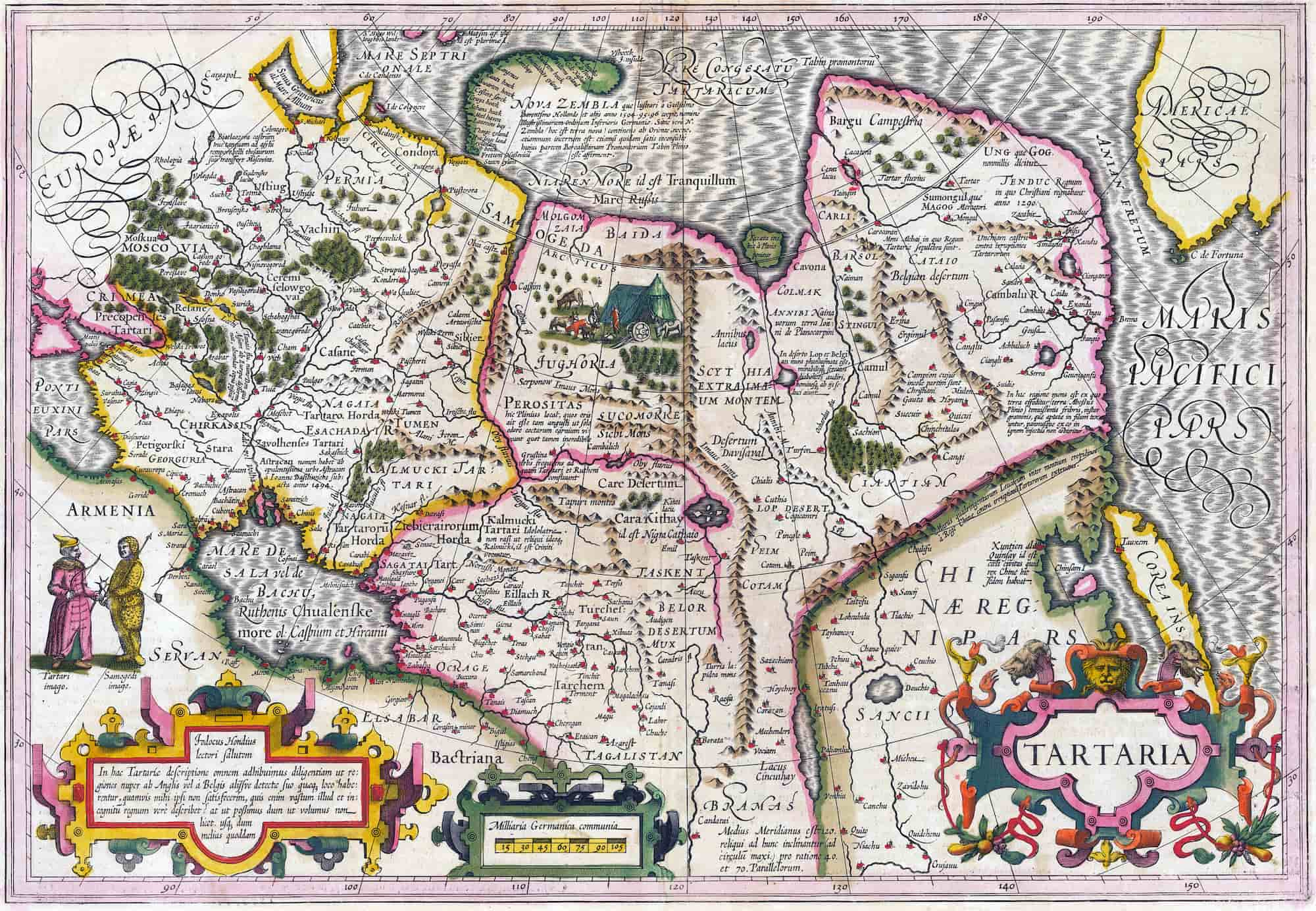
View this map in higher resolution. [1.6 MB]
A Tartaria map created by the Flemish and Dutch engraver and cartographer Jodocus Hondius (1563–1612). The map is from circa 1606. It depicts places like Tartaria, Central Asia, Asiatic Russia, the Great Wall of China, and the early Northwest Coast of America.
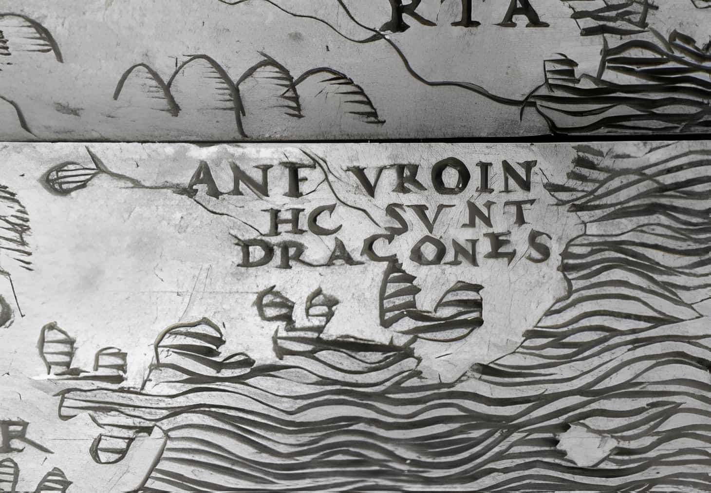
The island of Corea, Cape de Fortuna, and the Straits of Anian are noteworthy landmarks. The map covers the Black Sea and Russia in addition to showcasing specifics about Nova Zembla. Livestock, tents, and scenes depicting nomadic tribes are examples of decorative components.
Asiae Nova Descriptio, 1567–1570
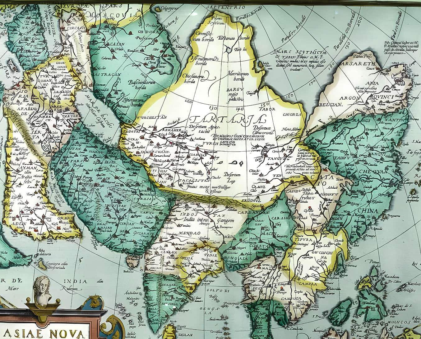
View this map in higher resolution. [1 MB]
A Tartaria map from 1567–1570. Abraham Ortelius, Theatrum Orbis Terrarum, English publication as The Theatre of the Whole World, London 1606; this map is a reduction of Ortelius’ 8-sheet map of Asia from 1567, which was primarily taken from Giacomo Gastaldi’s wall-map of Asia from 1559–161.
Tartaria and the Greater Part of the Kingdom of China, 1680
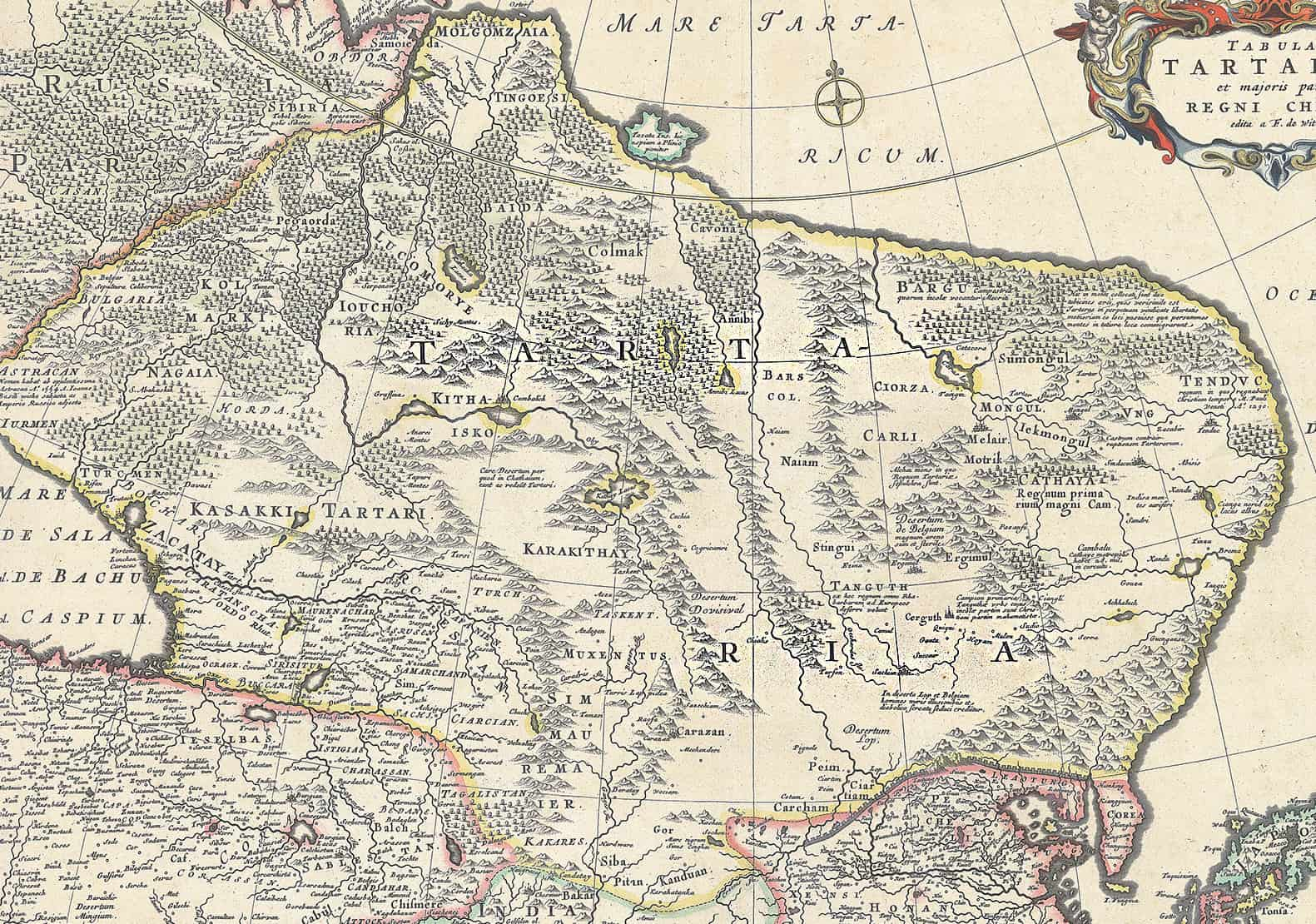
View this map in higher resolution. [11 MB]
This map of Tartaria is from the special collection of the University of Amsterdam. This map was published by Frederik de Wit (1629–1706). He was a Dutch cartographer and artist. The map shows Oceanus Occidentalis (Atlantic Ocean) and Mare Tartaricum (Arctic Ocean).
1667 Atlas Maior
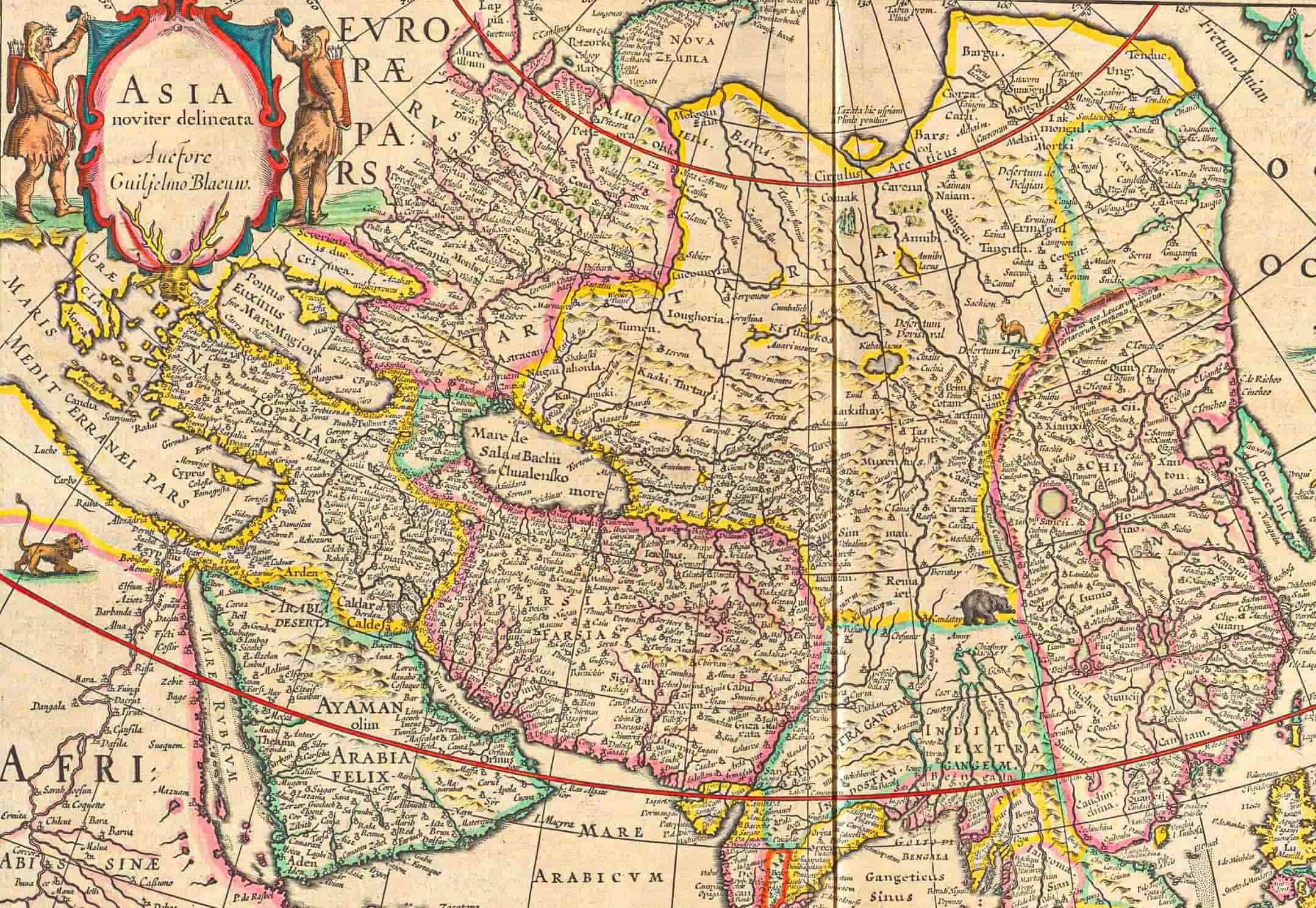
View this map in higher resolution. [3 MB]
The large middle area, surrounded by yellow borders, reads “TARTARIA.” This is a Tartaria map from the 1667 printing of the Tenth of Blaeu’s series of twelve atlases. The book is titled “Le Grand Atlas, ou Cosmographie Blaviane,” in which the Earth, the Sea, and the Heavens are described.
18th-Century Tartaria Map
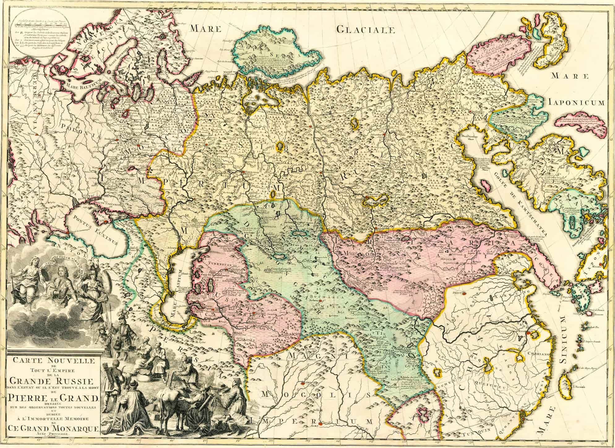
View this map in higher resolution. [5 MB]
The large pink area at the right reads “TARTARIA.” It was a brand-new map depicting the whole of the Russian Empire as it was at the time of Peter the Great’s passing. The maps read, “In the immortal memory of this great monarch.”
Russia in Asia and Tartaria, 1853
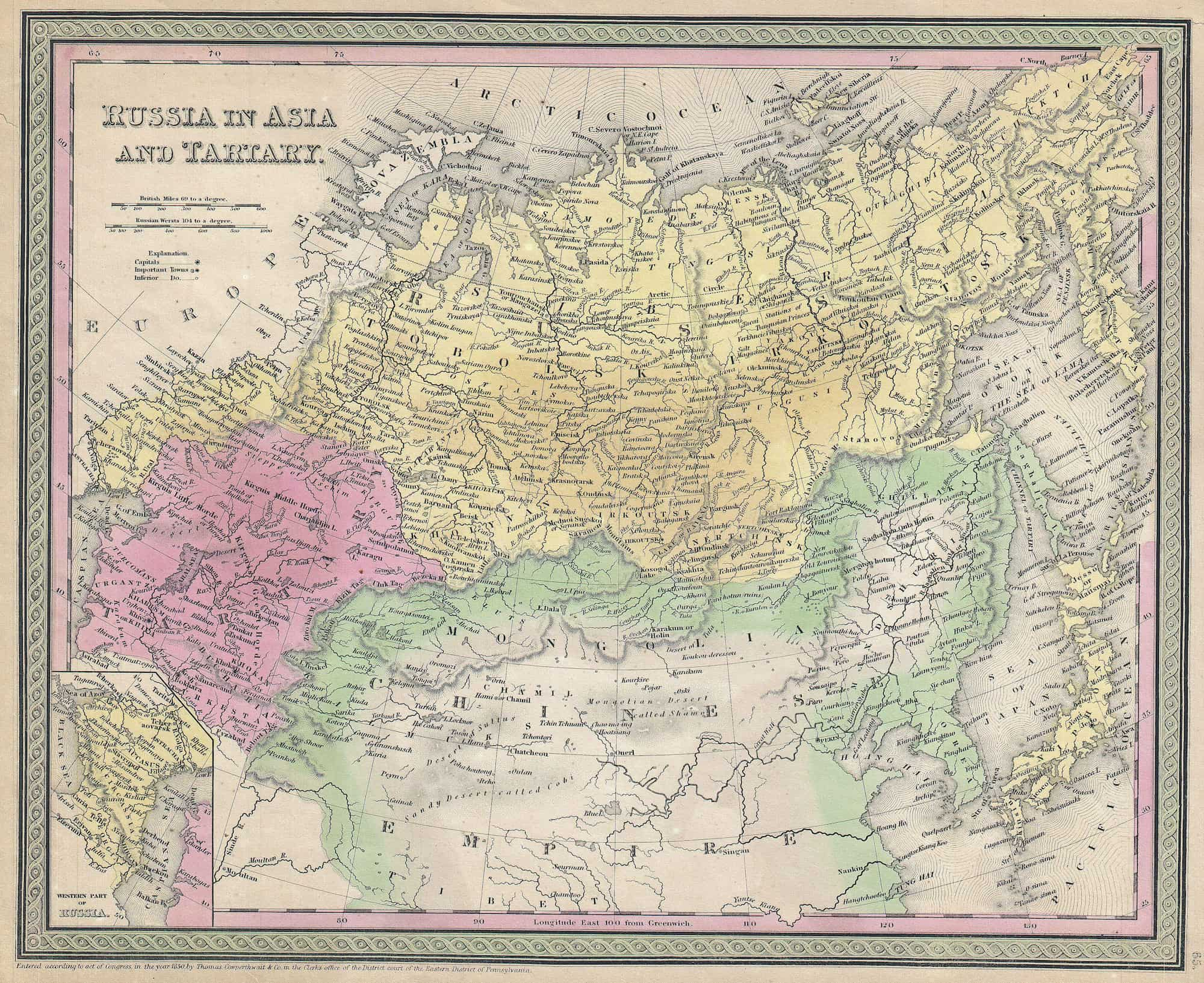
View this map in higher resolution. [4 MB]
An example of S. A. Mitchell Sr.’s map of Russia in Asia and Tartaria from 1853. Beginning in the Ural Mountains and ending at the Caspian Sea, it stretches all the way to Siberia, Kamtschatka, and Japan in the east. Includes most of northern China as well as parts of Mongolia and Korea farther to the south.
Map of Great Tartaria and China, 17th Century
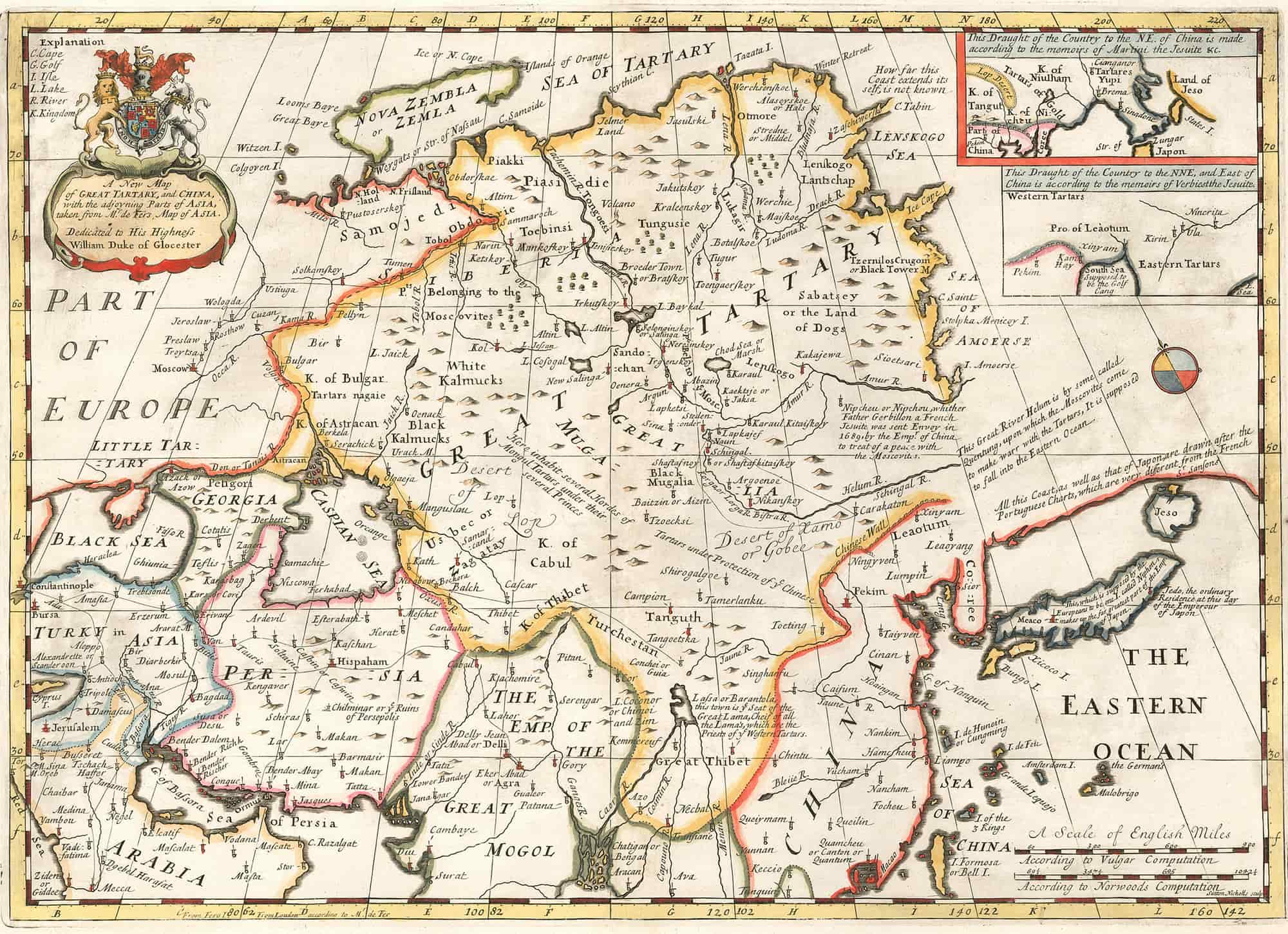
View this map in higher resolution. [4 MB]
A map of the Great Tartary and China, together with the neighboring parts of Asia, adapted from Mr. De Fer’s map of Asia. This work is dedicated to Prince William, Duke of Gloucester.
A Tartaria Map of 1626
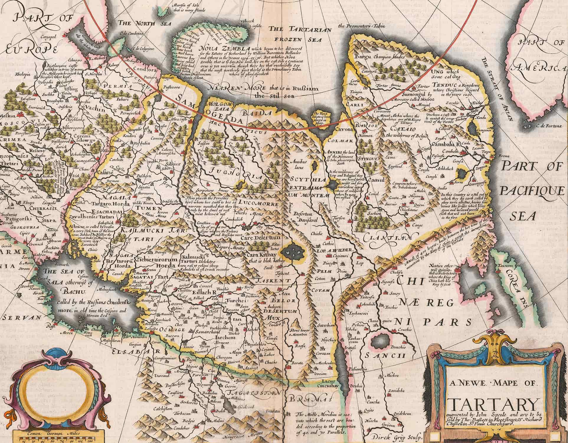
View this map in higher resolution. [4 MB]
An old map of Tartaria shows northern China, Kazakhstan, and Mongolia, as well as southern Russia and eastern China. The first English-made global atlas has this map, Speed’s map of Tartaria. There is a distinct depiction of the Great Wall of China, and the map’s interior is extensively marked.
Map of Tartaria by Bertius, 16th–17th centuries
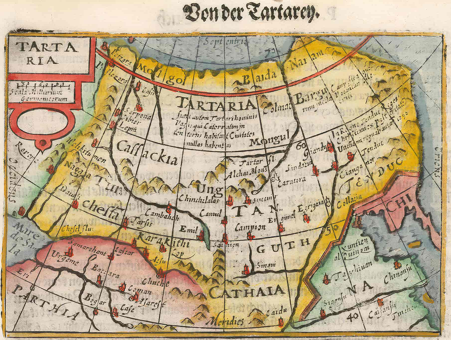
View this map in higher resolution. [2.5 MB]
The map of Tartaria by the geographer and cartographer Petrus Bertius (1565–1629). Bertius is best known as a mapper for his version of the Geographia of Ptolemy. In this 16th or 17th century Tartaria map, China is represented with “Chi” at the right and Parthia is shown at the bottom left next to the Caspian Sea, which reads Mar de Sala.
1706 Tartaria Map
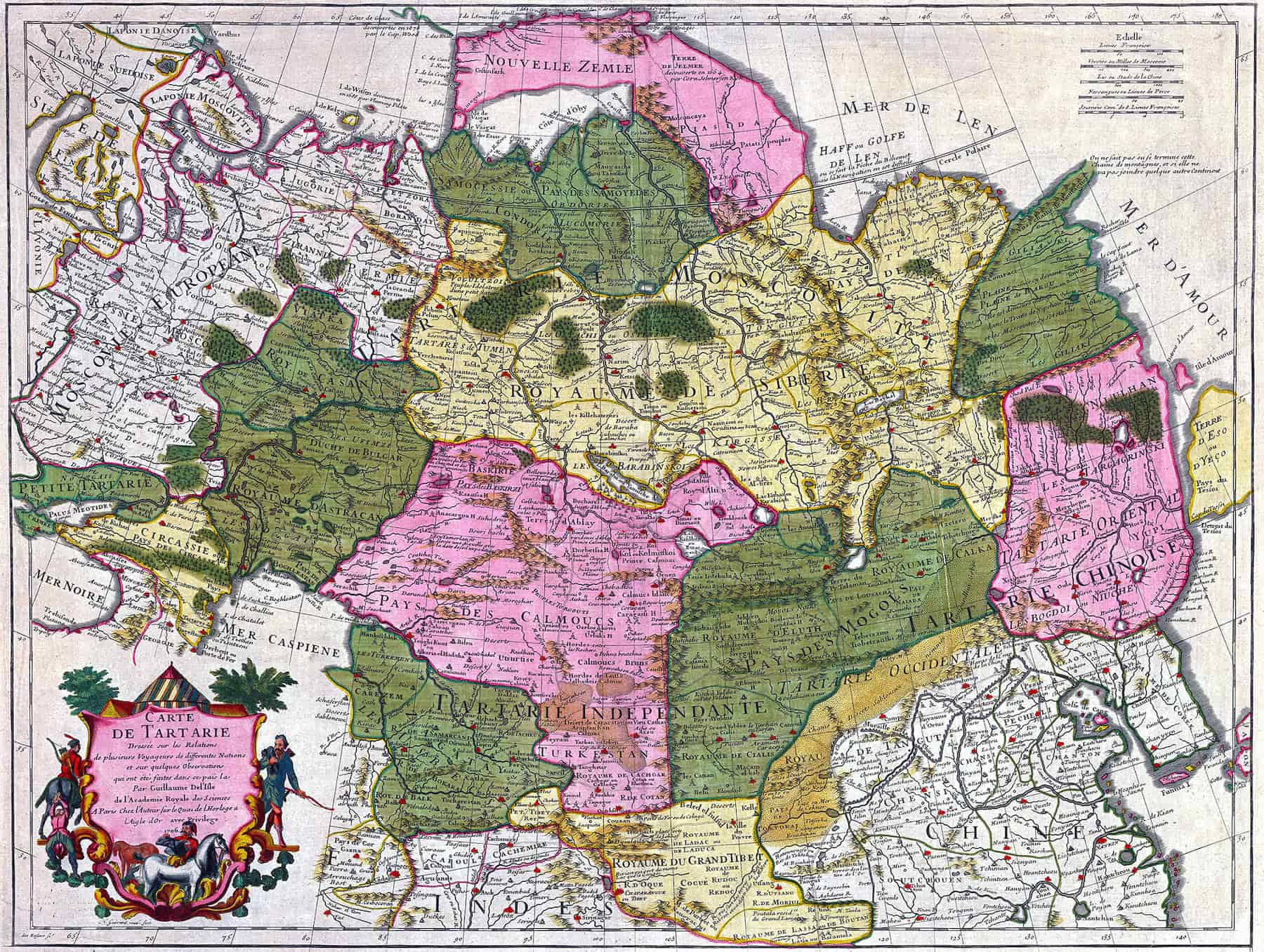
View this map in higher resolution. [5.2 MB]
Originally called “Carte de Tartarie” (Tartaria Map), it was created by the cartographer Guillaume Delisle (1675–1726) in 1706. The description on the bottom left side explains that this Tartaria map was drawn on the relationships of several travelers from different nations and on some observations made in French by Guillaume Delisle of the Royal Academy of Sciences, Paris.
Tartaria Map of the Kingdom of the Great Khan, 16th Century
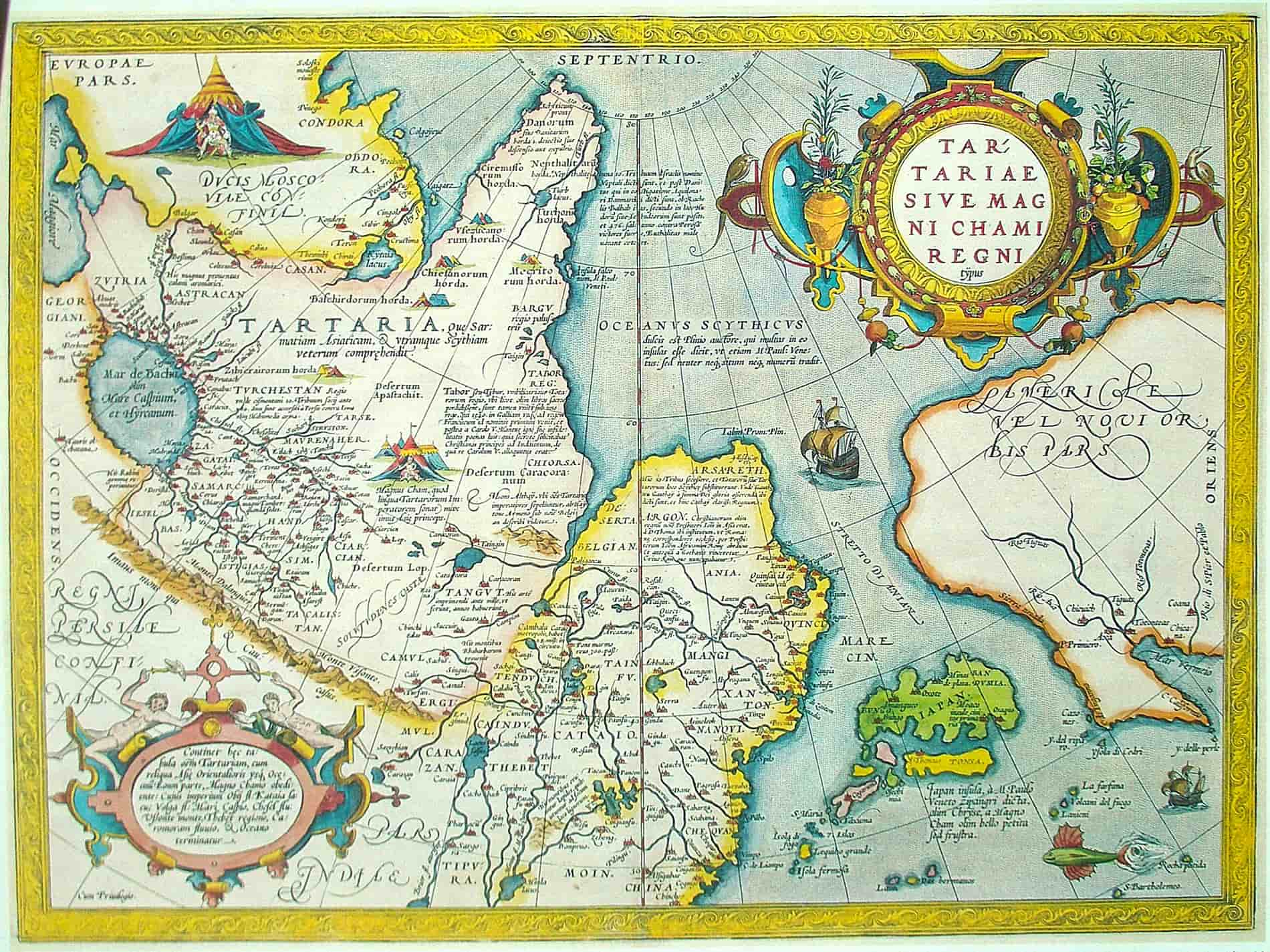
View this map in higher resolution. [2.3 MB]
An ancient Tartaria map drawn out by the great Brabantian mapper, geographer, and cosmographer Abraham Ortelius (1527–1598). The map shows the “Kingdom of the Great Khan,” which is likely Genghis Khan.
See also: Genghis Khan’s Children: His Number of Sons and Daughters
Grand Tartaria Map, 1674–1719
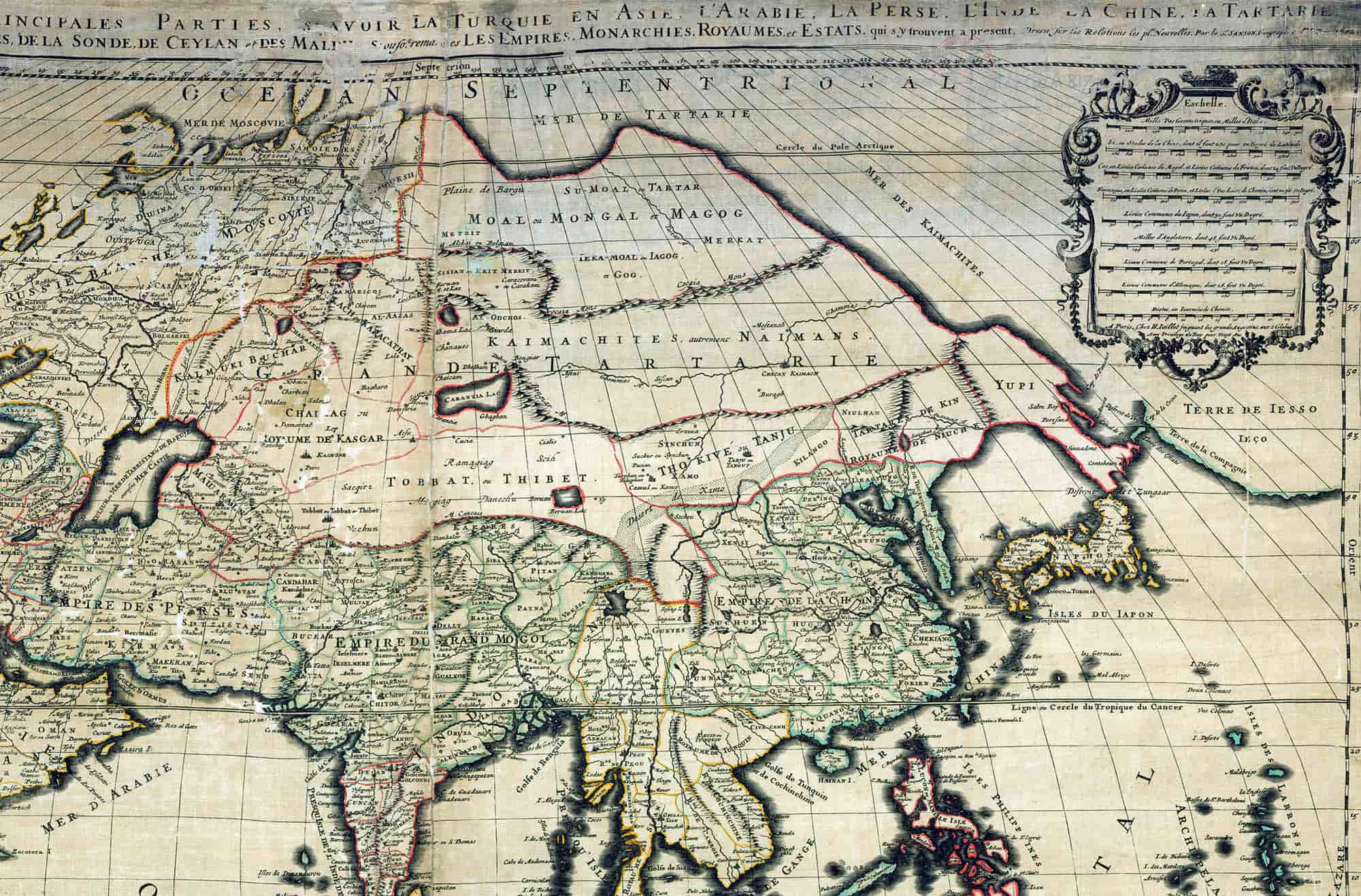
View this map in higher resolution. [9.5 MB]
The map of Grand Tartaria by the French cartographer Guillaume Sanson (1633–1703) at the French National Library. This map above is probably a copy from 1674–1719.
1719 Tartaria Map
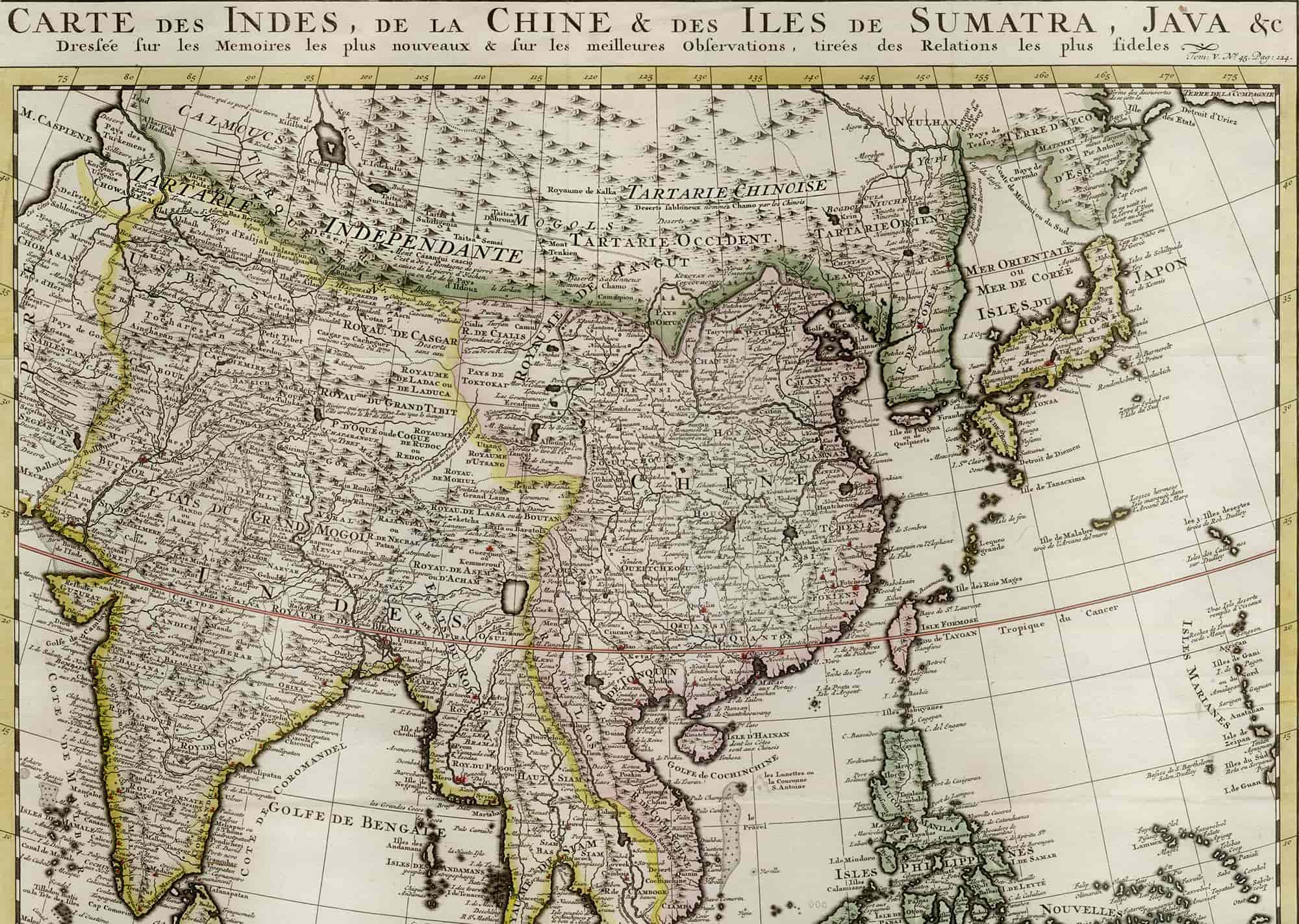
View this map in higher resolution. [9 MB]
This map of Asia and Tartaria (top) includes all of the East Indies, Japan, and India. It is drawn from H.A. Chatelain’s Atlas historique or nouvelle introduction à la chronologie (Historical Atlas or New Introduction to Ancient & Modern History, Chronology & Geography), 1719. He was a Huguenot pastor of Parisian origins.
3rd Map of Chinese Tartaria, 1737
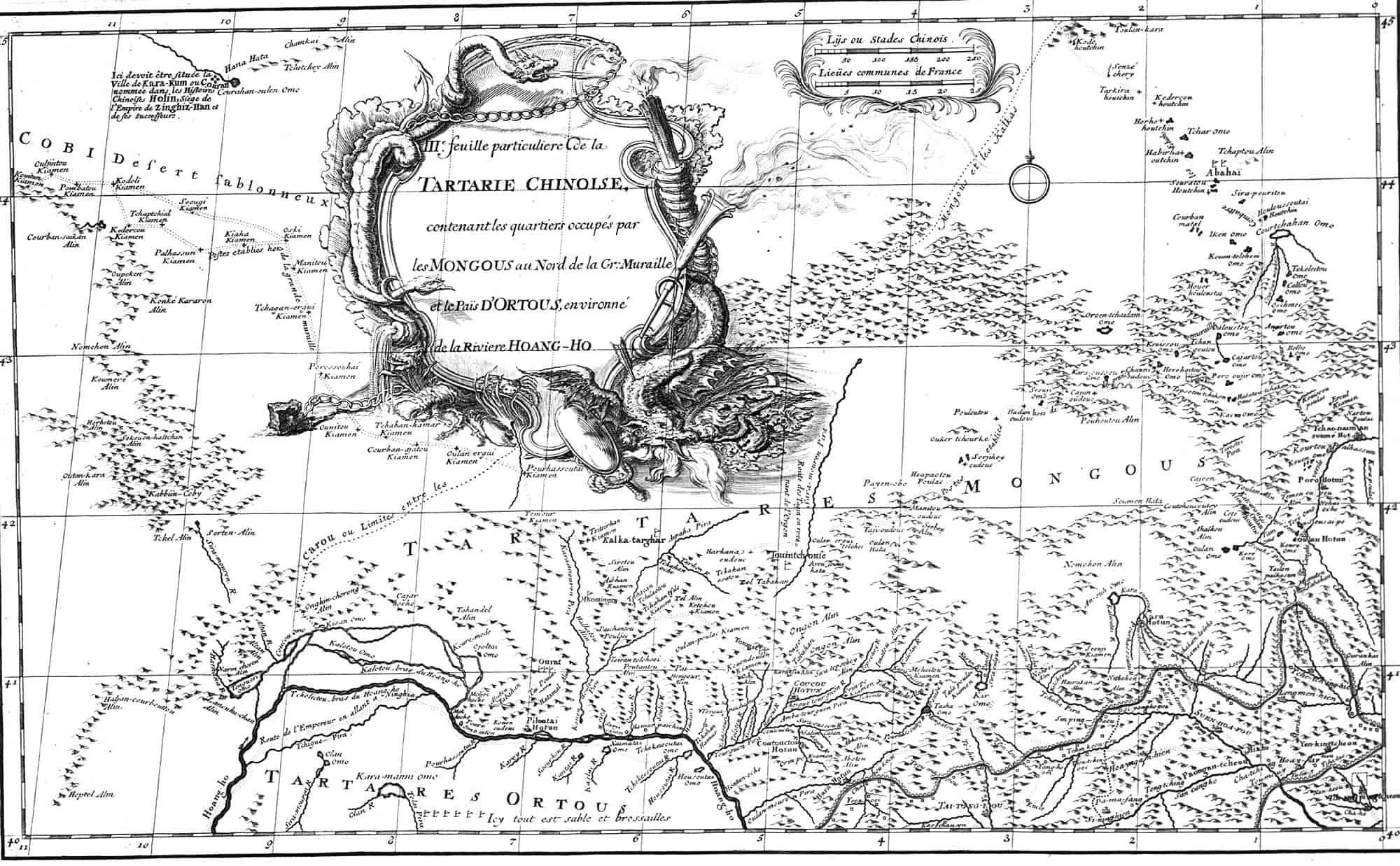
View this map in higher resolution. [2.4 MB]
Third Map of Chinese Tartary or Tartaria, from the New Atlas of China, Chinese Tartary, and Tibet, 1737. It includes the regions occupied by the Mongols north of the Great Wall and the lands of Ordos, encircled by the Yellow River.
Tatariae Sinensis, 1749
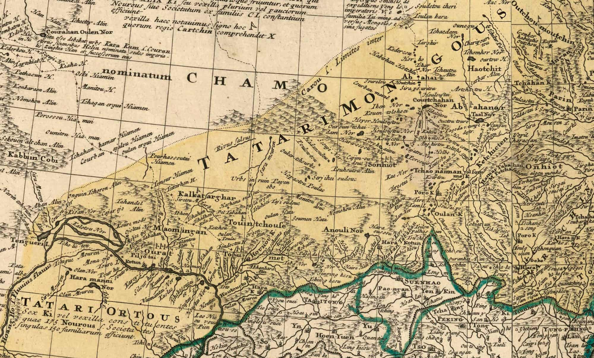
View this map in higher resolution. [12.7 MB]
Japan, Korea, Inner Mongolia, the Kingdom of Manchuria, and the Province of Great Tartary, North China, are depicted on a single Tartaria map named Tatariae Sinensis from 1749. Jean-Baptiste Bourguignon d’Anville (1697–1782), was a notable cartographer. Johann Tobias Mayer (1723-1762; elder), was also a renowned cartographer. Their works are housed in the National Library of France.
Independent Tartaria Map, 1851
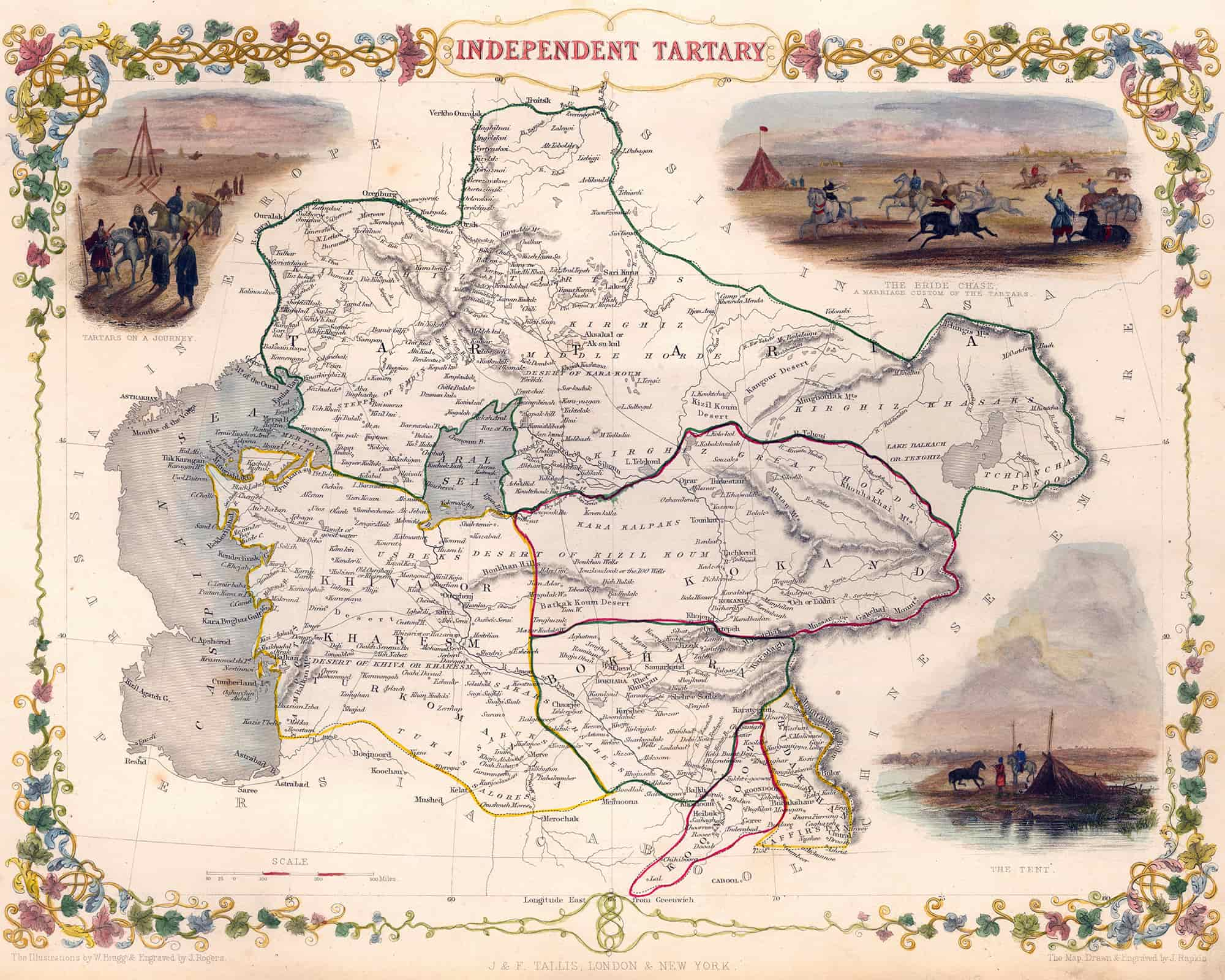
View this map in higher resolution. [6.8 MB]
Independent Tartaria map from 1851 with short stories about the Bride Chase, the Tartars traveling, and the Tent during those times. Engraved for the Illustrated Atlas of R. Montgomery Martin. Among the last great creators of colorful maps was the British John Tallis (1817–1876).


