Fire and ice rule the country of Iceland, where molten rock hisses and bubbles against glaciers, steaming geysers erupt into the Arctic air, and raging rivers of meltwater roar over the plains. The area just underneath Europe’s biggest glacier, Vatnajökull, is very active: The ice cap may be as much as 3,300 ft (1,000 m) thick, concealing a number of volcanoes. Every two or three years, on average, one of these volcanoes erupts, causing a spectacular but terrible natural disaster.
Iceland, born of fire
Despite its proximity to the Arctic Circle, Iceland has a milder average annual temperature than New York City. It’s located right in the midst of a hot area, one of the earth’s crust’s powder kegs, and yet everything on the surface frequently looks to be covered over by ice…
Glaciers, which cover several hundred feet of ground, conceal more than a tenth of the nation. Even after the Arctic, Antarctic, and Greenland, Vatnajökull is the greatest continuous mass of ice. Where the ice has melted, the island has exposed ridges and mountains, as well as extensive treeless steppes.
The early immigrants, Vikings from Norway and the British Isles, described the “ice country” as harsh and inhospitable. After fleeing Norwegian King Harald Fairhair in about 900 AD, they were forced to stay. All 250,000 of Iceland’s residents still cluster in the southwest, where the climate is more agreeable and the soil is more fruitful, and along the beaches. Extremely few people have ventured into the interior to explore the vast and desolate hills.
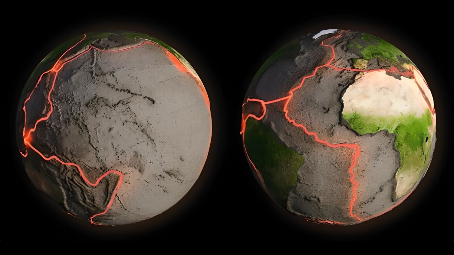
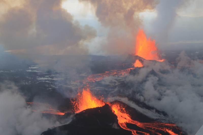
The island of Iceland in the North Atlantic is not only the biggest volcanic island in the world but it is also dominated by snow and ice. There is no other comparable-sized island that was born of fire and volcanoes. It’s located on the mid-Atlantic ridge, where the intense heat from deep below the Earth’s crust rises to the surface. Consequently, Iceland is littered with a string of volcanoes, the vast majority of which are still active. Once every two or three years, one of the many volcanoes erupts, discharging the incandescent contents of the subsurface magma chambers.
One of the most interesting sights in all of nature is the eruption of a glacial volcano, when hot lava meets cold glacial ice.
Bardarbunga and Grimsvötn, an active volcanic system
Danger lurks under the surface
The massive Vatnajökull ice cap gives the appearance of being tranquil and, above all else, cold from the surface, however, this is an illusion. Things are heating up under Europe’s second-greatest glacier’s ice cap, which can be as thick as 3,300 ft (1,000 m). The Icelandic hot spot and the Mid-Atlantic Ridge’s extended volcanic zone converge here, near the middle of the volcanic island. There is now a massive, half a mile long system of subsurface magma conduits, vents, and craters as a consequence.
Under Vatnajökull are some of Iceland’s tallest and most active volcanoes. Some of the island’s more “productive” systems are Bardarbunga and Grimsvötn. Some of Iceland’s biggest eruptions, notably Laki‘s huge 1783 eruption, were fueled by magma from this reservoir.
The glacier volcanoes of Central Iceland often go through cycles of low and high volcanic activity. During times of volcanic activity, magma rises from the mantle and fills the vast subsurface magma chambers. The glowing rock may extend from the core chambers to the foothills of the volcanic system because of the system’s many channels and rifts.
But some volcanoes of Iceland are also connected to each other beyond the channel system. Scientists have noticed that as the Krafla volcano expands in the north of the island owing to magma input, the Bardarbunga volcano (2,009 m or 6,590 ft high) underneath Vatnajökull contracts. This “seesaw” phenomenon is likely caused by pressure changes in the Earth’s semi-molten magma in the mantle.
The concentrated energy from the Earth’s core is released around once every two to three years, usually by the eruption of a glacier volcano. Although this pattern generally holds true, it seemed to be briefly disrupted in the Bardarbunga-Grimsvötn system after the large eruption in 1938 and the subsequent exceptionally calm phase, which lasted all the way up to 1996.
Then, in 2011, Grimsvötn (1,725 m or 5,660 ft high) erupted again -emitting many thousand tons of ash into the atmosphere – followed by 2,000-meter-high Bardarbunga in 2014-2015, the second-highest mountain in Iceland. Bardarbunga erupted at a scale not seen in Iceland in the previous 230 years.
The 1996 eruption of Gjálp
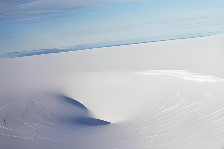
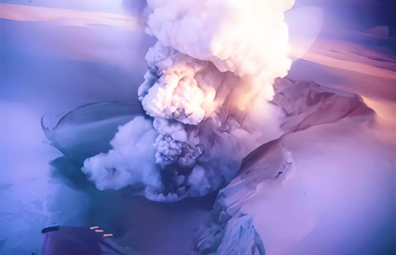
Previously, in October 1996, the volcano known as Grimsvötn, which lies under the Vatnajökull ice cap, had been dormant for almost 60 years. However, the volcanic system caused minor earthquakes around the close of the 20th century. The volcano began to stir in 1996. Above, a 1500 ft (450 m) thick ice sheet from the Vatnajökull glacier covered everything, but below, everything was bubbling: volcanic gases and the more than 1800 degrees F (1,000 degrees C) hot lava rushed out of their deep reservoir and started melting the ice.
The explosion from the Gjálp hyaloclastite ridge broke through the ice the next day. The ensuing crater sent an ash plume over 13,000 feet (4,000 meters) into the air. Over the following 12 days, a thin coating of ash from the eruption blanketed half of the glacier. The eruption ended on October 13. Unfortunately, the worst was yet to come.
During the Jökulhlaup glacial flood
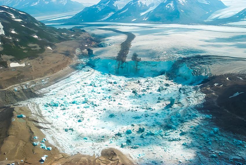
But although Vatnajökull’s glacial surface seemed to be returning to normal, a tragedy was already developing underneath it, hidden from view by the ice cap: Large quantities of meltwater were still making their way from the volcano’s epicenter into the underground reservoir lake of Grimsvötn volcano. The lake’s water level was continuing to increase, far over the critical point, as a result of the intake of 500 to 700 cubic meters (17,500 to 24,500 cubic feet) of water each second. This was due to the amount of ice melting annually from the glacier’s base due to geothermal heat, filling the Grimsvötn reservoir.
Today, 500 cubic meters (17,500 cubic feet) of ice continue to melt every year due to geothermal heat. Therefore, every four to six years, the lake’s outflow is blocked by a relatively thin ice barrier, causing a phenomenon known as a jökulhlaup, or glacier run. A flash flood then erupts from beneath the glacier and floods the lowlands. The Jökulhlaup flood from the 1996 eruption was one of the worst since 1938.
Mount Hekla, a volcanic peak
“Gateway to Hell”
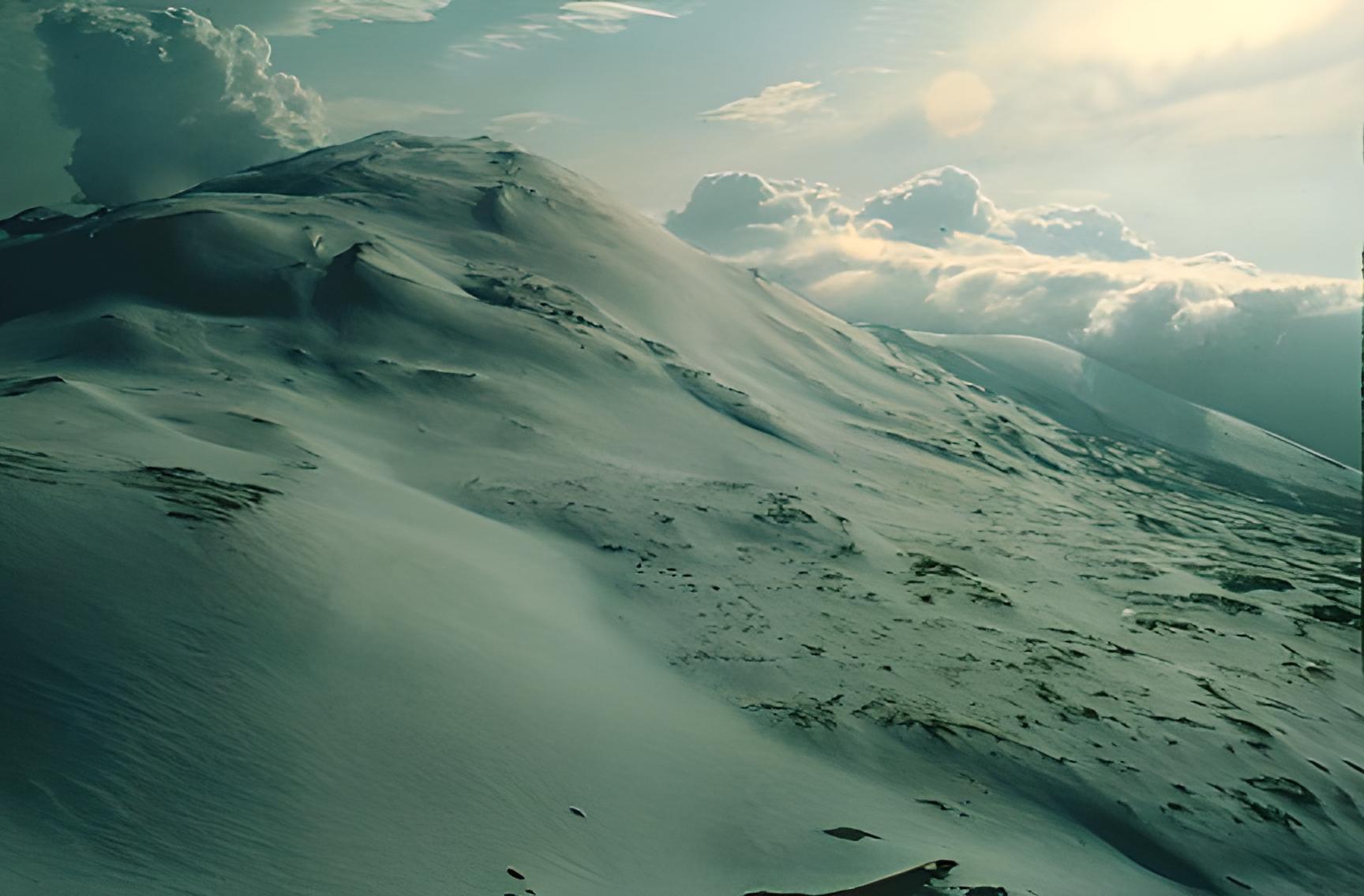
Around 4,900 feet (1,500 meters) high, the volcano Hekla has long been regarded as “the gateway to hell” by the locals. It is one of Iceland’s most well-known and active volcanoes even today. It sits smack dab in the middle of the plate boundary that cuts across Iceland’s southwest corner.
Heklugja is the most active part of the Hekla’s long, ragged ridge that runs from the southwest to the northeast for 5.5 km (3.4 mi). Heklugja is produced over time by a series of explosive eruptions. Recent craters and cracks from the volcano’s most recent eruptions are lined up along this ridge. Over and over, the ridge has been ripped apart by fresh eruptions, leaving deep fractures and transverse fissures. Even if you just observe Hekla from its narrow side, you can see that it is a typical cone-shaped stratovolcano.
One of Iceland’s most violent eruptions ever occurred during the first recorded Hekla eruption. Pjorsardalur, a valley at the foot of the mountain, was obliterated. More than 88,000 cubic feet (2,500 cubic meters) of tephra (lava chunks, ash, and fine debris) were propelled miles to the northwest during the 1104 AD eruption. Thus, by the end, tephra had blanketed almost two-thirds of the island. In modern times, this thin layer has proven to be an invaluable time marker for volcanologists and geologists dating glacial ice or lava deposits from other volcanoes.
Volcanologists find Hekla intriguing and significant for another reason: the magma within it has no business being there. Although it has some chemical similarities with the lava found in volcanoes in the subduction zones across the Pacific, its composition is otherwise entirely novel and exclusive to Iceland. A diverging plate boundary, like the one in Iceland, is when two crustal plates are moving apart and this phenomenon is uncommon.
The composition of the magma and the intensity of an eruption at Hekla are very variable. Volcanologists have discovered that the longer the period of dormancy between eruptions, the more powerful the subsequent eruption. Hekla seems to have settled into a sort of pattern during the previous 70 years: around once or twice a decade, it awakens and spews fire and ash over the ice of Iceland.
The last Hekla eruption
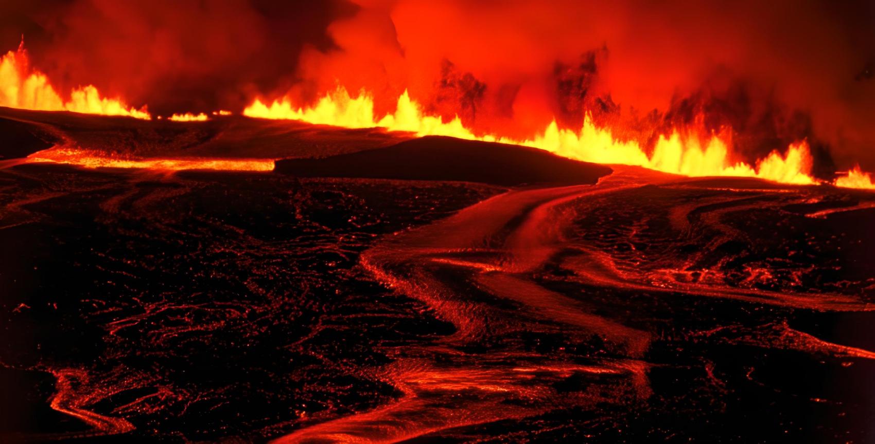
On this particular weekend in 2000, February 26, the Hekla volcano was the cause of the abnormal activity. As the magma rose to the surface, a bright crack broke out over a length of 4.5 miles (7 kilometers). Within two hours, lava began pouring out of the crack and down the slopes on the volcano’s eastern flank. There was a 6 miles (10 kilometers) high plume of gray ash from the eruption. Even in northern Iceland, 150 miles (300 kilometers) distant, ash was falling from the sky.
There were few immediate effects from the Hekla eruption since the ash and lava mostly fell in uninhabited regions to the north and east of the volcano. Following radio predictions of impending doom, hundreds of Icelanders went to the volcano’s edge. Simultaneously, a massive snowfall was building, and it would soon begin to lash the region. As a consequence, 1,500 individuals were left stuck in their snowed-in and broken-down vehicles on the two mountain highways.
The ensuing rescue effort was the greatest since the Heimaey’s Eldfell eruption in 1973, however this time it wasn’t lava but rather snow that had to be overcome.
The danger of Eldfell volcano
“Hill of Fire”
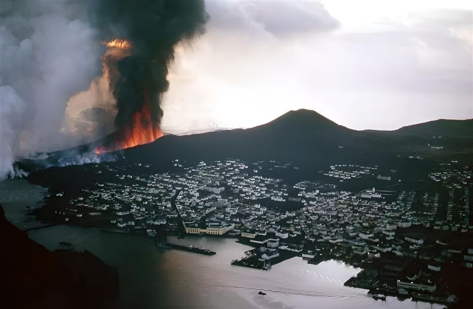
Volcanic activity is guaranteed on the island of Iceland since it sits on a plate boundary, which also generates frequent earthquakes. Icelanders are aware of the constant threat, even though lesser quakes merely appear to provoke a shrug of the shoulders or at best a momentary pause. It’s reasonable to be concerned about a catastrophic eruption.
A whole community was in danger when the Eldfell volcano on the island of Heimaey off the southwest coast of Iceland erupted in 1973. Almost a distance of over two kilometers, fissures opened in the rock, releasing molten lava in the form of fountains several feet high. Half of the island was subsequently ripped apart by a fissure. The only hope for the 5,300 people who live in the fishing community of Vestmannaeyjar was an emergency evacuation.
Granted, much of Iceland is either thinly populated or completely uninhabited, so the effects of a volcanic eruption there would be minimal at most. Ironically, one of Eldey Island’s busiest and riskiest areas also happens to be where most people live. Reykjavik is home to one-third of Iceland’s population of 360,000. The subsurface of Eldey Island is especially agitated in this area, known as the South Icelandic Seismic Zone. Numerous minor earthquakes are detected by seismologists’ sensors on a daily basis, and the closest active volcano is less than 25 miles (40 kilometers) from the city center.
It is possible that a major earthquake or the volcanic eruption itself may pose a significant hazard to the city if Hengill were to erupt. The people of Reykjavik will just have to put up with it, since an explosion of the volcano is inevitable at this point. Important risk areas are monitored by a seismological monitoring network to provide early warning.
Hengill volcano, under the capital
In sleep for 2000 years
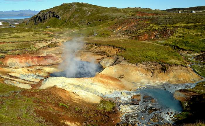
Hengill, a volcano in southern Iceland located barely 25 miles (40 kilometers) from the capital city of Reykjavik, has been showing very slight signs of unrest for too long. Icelandic seismologists and volcanologists have been studying the region around the country’s capital for quite some time. The reason is, underworld tensions in Reykjavik are rising.
Radiocarbon dating has placed the most recent eruption of the Hengill volcanic system at about 1900 years ago. Greenhouses, geysers, and hot springs are all geothermally heated and may be found around the area, including lava close to the surface.
Some days there might be as many as 1,200 earthquakes around Hengill in a 24-hour period, with some measuring as high as magnitude 4 on the Richter scale. Seismic activity this intense has not been seen since the mid-20th century.
The researchers at the Icelandic Meteorological Office do not see this as a promising omen. Moreover, if this is such an active tectonic zone, why hasn’t there been a volcanic eruption in this tectonic zone for 600 years? The Hengill is a popular theory among scholars, although no one knows the answer for sure.
Volcanologists have been reporting increasing activity under Feuerberg for the last 25 years as well. They discovered a greater quantity of magma entering the eastern of the volcano’s two magma chambers. It seems to be refilling after its last eruption over 10,000 years ago. GPS readings reveal that the earth’s crust is also shifting above the magma chamber. Below ground, there was a 1.5-inch or 5-centimeter rise just in 4 years. Although this is quite little in comparison to other volcanoes, it does indicate that something is happening under the surface.
It’s enough of a concern for volcanologists to keep an eye on Hengill throughout the clock. A specialized measurement instrument is placed on the ground near the volcano to track the flow of magma under the earth’s surface, and it sends its findings straight to Reykjavik via satellite.
However, it seems that the blaze is being reignited in other parts of Iceland as well. Researchers are now quite certain that a hot zone is boiling beneath the Vatnajökull ice sheet, despite the fact that projections for it are not exactly encouraging. They estimate that the magma source, which is 125 miles (200 kilometers) broad and 280 miles (450 kilometers) deep, will be quite active for the next years. In the opinion of volcanologists, eruptions can even occur annually at most.
Iceland’s Meteorological Office measures earthquakes
Unlike in other nations, Iceland’s Meteorological Office is in charge of earthquake reporting and monitoring. Since 1925, with weather stations mostly situated on farms around the nation, the institution has been collecting and analyzing data on weather, wind, and rain.
Because of this, it made sense to include seismic monitoring in the preexisting infrastructure. Over time, farmers around Iceland’s volcanic hotspots have put more and more seismometers on their fields. The farmers were responsible not just for monitoring the seismometers but also for reading the weather reports.
There was the relative calm before the advent of the Internet and distant data transmission: once a week, volunteer “readers” sent paper rolls containing the data to the nation’s capital of Reykjavik. Using the phone or radio to contact the main office was reserved for true emergencies only.
Nowadays, a lot of the measurement network is done automatically. The southwest and north of the island, where the most tectonic activity occurs, are constantly monitored.
GPS sensors, in addition to seismographs, record even the most subtle tremors and plate movements of the Earth. It is sent “in real time” by data connection to the command center, which is operational around the clock. Seismologists analyze the data and draw conclusions after the epicenters are automatically added to maps.
The seismologist on duty decides whether the tremors are the result of a tectonic activity or if the deviations detected by the seismographs are, in fact, precursors to an imminent eruption of Hengill or another volcano. To warn of an impending eruption, they shout an alarm in case of a telltale pattern of tremors on seismograms.
The Icelanders, in fact, should have all they need in the event of an actual emergency: An early warning system based on a network of sensors is in place, and earthquake-resistant structures and electrical lines are in place, with regular catastrophe simulations performed practically annually. The biggest of these “rescue drills” take place on what to do in the case of a magnitude 7 earthquake striking near the city of Reykjavik.


