Gustav Line at a Glance
What is the Gustav Line?
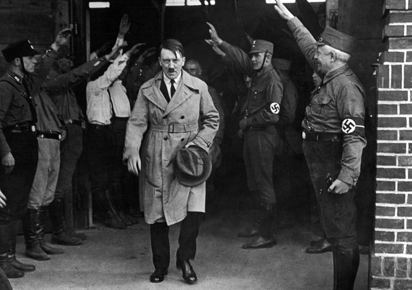
The Gustav Line was a defensive barrier constructed by the Organization Todt, which Adolf Hitler ordered to build during the Italian campaign of World War II on October 4, 1943. The purpose of the Gustav Line was to keep the Allies busy and prevent them from refocusing their efforts on the eastern and northern fronts by using the narrowest part of the Italian peninsula and the natural impediments provided by the Apennine Mountains.
What was the path of the Gustav Line?
The Gustav Line was located 60 miles (100 km) south of Rome and began at the point where the Garigliano empties into the Tyrrhenian Sea, continued upstream through Monte Cassino and the headwaters of the Rapido at an elevation of about 6,550 feet (2,000 m), across Roccaraso and the ridge of the Apennines to Casoli, and finally ended in the Adriatic between Ortona and Vasto.
What was the purpose of the Gustav Line?
The purpose of the Gustav Line was to keep the Allies busy and prevent them from refocusing their efforts on the eastern and northern fronts by using the narrowest part of the Italian peninsula and the natural impediments provided by the Apennine Mountains.
What was the history of the Gustav Line?
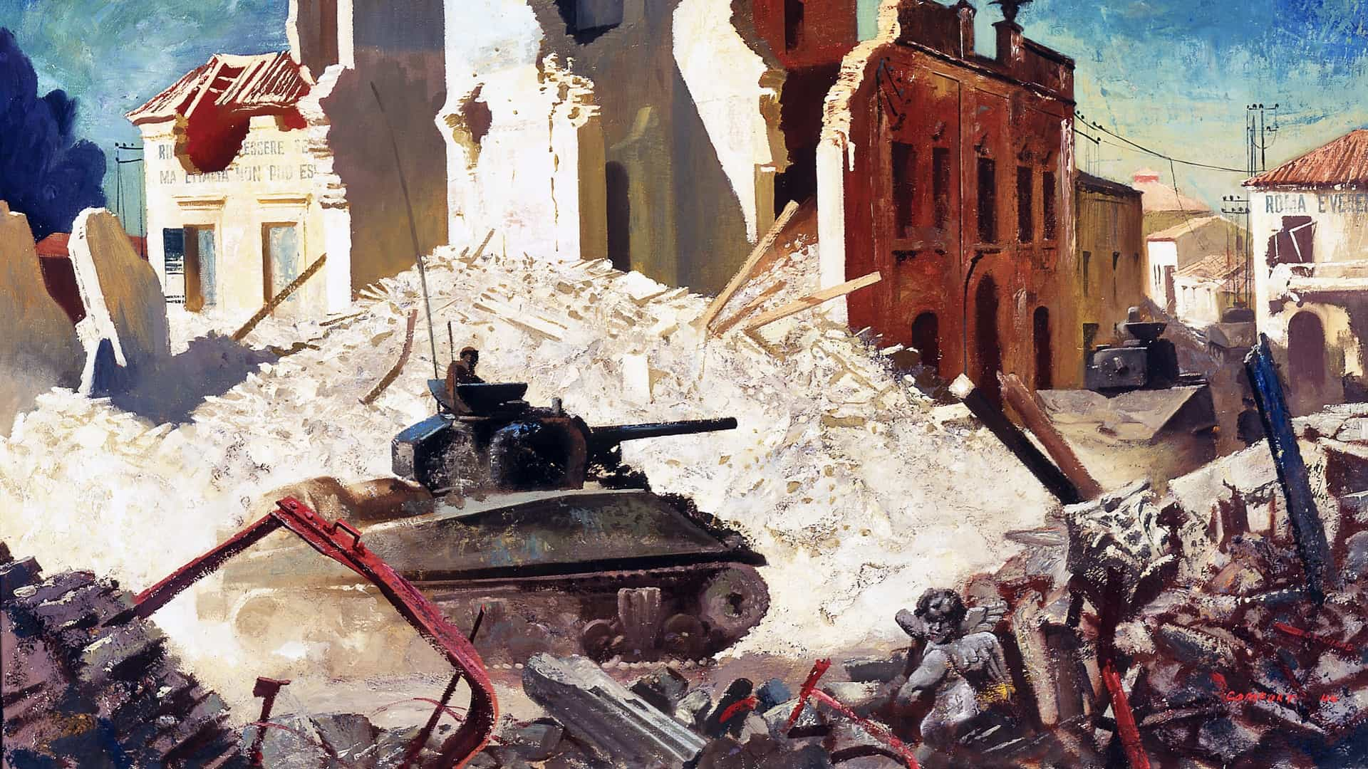
Despite early resistance at the Volturno Line and later the Bernhardt Line, the German troops were forced to fall back around the peninsula following the invasion at Salerno in September 1943. The strategic importance of Monte Cassino and its location on the one direct road north into Rome were decisive factors in this move. From San Pietro Infine comune to San Vittore del Lazio and Cervaro, fierce fights raged for control of strategic locations along the Gustav Line. The Battle of Monte Cassino occurred in 1944 between southern Lazio and northern Campania. It resulted in the destruction of the Tower of Capodiferro, the Real Ferdinando Bridge across the Garigliano River, and the Monte Cassino Abbey.
What happened to the Gustav Line?
On May 18, 1944, the Gustav Line collapsed in the face of Allied pressure, forcing the Germans to move north to the Hitler Line. The battles at Monte Cassino and Anzio alone during the assault on the Gustav Line claimed the lives of 98,000 Allies and 60,000 Axis soldiers.
What was the significance of the Battle of Ortona?
On the Adriatic coast, the Gustav Line followed the Sangro River, through which a breach was created during the Battle of Ortona. The Canadian Army considers the Battle of Ortona to be one of its biggest battles. The u0022Moro River Canadian War Cemeteryu0022 in the province of Chieti is the last resting place for 1,400 Canadians, 170 British, 40 New Zealand and South African, and 50 unknown soldiers. The British dubbed the most advanced section of the Gustav Line in the north of the Sangro River as the Sangro Line, while the Germans termed it the Siegfried Line.
During the Italian campaign of World War II, Adolf Hitler ordered the Organization Todt to construct a defensive barrier known as the Gustav Line (or “Winter Line”) in Italy on October 4, 1943. The first letter “G” in the German alphabet is where the name originates. With the Gustav Line, the Italian peninsula was effectively split in half, with German forces stationed in the northern half (in areas ostensibly controlled by the Italian Social Republic) and Allied forces stationed in the southern half.
The path of the Gustav Line: The code name for a defensive line, the Gustav Line was located 60 miles (100 km) south of Rome. The Gustav Line began at the point where the Garigliano empties into the Tyrrhenian Sea, continued upstream through Monte Cassino and the headwaters of the Rapido at an elevation of about 6,550 feet (2,000 m), across Roccaraso and the ridge of the Apennines to Casoli, and finally ended in the Adriatic between Ortona and Vasto.
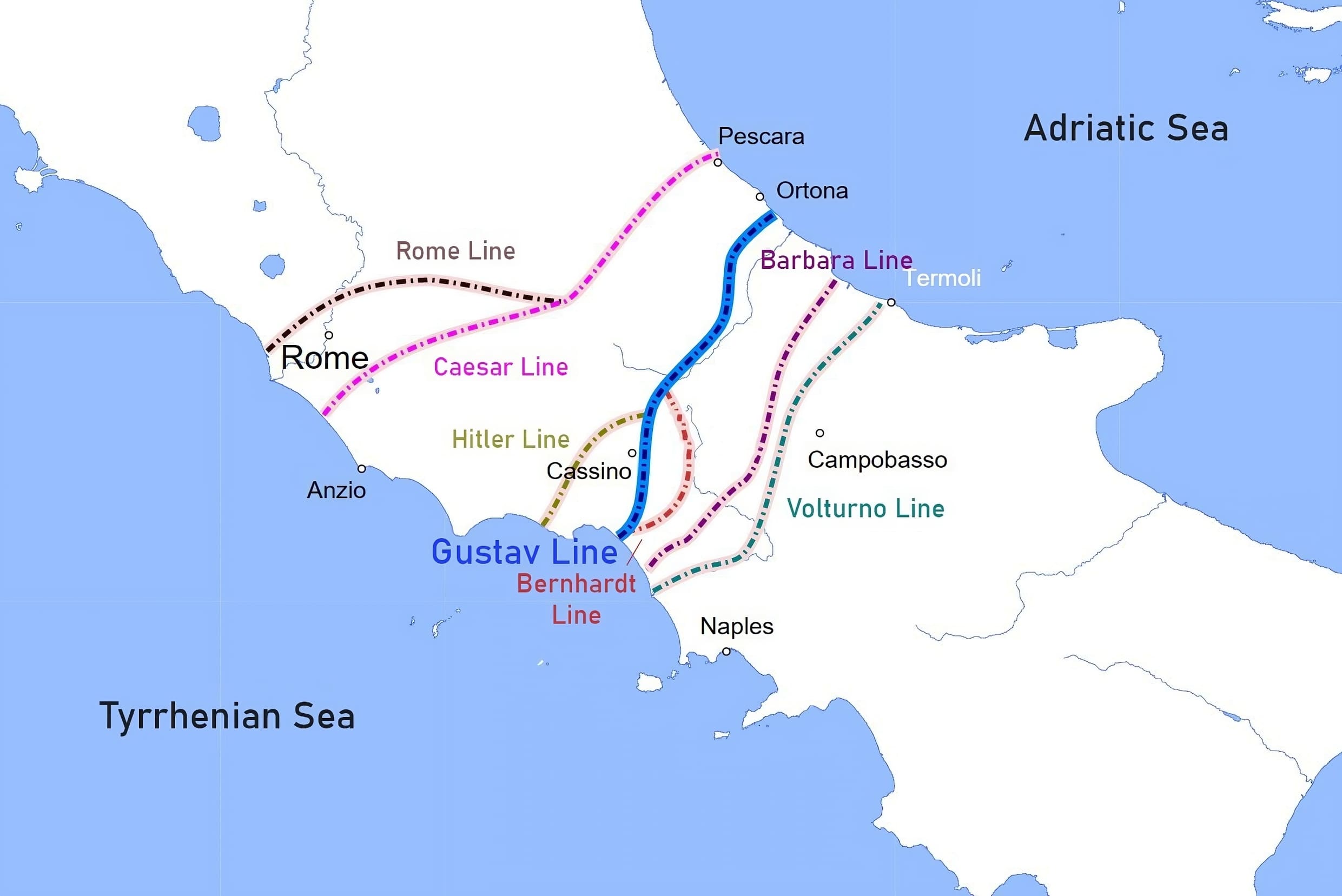
The purpose of the Gustav Line was to keep the Allies busy and prevent them from refocusing their efforts on the eastern and northern fronts by using the narrowest part of the Italian peninsula and the natural impediments provided by the Apennine Mountains.
The battles at Monte Cassino and Anzio alone during the assault on the Gustav Line claimed the lives of 98,000 Allies and 60,000 Axis soldiers. On May 18, 1944, the Gustav Line collapsed in the face of Allied pressure, forcing the Germans to move north to the Hitler Line.
History of the Gustav Line
The Tyrrhenian Side of the Gustav Line

Despite early resistance at the Volturno Line and later the Bernhardt Line, the German troops were forced to fall back around the peninsula following the invasion at Salerno in September 1943. The strategic importance of Monte Cassino (cf. Battle of Monte Cassino) and its location on the one direct road north into Rome (the “Via Casilina”) were decisive factors in this move. Because they were fortified in the highlands, the Germans were able to halt the Allied assault.
Starting on July 19, 1943, on the Tyrrhenian Side—the part where the Gustav Line ends in the Tyrrhenian Sea—the Aquino airport was repeatedly bombed. And on September 10, that same year, Anglo-American soldiers bombed Monte Cassino, demolishing the Abbey and leading to numerous civilian losses, only two days after the declaration of the Armistice of Cassibile through the Badoglio Proclamation.

From San Pietro Infine comune to San Vittore del Lazio and Cervaro, fierce fights raged for control of strategic locations along the Gustav Line. The Italian Co-belligerent Army’s early “I Motorized Grouping” played a significant role in this operation. The same group also fought in the Battle of Monte Lungo in the early days of December to seize Mignano Monte Lungo.
On the 8th of the same month, despite the loss and devastation of Italy’s ancient heritage, Allied troops passed through the Gustav Line and captured the first enemy strongholds along the Rapido River and Gari River.
The Battle of Monte Cassino occurred in 1944 between southern Lazio and northern Campania. It resulted in the destruction of the Tower of Capodiferro, the Real Ferdinando Bridge across the Garigliano River, and the Monte Cassino Abbey. The mass rape and killings (“marocchinate”) on both sides of the Gustav Line by the Anglo-Americans and Moroccans highlighted this time period as well.
The Adriatic Side of the Gustav Line
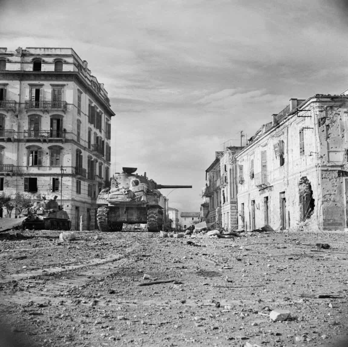
On the Adriatic coast, the Gustav Line followed the Sangro River, through which a breach was created during the Battle of Ortona (also known as “the Italian Stalingrad”). The Canadian Army considers the Battle of Ortona to be one of its biggest battles. The “Moro River Canadian War Cemetery” in the province of Chieti is the last resting place for 1,400 Canadians, 170 British, 40 New Zealand and South African, and 50 unknown soldiers.
The “Maiella Brigade,” actually part of the V British Corps, was not the only partisan group active in the region; several other groups did as well.
The Germans planned to use nine temporary defense lines to buy themselves time while retreating to the tenth, the Gustav or Bernhard Line, which stretched several miles in depth from Gaeta to Ortona and was more defensible from a morphological perspective.
The British dubbed the most advanced section of the Gustav Line in the north of the Sangro River as the Sangro Line, while the Germans termed it the Siegfried Line. Despite only having the 16th Panzer Division and the 1st Parachute Division at his disposal, General Traugott Herr, commanding the LXXVI Panzer Corps along the Adriatic coast, adopted General Kesselring’s strategy. He made preparations to hold out at three delaying positions as long as possible before retreating to the Gustav-Bernhard Line.
Barbara Line, the first line of defense some 10–20 mi (16–32 km) south of the Gustav Line, stretched from San Salvo comune to Colli a Volturno through Lentella and Celenza. The eastern section followed the Trigno River and branched off far into a second delayed line that was still a part of the Barbara Line and stretched from Vasto to Cupello, Furci, and Carunchio.
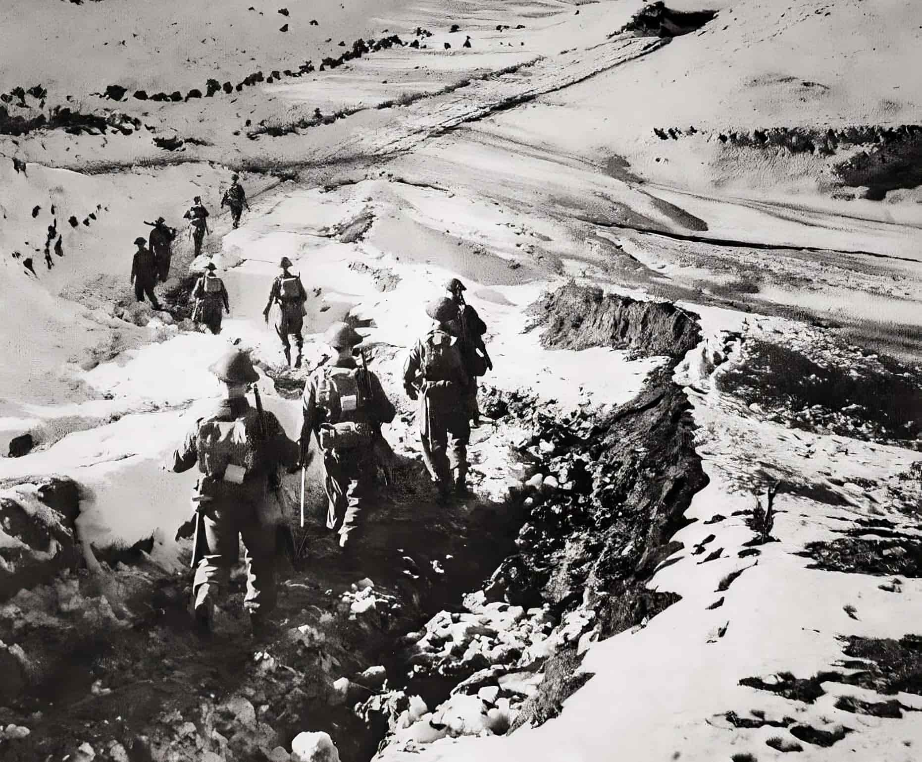
A third line, called the Advanced Sangro Line, ran from south of Fossacesia and Mozzagrogna to Roccascalegna, Torricella, Gamberale, and Castel di Sangro, but it was technically part of the Gustav-Bernhard system.
The Germans, under pressure from General Bernard Law Montgomery’s Eighth Army, retreated at the end of October 1943 from the line on the Trigno River near Vasto comune. They collected the locals from the villages around Lanciano town and set off bombs on the bridges across the Sangro River as part of their fortification efforts.
It took the Allies two weeks to cross the Sangro River and resume offensive operations toward Lanciano, their primary military goal, owing to bad weather and mistaken bombings of Fossacesia, Mozzagrogna, and Lanciano.
Instead of immediately destroying all German garrisons, they retreated to the north and strengthened their position along the Moro River between Ortona, Orsogna, and Guardiagrele.
Canadian and New Zealander operations, launched by Montgomery in early December 1943 as part of the Moro River campaign, continued until the end of the year without capturing Orsogna or Guardiagrele from the Germans.
Hitler had given the Germans strict instructions to hold on to Ortona at all costs. It was a major seaport and a strategic location on the Gustav Line and the Adriatic Sea. As a result, the locals were sent to safer rural areas, and the urban core was mined and set up with different traps to welcome the Canadian allies.
The Anglo-Canadians, led by General Christopher Vokes and sent by Montgomery, launched an assault from the San Donato neighborhood, advanced to the Piazza di Porta Caldari, and then entered the city proper through Corso Vittorio Emanuele and the Piazza del Duomo. Fighting broke out in every street in Ortona, and the city was nearly completely devastated when it was retaken, earning it the nickname “Little Stalingrad.”
In December of 1943, the New Zealand forces launched an offensive that included heavy bombardment of the city of Orsogna. However, the orography of the land, a lack of military preparedness, and the fact that the Germans seized the most crucial sites meant that Orsogna could not be taken until 1944.
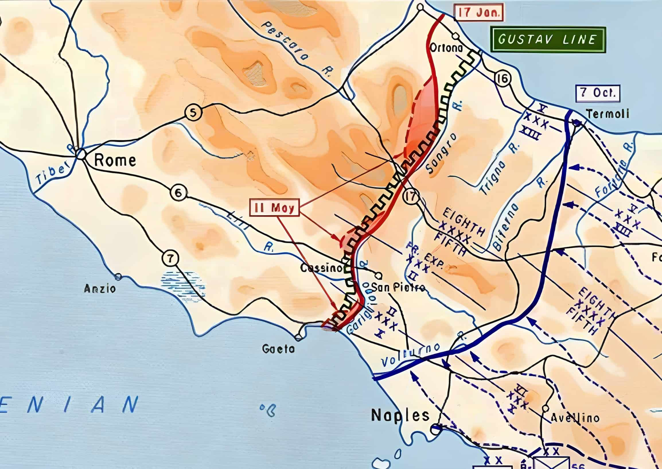
To slow the Allied advance, retreating Germans bombed the Marrucina plain (between Orsogna and Ortona) from December 1943 to June 1944, plundering and killing in every town along the way. Orsogna and Poggiofiorito were the first urban areas obliterated, followed by Crecchio (where King Victor Emmanuel III of Italy had taken refuge in the fortress on September 9). The town of Orsogna wasn’t freed until June of 1944, after heavy casualties and near-total devastation.
Miglianico and Tollo, two adjacent towns, eventually followed suit. The Allied bombing campaign to pull the Germans out nearly totally devastated even the latter town.
The Germans were lured back to the Sangro Line behind the Gustav Line and forced back from Lanciano in a fatal trap in November 1943, when the Allies arrived from Fossacesia and Castel Frentano.
On October 6th, the town rose up against the military occupation, and 11 individuals, including Trentino La Barba, the leader of the young Lancian revolutionaries, were slain in retribution. “Martyrs of Lanciano”, as they were often referred to.
From Lanciano, the front stretched alongside the Sangro River to Sant’Eusanio del Sangro, Casoli, Gessopalena, Torricella Peligna, Montenerodomo, and Pizzoferrato, and then up the Aventino River to Lama dei Peligni, Taranta Peligni, Lettopalena, Palena, Roccaraso, and Castel di Sangro.
Gessopalena, Lettopalena, and Taranta were just a few of the towns the Nazis captured, robbed, and devastated with landmines in advance of an Allied onslaught.
In January of 1944, Italian patriot Ettore Troilo succeeded in gathering a group of civilian volunteers—the Maiella Brigade—at Casoli, the headquarters of the British military command. With the assistance of the Allied forces and a thorough understanding of the Nazi-controlled area, the Maiella Brigade gradually took the towns back.
From Casoli, they traveled along the Sangro River to Torricella, Pizzoferraro, Castel di Sangro, Campo di Giove, Sulmona, and finally Bologna, where they joined the Allies.
The Maiella Brigade and the Battle of Sangro
The Germans invaded the Sangro Valley in November 1943 and again in April 1944 through Torino di Sangro, Paglieta, and Lanciano. As a result of the Nazis’ advance to Gessopalena comune, where the slaughter of Sant’Agata took place in early 1944, the town of Casoli, the second most populated after the adjacent Atessa, was proclaimed a “free city” for refugees.
The Germans used the “scorched earth” strategy to stall the Allied advance through the Gustav Line. The people of the Maiella village were confined in their houses on New Year’s Eve, and the settlement was mined for its underlying limestone before being blasted to bits.
The Germans repeated the process at Taranta Peligna and Lettopalena when they arrived later. Both Lettopalena and Taranta were brutally bombarded by the Allies, but the former was completely destroyed.
To prevent similar efforts by the Germans, the Allies dropped bombs on Colledimacine and Torricella. Commander Ettore Troilo, head of the Maiella Brigade’s partisan resistance, supported the Allies. However, the baronial castle and many civilian lives were lost in Torricella, the Allies blew off the roof of San Falco Church in Palena as mass was being held, and nearly the whole ancient town of Montenerodomo was destroyed.
The action then moved on to Castel di Sangro (where the lower portion of the town was devastated by Allied bombing) and Roccaraso, with Gamberale being mined and blown up by German soldiers to destroy the ancient town.
Roccaraso saw the horrific September 1943 slaughter at Pietransieri. The Nazis also destroyed a portion of Rocca Pia and the neighboring village of Roccacinquemiglia. The refugees from Lettopalena, almost 12.5 miles (20 km) away, were confined there after being forced by the Nazis to cross the Forchetta Pass, at an elevation of 4,000 feet (1220 m), in the dead of winter.
The Victory and Allied Progress
In March of 1944, the Allies were successful in pushing back the Germans from the Gustav Line, who were eventually forced to fall back to Ateleta, San Pietro Avellana, and finally the Volturno valley in Molise.
It wasn’t until May that the Gustav Line was finally conquered, allowing the Allies to push forward towards the Hitler Line, where Nazi Germany’s troops had once again fortified themselves. This was made possible by Operation Diadem, which involved the Polish II Corps, the United States Army North, and the British Eighth Army.
The Municipalities Crossed by the Gustav Line
Passing through Cassino comune, the Mainarde Mountains, the highest plateaus of the Abruzzo Mountains, and finally the Maiella Mountains, the Gustav Line reached from the mouth of the Garigliano River on the boundary between Lazio and Campania to Ortona, a seaside municipality south of Pescara.
During the Italian military campaign of the years 1943–1944, the Gustav Line passed through the following municipalities. The municipalities are presented in the sequence in which they were traversed by the Germans and the Allies.
Abruzzo Region
Ortona, San Vito Chietino, Contrada Caldari, Miglianico, Tollo, Canosa Sannita, Crecchio, Arielli, Poggiofiorito, Frisa, Orsogna, Paglieta, Atessa, Fara San Martino, Gessopalena, Lama dei Peligni, Taranta Peligna, Lettopalena, Colledimacine, Torricella Peligna, Montenerodomo, Palena, Pizzoferrato, Gamberale, Quadri, Castel di Sangro, Roccaraso, Castelguidone.
Molise Region
Colli a Volturno, Rionero Sannitico, Isernia, Venafro, Castel San Vincenzo, Rocchetta a Volturno.
Campania and Lazio Region
Mignano Monte Lungo, Minturno, Cassino, Ausonia, Coreno Ausonio, Castelforte, Formia, Vallemaio, Gaeta, Vallerotonda
War Cemeteries in the Gustav Line
- Cassino War Cemetery (Commonwealth)
- Monte Cassino Polish War Cemetery
- Moro River Canadian War Cemetery
- Sangro River War Cemetery (British and Commonwealth)
- English Cemetery of Minturno


