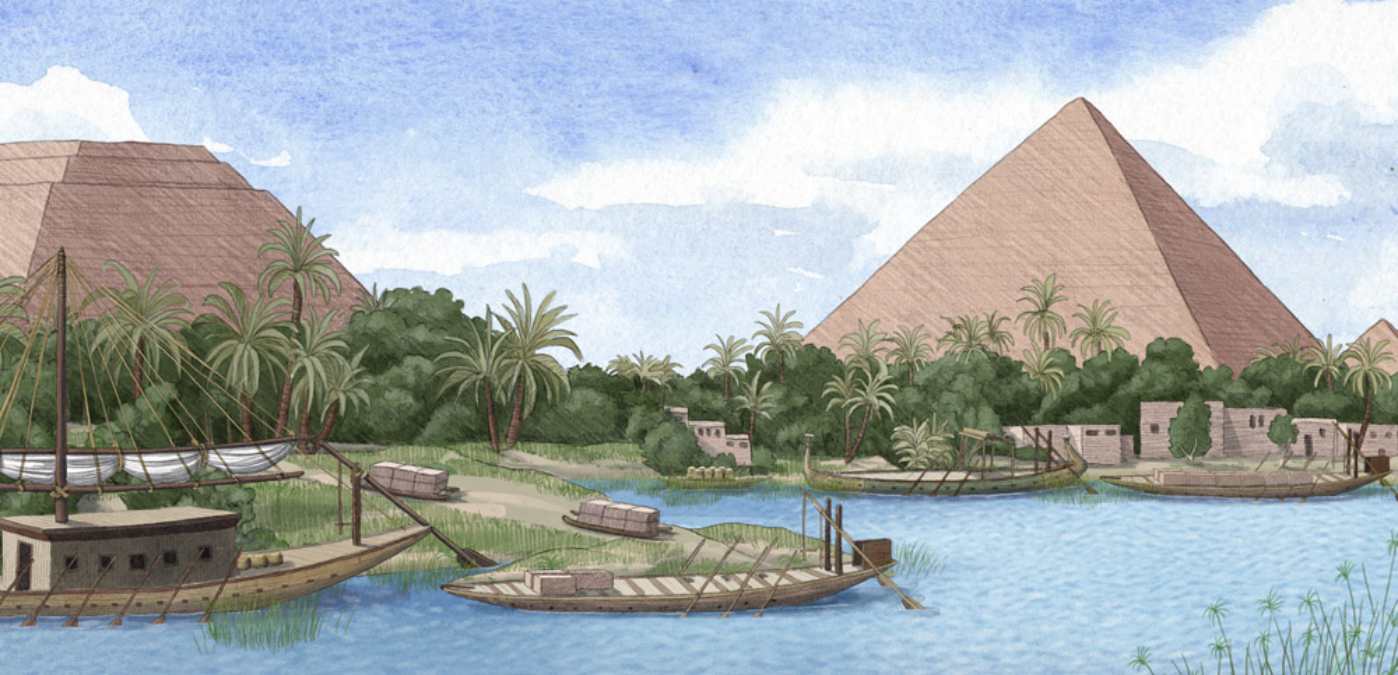
A research suggests that a branch of the Nile that is no longer flowing may have been essential for the building of the Giza pyramids. The Egyptian builders were able to transport the massive stone blocks to the plateau of the pyramids by ship because the Khufu branch of the Nile was navigable at the time period. Despite the Nile’s level already having plummeted during the reigns of Pharaohs Khufu, Khafre, and Menkaure, the branch was still navigable the whole time the pyramids were being built.

One of the seven wonders of the ancient world, the three enormous pyramids of Giza—Khufu, Khafre, and Menkaure—are among the most well-known buildings on the whole globe. They were constructed during the Fourth Dynasty between 2620 and 2500 BC on a large limestone plateau, which is now located about 6 miles (10 km) from the west bank of the Nile. It has long been a mystery as to how laborers of the period moved the massive stones to the plateau which weighed tons and were hauled from quarries up the Nile.
A Potential Port at Nile’s Arm
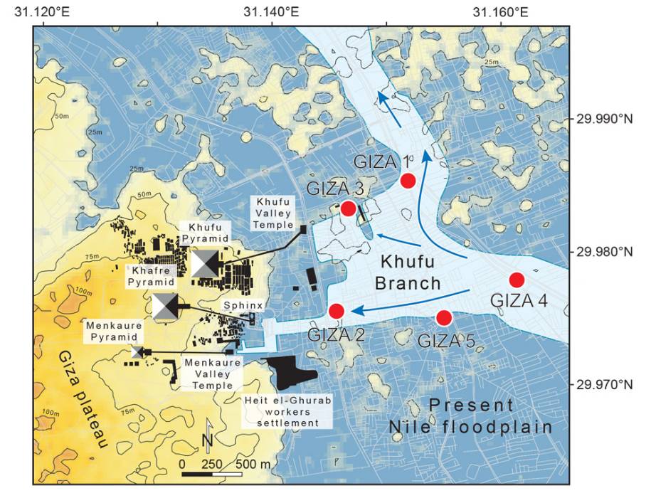
However, it is now known that geography and a good climate had a role in the transportation logistics of the pyramid building. Long-held theories among scientists suggest that the plateau of the pyramids was once directly reached by a now-dry branch of the Nile River. According to Hader Sheisha of the University of Aix-Marseille and his colleagues, the river port theory postulates that the pyramid builders excavated a passage through the west bank of this Nile arm of Khufu and widened it.

They assume that this made it possible to transport the building materials for the pyramids straight up to the plateau and discharge them there. The question of whether the level of the Nile and its Khufu branch at the time was high enough to permit this transport by ship to the plateau remained unanswered. With the aid of five drill cores taken from the region of the old Khufu branch, researchers have now looked at this question further. They were able to recreate the water level over 8,000 years using climate models, pollen and rock analysis, and other methods.
From Too Deep to Just Right
The finding was that Egypt had generally rainy weather up until around 3500 BC, and the Khufu branch of the Nile river had unusually high water levels. Then, however, the levels began to gradually decline, enabling people to colonize the rich lowlands along the riverbanks throughout the predynastic era and the early Egyptian Kingdom. According to the researchers, this decline in river levels may be intimately related to the appeal of Giza throughout the fourth century BC.
The climate began to become considerably drier at approximately 2970 BC, and the yearly Nile floods also became less powerful. However, the Khufu branch’s water level stayed consistently high enough to be navigable. The pharaohs of the early part of the Old Kingdom gained the most from this beginning in 2686 BC. Khufu branch was later adapted for setting out and developing the pyramid construction site by the Third to the Fifth Dynasties.
The Khufu Arm Was Navigable During Construction

The researchers claim that there is proof that the Khufu Nile and the Giza plateau were both used for the construction of the pyramids. Sheisha and his colleagues claimed that the Old Kingdom engineers made use of the river environment and the yearly Nile floods to create their colossal monuments on the plateau. To better unload goods, the builders had the arm of Khufu’s deepened in some places and constructed canals and port facilities.
This helped the builders manage the transfer of stones and other supplies by ship and made it possible for even heavily laden freighters to proceed virtually straight to the pyramid building site, especially during the yearly Nile floods. The outcome was a sharp rise in the number of archaeological sites on the Giza plateau, particularly during the Fourth Dynasty. This was used by the pharaohs Khufu, Khafre, and Menkaure to construct the Great Pyramids, a special structure that is still standing today.
The Old Empire Came to an End Because of Declining Levels
The steady water levels in the Khufu branch of the Nile persisted until about 2225 BC, or around the end of the Old Kingdom. Following that, the Nile and its branches experienced a drop in water levels, and a short time later, North Africa experienced a dry spell that prevented even the annual Nile flood from occurring. It is thought that this failure set off terrible famines that brought about the end of the Old Kingdom and the start of the First Intermediate Period of Egypt.
The climate and water levels changed drastically over the next centuries until another dry spell loomed around the start of Pharaoh Tutankhamun’s reign in 1349 BC. The water levels of the Nile and the Khufu branch had dropped significantly by the start of the Third Intermediate Period, which led to the Khufu branch progressively silting up and drying out.


