Every day, a fleet of satellites of every possible size and form completes numerous orbits around the Earth. The variety of duties they do mirrors the diversity of their appearances. Above the turbulent atmosphere, scientific satellites probe the depths of space, seeking answers to the astronomical community’s many unresolved problems. Television, long-distance telephone conversations, and global information exchange as we know them today would not exist if not for the fleet of communications satellites.
However, artificial celestial bodies employed for Earth monitoring are very crucial for living on Earth. They are able to see well even in the dark, and even through thick clouds. They aid in the mapping of the Earth, the forecasting of weather, the monitoring of volcanoes, and the packing of ice. To sum up, space explorers have emerged as crucial partners in mapping our home planet.
Keeping an eye on Earth
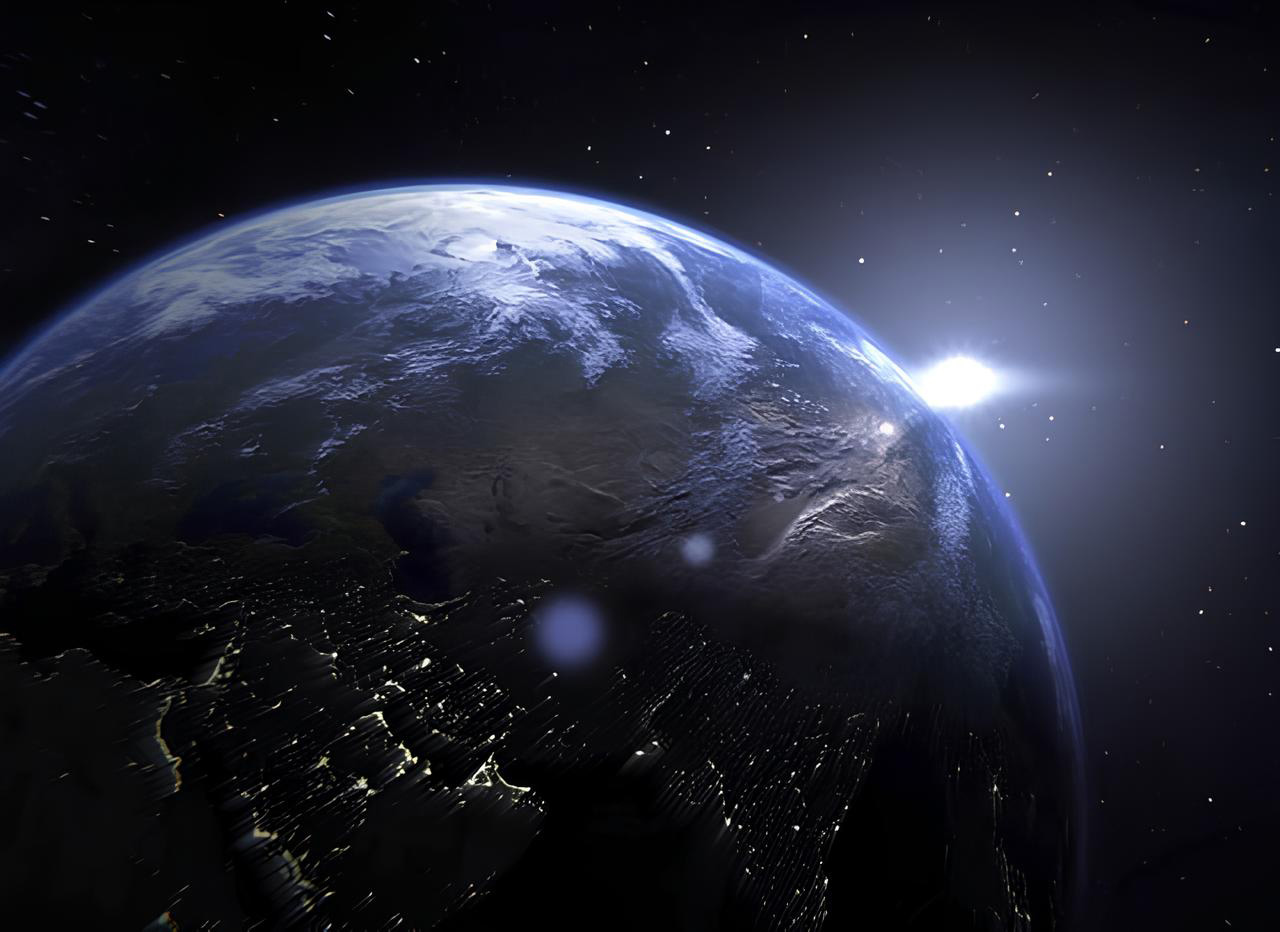
When in the right position, the naked eye may get a glimpse of a satellite even though it is very tiny and traveling at a great distance from Earth. This can only be done if their orbits are quite low, between 185 and 500 miles (300 and 800 kilometers) above the surface of the Earth; at these altitudes, they can complete an orbit of the Earth in around 90 minutes.
The optimum conditions for seeing satellites occur when the satellite is bathed in sunshine but the observer is located in Earth’s shadow, making it night for the observer. During the months of May, June, and July, when the days are long and the nights are short, this is particularly true. During this season, the sun dips just below the horizon at night. As a result, the nighttime elevation of Earth’s shadow is shallowest from north to south. In other words, at the height of the satellite, it is always daytime, even in the midst of the night. If the satellite is still receiving solar radiation, we on Earth will see it as a bright, swiftly moving object in the sky. If it travels too far south into the shadow of the Earth, where it is also dark, its light will suddenly go out.
These manmade stars shine brighter as their size and orbital height increase. The “satellite” ISS’s size and brightness are visible even to the unaided eye. The ISS is only visible because it reflects sunlight. You’ll need a telescope to see satellites that are either too small or too high in the sky.
It’s interesting to note that hardly any satellites can be seen crossing the sky from east to west. The ISS travels in a southwest-to-northeast direction. The rotational axis of the Earth explains why. The majority of satellites are positioned in a west-to-east pointing orbit, called a “corrected orbit”. It is not necessary to use maximum thrust in these orbits since the Earth’s rotation also adds to the speed. There would be no use in a satellite flying counter to the Earth’s rotational axis other than to use more fuel for acceleration.
So-called Iridium flares are magnificent celestial occurrences that are released by satellites. For the purpose of creating a mobile communications network that could be used all over the world, the defunct business Iridium launched 66 communications satellites into space. Years later, in 2022, 75 new Iridium satellites were launched into orbit on SpaceX Falcon 9 rockets to replace the old constellation. The satellites are still floating around up there, and they’re the ones making all those bright spots.
Flares are transient light phenomena characterized by a quick onset and rapid decay. Each satellite’s three enormous transmission panels are to blame for these phenomena. As the sun shines on the panels, some of the light is reflected back to Earth, where it quickly spreads into a 60-mile-wide (100-kilometer) light spot. The following may be seen by an observer who places themselves in the beam of this light: At first, we see a dim object whizz across the sky. In the next few seconds, it will brighten gradually at first, and then rapidly, until it practically blinds you. In the same rapid fashion, the brilliance will begin to fade once again until the satellite apparition is ended.
Satellites and their uses
According to the Union of Concerned Scientists (UCS), more than 5,500 man-made satellites performing a broad range of functions orbit the Earth today. And there are about 1,500 new satellites launched into orbit every year. Larger objects like the International Space Station (ISS) and the Space Shuttle also travel in orbit above Earth, although satellites are the most common. But what exactly are satellites anyway?
A “satellite” is the scientific term for any smaller entity in orbit around a bigger body. Therefore, the moon orbits around Earth, while Earth orbits around the sun. However, in a strict sense, we consider any artificial flying object that is in orbit around a celestial body to be a satellite. Manned and unmanned spacecraft exist, with the former more often referred to as space stations and the latter as space shuttles. There is also a great deal of space debris, such as retired satellites and spent rocket stages, orbiting among those artificial satellites. As of 2022, their number is around 27,000.
Satellites are launched into orbit for three major purposes: observing the Earth, communication, and space exploration. The latter investigates the solar system or space in different electromagnetic spectrum bands, including X-rays. Their primary function is to shield astronomers from the disruptive effects of the planet’s atmosphere.
A satellite designed for Earth observation performs a wide range of functions. They aid in weather prediction, volcano monitoring, Earth mapping, iceberg tracking, and a whole lot more. Without communications satellites, modern society would be a long way from its aim of globalization. They allow for global communication through the smartphone, global television broadcasting, and the transmission of scientific data from orbiting satellites to ground stations on Earth.
The development of satellite technology has substantially increased humanity’s knowledge of the planet and the cosmos. Quite a bit of the data satellites acquire reveals Earthly phenomena. The Landsat satellites (the newest Landsat 9 launched in 2021) provide such a detailed map of the Earth that it can be used to check the accuracy of older, less reliable maps. Scientists can even use them to check whether the vegetation in an area is healthy or has been harmed. The scouts in space can also assist in finding pollutants in the environment. Images from the Hubble Space Telescope, which is technically a satellite, have shed light on fundamental aspects of the cosmos. The James Webb Telescope has taken the flag now.
The specific orbits of satellites
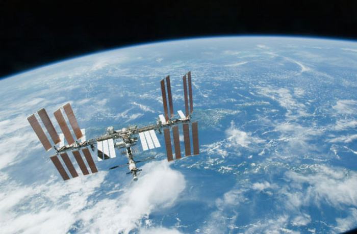
Scientists use the term “orbit” to describe the specific route taken by each satellite as it circles the planet. All satellites must fly at heights above the tropopause (17 km/11 mi above the equator or 9 km/5.6 mi above the polar regions) to prevent speed reductions due to air friction. This is the case at altitudes above 185 miles (300 km), below which satellites cannot be put into permanent orbit.
An artificial celestial body’s orbit is determined primarily by two factors: its speed and the angle at which it orbits the Earth’s equator. A satellite’s speed is its circular orbital velocity, at which centrifugal force and Earth’s gravity cancel each other out, keeping the satellite in a stable orbit. This is conditional on the satellite’s height. It’s 5 miles per second (or 7.9 km ps) close to the surface and slows down with increasing altitude.
Depending on the satellite’s purpose, various orbits may be more or less appropriate. A polar orbit’s inclination angle is around 90 degrees with respect to the equator. Satellites in these orbits circle the Earth above the poles, providing a birds-eye view of the whole planet as it spins beneath them. In order to track storms, for instance, some weather satellites are placed in such orbits.
The geostationary orbit is used by other satellites. They need to be precisely 22,300 miles (35,888 km) above the equator to achieve this. At this height, a satellite travels around the Earth at a speed of 3.065 km/s, the same speed as a point on the earth’s surface when the earth rotates. Because of this, the celestial body always stays above the same point on the Earth’s surface.
Such orbits are often used by meteorological and broadcast satellites. Because otherwise, for example, the television satellite’s reception antenna would need to be continually adjusted with the satellite. Since the geostationary satellite’s transmitter is permanently fixed in the sky, the satellite dish only needs to be adjusted once to receive signals.
The equipment of the artificial satellites
Equipment for measuring and solar cells
The appearance of satellites, their size, and weight can be rather variable. The first satellite of the United States, Explorer 1, launched in 1958, was 6.5 feet (2 meters) in length and weighed 17.5 pounds (8 kilos). The Compton Gamma-Ray Observatory, built and launched by NASA in 1991, was 70 feet (21.3 meters) in length and weighed 17 tons. The largest artificial satellite is the International Space Station (ISS), weighing 444 tons or 980,000 lb with a diameter of 109 m or 357 ft in width.
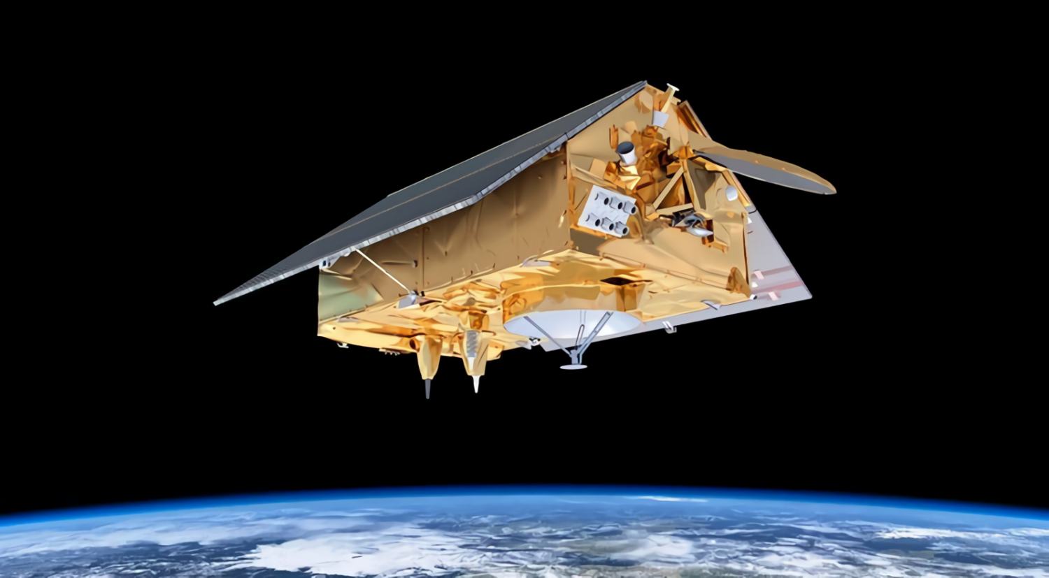
Although satellites might vary widely in terms of size and mass, their core design features remain the same across the board. Large solar panels equipped with solar cells are the energy source for most satellites. The satellites are equipped with correction engines to counteract the effects of the Earth’s gravity and the very small amount of residual friction experienced during orbit. This enables the control center’s experts to reset the satellite’s orbit.
In addition to the measurement equipment that is essential for the satellite’s mission, they also carry additional instruments that are used for command and control. These tools can be used to identify power outages, temperature fluctuations, and pressure fluctuations, among other things. To keep the satellite on track, control sensors measure the spacecraft’s distance from Earth and its angle with respect to the horizon and the stars. The ground station can make course adjustments in response to erroneous readings from this equipment.
Earth observation satellites
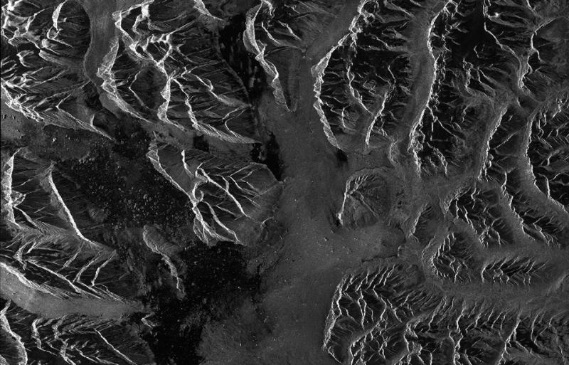
The vast majority of satellites are deployed in Earth observation roles. Primarily, weather monitoring satellites and other asteroids are crucial to human survival on Earth. But how do we make use of space-based observations?
Hurricanes, typhoons, floods, cyclones, tidal waves, and even wildfires can’t be predicted without the help of weather satellites. Understanding these occurrences allows for better catastrophe prediction and prevention.
It would be a mistake to discount the value of weather satellites in agriculture. They inform farmers of impending weather events like hail and snow, allowing them to better plan planting and harvesting. When a weather change is imminent, crops that are vulnerable to frost or wetness can be moved to a safe location with the aid of satellites. Planning large-scale projects like the building of bridges, roadways, and dams relies heavily on accurate weather predictions.
Television Infrared Observation Satellites (TIROS) were the first of their kind to study Earth from space. It was crucial in studying Earth’s cloud cover and proving the usefulness of satellites for meteorological reasons. The first in this series, TIROS 1, was launched in 1960, and its data has greatly improved our understanding of the Earth’s cloud cover ever since.
Nimbus is the name of a cloud formation that inspired NASA to create a program of the same name in 1964. To create the first-ever worldwide meteorological satellite system, these satellites were to be outfitted with both visible and infrared imaging sensors. The ozone spectrometer aboard Nimbus 7 was crucial to the investigation of the ozone hole over Antarctica and the worldwide distribution of ozone.
The newest weather satellites can be found in the GOES (Geostationary Operational Environmental Satellite) fleet. The first satellite in this series, GOES-1, ushered in a whole new era in weather monitoring. GOES-18 was launched on March 1, 2022, and GOES-U is scheduled for launch in April 2024. They are able to capture detailed photos throughout the visible and infrared spectrums and give maps of the Earth’s temperature and humidity.
Many more satellites than just those dedicated to weather monitoring circle the planet. The Global Positioning System (GPS) satellite fleet is one such example; it is used for satellite-based navigation. Within a few meters of accuracy, they allow for pinpoint earthly position determination. 24 satellites make up the GPS constellation, which circles the planet at varying distances from one another. And they allow up to 32.
All of Earth can receive satellite transmissions since their orbits span from 60 degrees north to 60 degrees south. Additionally, they serve a purpose regardless of the climate. Whenever a satellite communicates with Earth, it relays data about itself, its location, and the current time.
The GPS receiver uses the difference in time between when the signal was broadcast and when it was received to pinpoint its location. Scientists use the time difference to determine how far away the satellite is. The so-called 2D position, or geographical longitude and latitude, can be calculated if the receiver processes signals from three separate celestial bodies. A GPS device can determine the altitude value using information from four or more GPS satellites in orbit.
As of 2022, more than 140 million drivers in the United States alone rely on the GPS system to help them navigate unfamiliar places.
Satellites investigating space
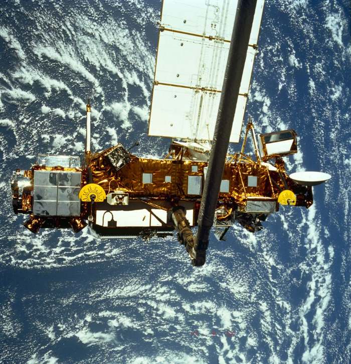
The first satellites in history were scientific satellites, which not only monitored the Earth but also looked out into the void of space. Scientists have learned a lot about the Earth and the cosmos from the data they have offered.
The Upper Atmosphere Research Satellite (UARS), which was launched in 1991, was the first research satellite to gather information about Earth from orbit. Its goal was to identify the systems in charge of the operations in the upper atmosphere. For instance, UARS created the first worldwide map of the atmospheric dispersion of chlorine monoxide. This demonstrated a clear correlation between the substance’s presence and the drop in ozone levels.
From orbits around the Earth, several additional satellites study the universe, the Sun, and other celestial bodies. For instance, Supernova 1987A was observed by the International Ultraviolet Explorer (IUE) in 1978, and it was discovered that the star explosion cooled surprisingly swiftly.
Both the Hubble Space Telescope (1990–today) and the Compton Gamma Ray Observatory (1991–2000) examined gamma rays in space, and produced important discoveries in the field of astronomy. The so-called gamma-ray bursts, one of the celestial phenomena that continue to confound scientists, were discovered by Compton to be far more intense than previously believed and to originate from regions well beyond the Milky Way. By that time, these gamma bursts had only recently been detected.
The United States launched a number of satellites in 1963 to keep an eye out for any nuclear weapon explosions in the atmosphere or in space during the Cold War. Instead of finding nuclear explosions on Earth, scientists were able to detect gamma bursts from space, a phenomenon that is still disputed among astrophysicists today.
We have discovered a great deal about the universe’s beginning thanks to these research satellites. A NASA satellite discovered slight temperature changes in cosmic background radiation in 1992. This radiation is a remnant of the Big Bang, the explosion that gave rise to the universe 13.8 billion years ago. The temperature changes that have been seen are consistent with the idea that the universe’s structure was formed when it was less than a trillionth of a second old.
A scientific satellite with equipment that goes far into outer space is the XMM-Newton built by ESA in 1999. It is equipped with the very sensitive X-ray telescope XMM (X-Ray Multi-Mirror), which hunts out and investigates undiscovered celestial bodies. It is accomplishing this by concentrating on countless stars in the Milky Way, extraterrestrial galaxies, galaxy clusters, and quasars, which are thought to contain black holes. One of the most powerful X-ray satellites in the world, XMM-Newton can detect minute amounts of X-ray radiation, penetrating the cosmos to depths never before reached.
The XMM-Newton travels in an elliptical orbit around the Earth at an altitude of between 5,700 (3,540 mi) and 113,000 kilometers (70,200 mi). It looks for X-ray sources in space outside the Earth’s atmosphere, which filters X-rays from space. These measurements may subsequently be used by researchers to make inferences about the physical and chemical data they hold. As of 2018, at least 5,600 papers have been published on the XMM-Newton and its scientific results.
Satellites simplify life
Today, the ability to connect to a phone anywhere on the globe and make calls is taken for granted, even in the most isolated areas. In a similar vein, the news can spread like wildfire around the world. Without the use of communications satellites, none of this would be feasible. This would otherwise only be possible via the time-consuming installation of cables in several parts of the globe; just like the first transatlantic cable.
The earliest commercial satellites were communications satellites. While some satellites are effectively administered by government entities, the majority are run by commercial businesses.
In 1960, aluminum-coated balloons were used as the first communications satellites. These were inactive satellites that only actively reflected radio signals in order to transfer them. Due to their restricted usefulness, they were quickly replaced by active satellites, which receive signals, amplify them, and then transfer them to another location on the Earth’s surface.
Telstar 1, which was run by the American telecommunications corporation AT&T, was the first privately launched communications satellite. It was the first satellite to carry both black-and-white and color television across two continents, and it was also capable of switching telephone calls between America and Europe.
The International Telecommunication Satellite Consortium (Intelsat), a global organization made up of 65 nations that significantly enlarged the commercial communications network, was created in response to the enormous need for new communication channels. Only two stations could connect at once with the first Intelsat satellite. Intelsat now runs one of the world’s biggest fleets of communications satellites, consisting of 52 satellites that provide service to 200 nations.
The NASA-developed Advanced Communications Technology Satellite (ACTS) was sent into orbit in 1993. This technology was far more cost-effective and affordable since it guaranteed three times the communications capacity at the same weight as other satellites. Additionally, it enabled quicker communication, enabling a business to use this upgraded technology. In fact, ACTS was the first high-speed, all-digital communications satellite.
Meteorologists need to be aware of the vertical distribution of temperature and water vapor in the Earth’s atmosphere in order to anticipate the weather. Weather balloons have often been used up to now to determine these. The gaps in our understanding of the vertical structure of the atmosphere are enormous since they are only ever installed at a few sites on Earth and at great intervals.
LANDSAT
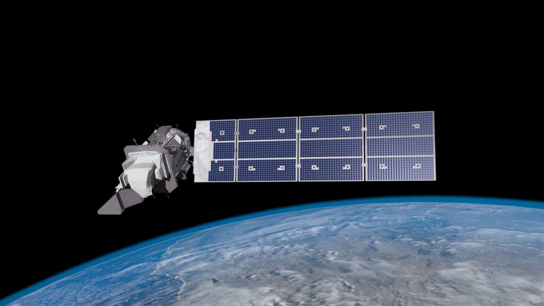
The LANDSAT series, launched in 1972, is one of NASA and the U.S. Geological Survey’s (USGS) most adaptable Earth observational tools. Earth’s surface has been observed by LANDSAT satellites for more than 50 years, which has aided in our understanding of the intricate interactions that cause many of the world’s changes.
In 1972, the first of the LANDSAT satellites were sent into orbit, paving the way for detailed, high-resolution monitoring of the planet’s land and sea surfaces ever since. The last of these heavenly bodies, called LANDSAT 9, entered Earth’s orbit in 2021 and is tasked with doing so for the next five years. LANDSAT is unlike any other Earth-observing satellite due to the breadth of its possible uses. From tracking the growth and shrinkage of glaciers to checking the cleanliness of lakes and coastlines to charting the distribution of pack ice and mapping out forest coverage, the Earth satellites’ imagery has been used for a wide variety of uses.
LANDSAT is used by researchers to keep an eye on the land surface and nearshore water regions and analyze the effects of climate change on various ecosystems. Important natural processes and human-induced changes, including deforestation, agricultural usage, erosion, and water levels in drinking water reservoirs, are all documented by LANDSAT. Repeated observations of the same spot over the course of a year can reveal seasonal variations.
The repeated eruptions of Hawaii’s Kilauea have been studied in part via the use of LANDSAT imagery. Mapping active lava flows is critical so that locals may be warned in a timely manner. The delicate equipment on LANDSAT is capable of distinguishing between fresh lava flows and those that have previously cooled.
In recent years, forest fires have played a significant role in the degradation of ecosystems across the world. Knowledge of the volume and wetness of biomass on the ground, which supplies fuel for the flames, is crucial in preventing and putting out these types of natural catastrophes. For safer firefighting, this data may be used to identify potentially hazardous places and minimize dry biomass there.
Methods for recognizing various kinds of dry biomass have been developed with the use of LANDSAT images. Scientists may use spectral analysis to tell whether the flora they’re studying consists of lush meadows or dry trees that might spark the next forest fire.
Radar satellites
Tracing the surface of the planet
Scientists utilize radar satellites for the specific purpose of surveying the Earth’s surface. In the course of their development, radar systems have become the most potent remote sensing tools available today.
Radar waves, which have a wavelength in the centimeter range, are simply radio waves that are reflected by solid objects and liquids. These systems are versatile in their use, since they may be used not only to find things but also to investigate surfaces through their unique reflecting qualities. Radar systems excel due to their ability to function in low-light conditions and see-through cloud cover.
The military first used radar as a means of surveillance in order to locate and track hostile aircraft and ships. After the war, the technology was adopted by the general public. It was rapidly recognized for its use in cartography, oceanography, and land-use research.
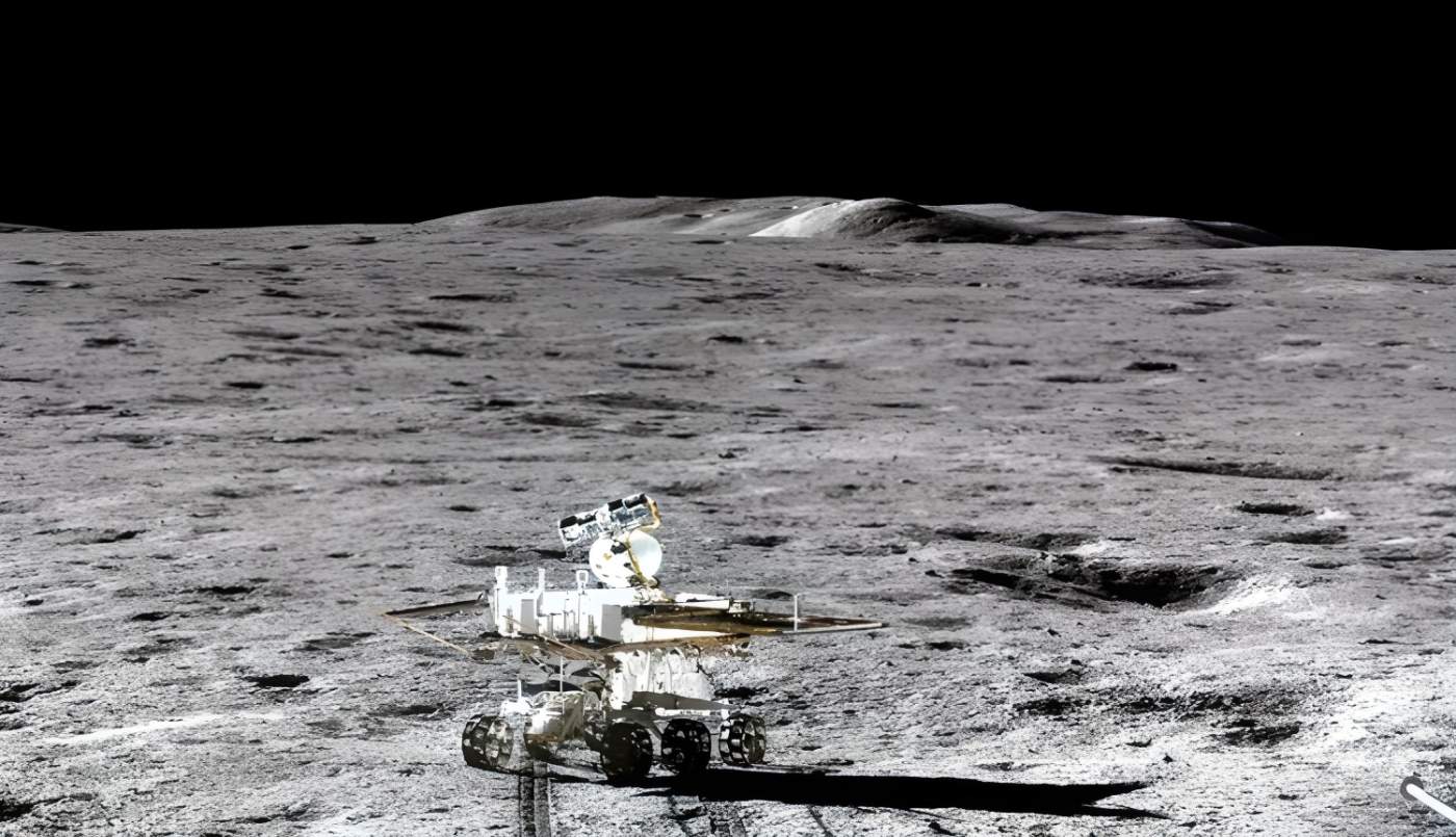
Radar systems need to be elevated above the reach of airplanes if they are to be used for mapping out bigger regions. NASA began conducting experiments with radar systems in orbit as early as 1962; in 1972, Apollo 17 sent an upgraded version of this device to the moon for a detailed study of the lunar surface and underlying geological features. These findings prompted the addition of a radar system to the SEASAT satellite for ocean monitoring. As a result of SEASAT’s efforts, more data was collected in 100 days about the ocean floor than in the previous 100 years of ship-based research combined.
The use of radar equipment on space shuttles became commonplace in the 1980s. During this trial run, new information on how to scan geological features was gleaned from radar pictures. Meanwhile, there are a plethora of radar satellites in Earth’s orbit. They were used to learn more about the planet’s surface in novel ways and to keep tabs on noteworthy occurrences. In the past, for instance, after its replacement, ERS-2, had taken up its duties, the ERS-1 satellite was reactivated so that it could watch the eruption of the Icelandic volcano Vatnajökull.
ERS satellites (European Remote-Sensing Satellites) have a dual capability for observation. The first setting is utilized for land surveys, while the second is for ocean research. Applications for satellite radar data are expanding in the field of environmental monitoring. To better understand oceanic phenomena like wavefronts and sea conditions, for instance, researchers can monitor oil spills, track sediment intake from rivers, and track the movement of ice sheets. The satellites collect information on human activities on the ground, such as farming and logging, as well as natural phenomena, such as earthquake hotspots and geological formations.
Radar satellites can also be used to investigate mineral, oil, and gas deposits as well as underground water supplies. Archaeology, for example, has benefited greatly from the use of radar technology. In the past, scientists were able to measure the whole Angkor temple complex in Cambodia. In addition, barely visible from the ground, vestiges of an even earlier wall complex were uncovered close to the modern Great Wall of China.


